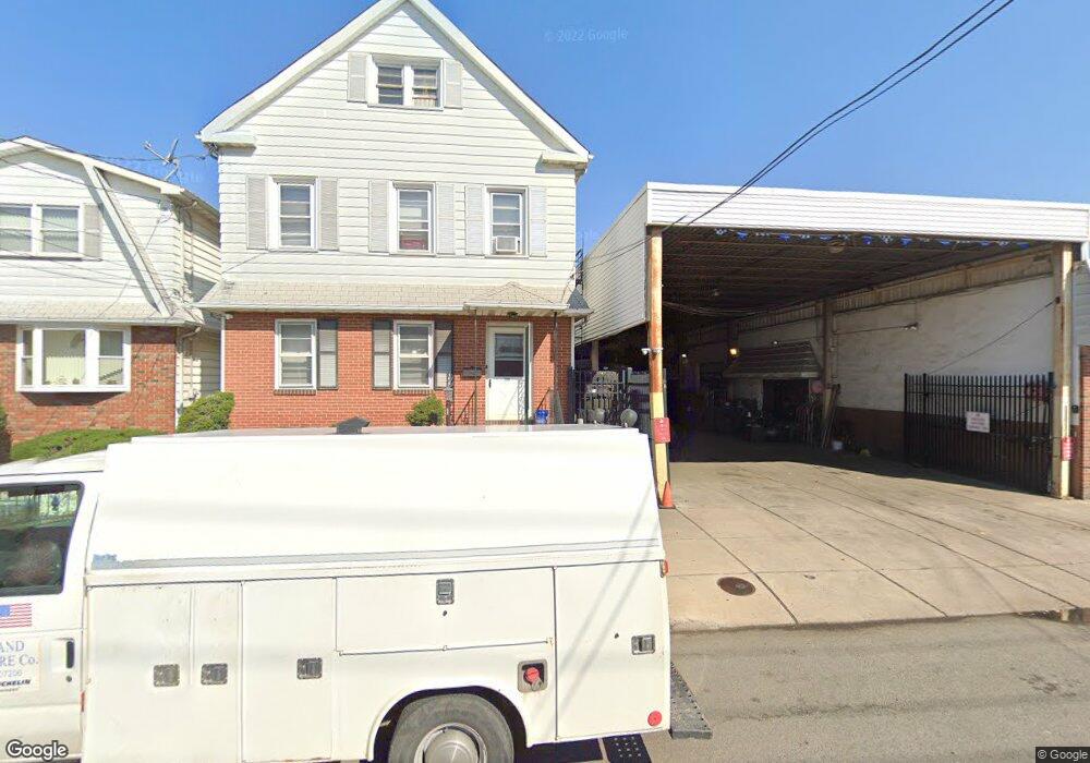
309 Loomis St Unit 311 Elizabethport, NJ 07206
Peters NeighborhoodEstimated Value: $469,604 - $726,000
--
Bed
--
Bath
2,112
Sq Ft
$295/Sq Ft
Est. Value
About This Home
This home is located at 309 Loomis St Unit 311, Elizabethport, NJ 07206 and is currently estimated at $623,901, approximately $295 per square foot. 309 Loomis St Unit 311 is a home located in Union County with nearby schools including Number 15, Christopher Columbus Elementary School and Elizabeth High School.
Ownership History
Date
Name
Owned For
Owner Type
Purchase Details
Closed on
May 24, 2022
Sold by
James Desalvo Jr
Bought by
Jh Squared Llc
Current Estimated Value
Purchase Details
Closed on
Jan 5, 2001
Sold by
Desalvo James and Mauti Marion
Bought by
Desalvo James
Purchase Details
Closed on
Jul 21, 1994
Sold by
Mauti Marion A and Desalvo Vita
Bought by
Mauti Marion A and Desalvo James
Create a Home Valuation Report for This Property
The Home Valuation Report is an in-depth analysis detailing your home's value as well as a comparison with similar homes in the area
Home Values in the Area
Average Home Value in this Area
Purchase History
| Date | Buyer | Sale Price | Title Company |
|---|---|---|---|
| Jh Squared Llc | -- | Dipaola Rocco | |
| Jh Squared Llc | -- | Dipaola Rocco | |
| Desalvo James | $94,000 | -- | |
| Mauti Marion A | -- | -- |
Source: Public Records
Tax History Compared to Growth
Tax History
| Year | Tax Paid | Tax Assessment Tax Assessment Total Assessment is a certain percentage of the fair market value that is determined by local assessors to be the total taxable value of land and additions on the property. | Land | Improvement |
|---|---|---|---|---|
| 2025 | $8,346 | $433,800 | $175,000 | $258,800 |
| 2024 | $11,221 | $433,800 | $175,000 | $258,800 |
| 2023 | $11,221 | $35,700 | $10,000 | $25,700 |
| 2022 | $10,917 | $35,700 | $10,000 | $25,700 |
| 2021 | $10,691 | $35,700 | $10,000 | $25,700 |
| 2020 | $10,450 | $35,700 | $10,000 | $25,700 |
| 2019 | $10,290 | $35,700 | $10,000 | $25,700 |
| 2018 | $10,190 | $35,700 | $10,000 | $25,700 |
| 2017 | $9,906 | $35,700 | $10,000 | $25,700 |
| 2016 | $9,906 | $35,700 | $10,000 | $25,700 |
| 2015 | $9,317 | $35,700 | $10,000 | $25,700 |
| 2014 | $9,038 | $35,700 | $10,000 | $25,700 |
Source: Public Records
Map
Nearby Homes
- 433 3rd Ave
- 313 Loomis St
- 315 S 5th St
- 325 Spencer St
- 234 Niles St
- 232 Niles St
- 31 Spencer St
- 220 Palmer St
- 28 Niles St
- 234 Lt Glenn Zamorski Dr Unit G
- 227 Palmer St
- 221 Palmer St
- 225 Delaware St
- 566 2nd Ave
- 429 Niles St Unit 431
- 216 Delaware St
- 316-318 John St
- 71 Erie St
- 336 John St Unit 340
- 208 Erie St
- 315 Loomis St Unit 317
- 306 S 5th St
- 468 3rd Ave Unit 470
- 319 Loomis St Unit 321
- 314-PT 316 S 5th St
- 472 3rd Ave Unit 474
- 308 Loomis St Unit 310
- 456 3rd Ave
- 312 Loomis St
- 314 Loomis St
- 323 Loomis St Unit 325
- 316 S Pt 5th St
- 316 Loomis St Unit 318
- 454 3rd Ave
- 454 3rd Ave Unit 2
- 454 3rd Ave Unit 1
- 320 Loomis St
- 452 3rd Ave
- 320 S 5th St
- 327 Loomis St