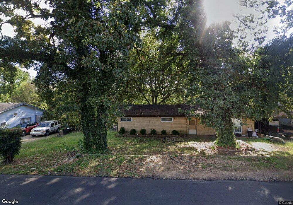
309 Mockingbird Ln Poteau, OK 74953
Estimated Value: $109,000 - $191,139
3
Beds
2
Baths
1,844
Sq Ft
$87/Sq Ft
Est. Value
About This Home
This home is located at 309 Mockingbird Ln, Poteau, OK 74953 and is currently estimated at $160,535, approximately $87 per square foot. 309 Mockingbird Ln is a home located in Le Flore County with nearby schools including Poteau Primary Elementary School, Poteau Upper Elementary School, and Pansy Kidd Middle School.
Ownership History
Date
Name
Owned For
Owner Type
Purchase Details
Closed on
Sep 29, 2025
Sold by
Ford Christopher Ray and Ford Heather Michelle
Bought by
Ford Seth and Ford Whitley
Current Estimated Value
Home Financials for this Owner
Home Financials are based on the most recent Mortgage that was taken out on this home.
Original Mortgage
$104,545
Outstanding Balance
$104,452
Interest Rate
6.58%
Mortgage Type
New Conventional
Estimated Equity
$56,083
Purchase Details
Closed on
Aug 6, 2025
Sold by
Perdue Edgar Andrew and Perdue Bobbie Jo
Bought by
Ford Christopher Ray and Ford Heather Michelle
Home Financials for this Owner
Home Financials are based on the most recent Mortgage that was taken out on this home.
Original Mortgage
$104,545
Outstanding Balance
$104,452
Interest Rate
6.58%
Mortgage Type
New Conventional
Estimated Equity
$56,083
Purchase Details
Closed on
Jul 2, 2008
Sold by
Hardesty Frederick and Hardesty Rosemary
Bought by
Perdue Edgar A and Perdue Branda
Home Financials for this Owner
Home Financials are based on the most recent Mortgage that was taken out on this home.
Original Mortgage
$69,089
Interest Rate
7.75%
Mortgage Type
Adjustable Rate Mortgage/ARM
Create a Home Valuation Report for This Property
The Home Valuation Report is an in-depth analysis detailing your home's value as well as a comparison with similar homes in the area
Home Values in the Area
Average Home Value in this Area
Purchase History
| Date | Buyer | Sale Price | Title Company |
|---|---|---|---|
| Ford Seth | $91,000 | Fidelity National Title | |
| Ford Christopher Ray | -- | Adams Abstract | |
| Perdue Edgar A | $74,500 | -- |
Source: Public Records
Mortgage History
| Date | Status | Borrower | Loan Amount |
|---|---|---|---|
| Open | Ford Seth | $104,545 | |
| Previous Owner | Perdue Edgar A | $69,089 |
Source: Public Records
Tax History
| Year | Tax Paid | Tax Assessment Tax Assessment Total Assessment is a certain percentage of the fair market value that is determined by local assessors to be the total taxable value of land and additions on the property. | Land | Improvement |
|---|---|---|---|---|
| 2025 | $651 | $8,300 | $939 | $7,361 |
| 2024 | $631 | $8,300 | $926 | $7,374 |
| 2023 | $631 | $7,824 | $898 | $6,926 |
| 2022 | $590 | $7,596 | $880 | $6,716 |
| 2021 | $569 | $7,375 | $880 | $6,495 |
| 2020 | $598 | $7,669 | $880 | $6,789 |
| 2019 | $645 | $8,177 | $880 | $7,297 |
| 2018 | $618 | $8,244 | $880 | $7,364 |
| 2017 | $611 | $8,127 | $880 | $7,247 |
| 2016 | $585 | $7,889 | $880 | $7,009 |
| 2015 | $577 | $7,659 | $880 | $6,779 |
| 2014 | $636 | $8,282 | $880 | $7,402 |
Source: Public Records
Map
Nearby Homes
- 104 Craigway St
- 205 Bowlin Dr
- 606 Torby Ave
- 516 Beeler St
- 102 Dogwood Ave
- 2104 N Broadway St Unit b
- 103 Paul Mathis Dr
- TBD Mission Dr
- 100 Royal Oak Dr
- 200 Franzini Dr
- 307 Mission Dr
- 105 Witteville Rd
- 110 Witteville Rd
- TBD College Ave
- 315 College Ave
- 301 Wilson Ave
- 206 Green Ave
- 2200 Redwood Ln
- 303 Wilson Ave
- 400 Peters St
- 307 Mockingbird Ln
- 311 Mockingbird Ln
- 305 Mockingbird Ln
- 306 Mockingbird Ln
- 309 Stadium Dr
- 600 N Paul Mathis Dr
- 307 Stadium Dr
- 303 Mockingbird Ln
- 106 Craigway St
- 305 Stadium Dr
- 108 Craigway St
- 30335 Mtn View Rd
- 102 Craigway St
- 306 Stadium Dr
- 100 Craigway St
- 304 Stadium Dr
- 700 N Paul Mathis Dr
- 1700 Witteville Dr
- 5130 Paul Mathis
- 302 Stadium Dr
Your Personal Tour Guide
Ask me questions while you tour the home.