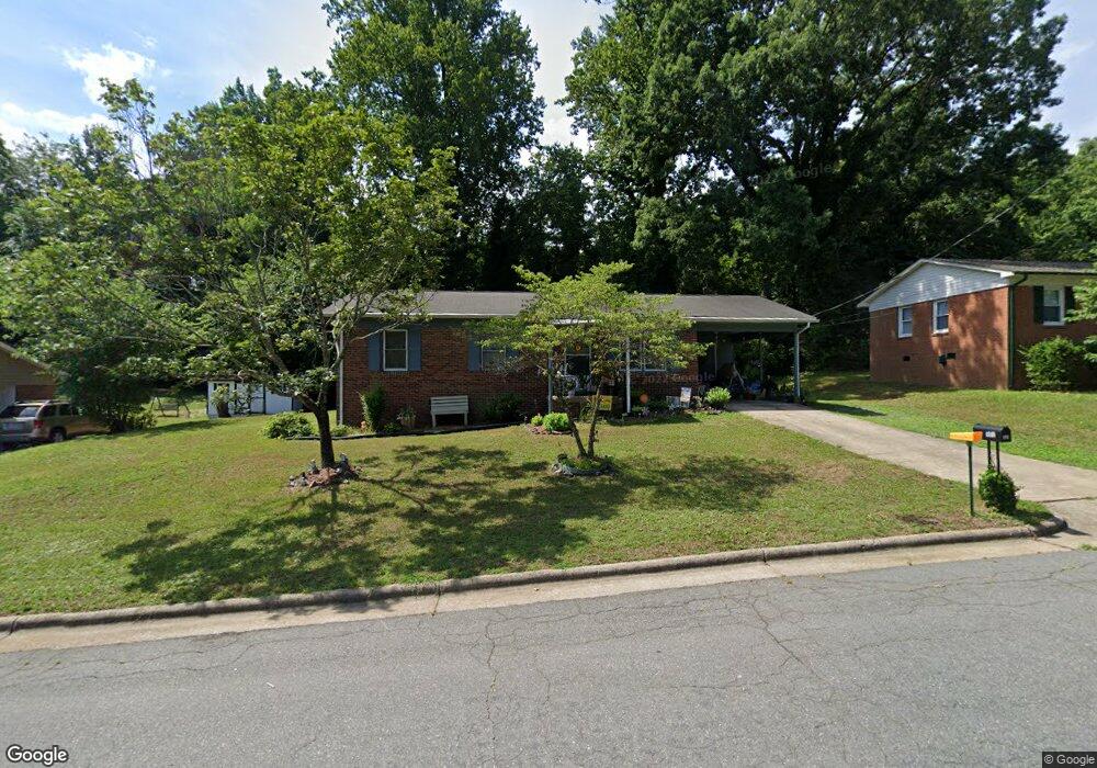
309 Roanoke St Reidsville, NC 27320
Estimated Value: $134,000 - $192,000
--
Bed
--
Bath
1,025
Sq Ft
$158/Sq Ft
Est. Value
About This Home
This home is located at 309 Roanoke St, Reidsville, NC 27320 and is currently estimated at $162,433, approximately $158 per square foot. 309 Roanoke St is a home located in Rockingham County with nearby schools including Moss Street Elementary, Reidsville High School, and Reidsville Middle School.
Ownership History
Date
Name
Owned For
Owner Type
Purchase Details
Closed on
Sep 22, 2006
Sold by
Deutsche Bank National Trust Co
Bought by
Brown Genette Lanier and Brown Genette L
Current Estimated Value
Home Financials for this Owner
Home Financials are based on the most recent Mortgage that was taken out on this home.
Original Mortgage
$30,653
Outstanding Balance
$18,197
Interest Rate
6.46%
Mortgage Type
Unknown
Estimated Equity
$144,236
Purchase Details
Closed on
May 3, 2006
Sold by
Noell Erica and Noell Charles
Bought by
Deutsche Bank National Trust Co
Create a Home Valuation Report for This Property
The Home Valuation Report is an in-depth analysis detailing your home's value as well as a comparison with similar homes in the area
Home Values in the Area
Average Home Value in this Area
Purchase History
| Date | Buyer | Sale Price | Title Company |
|---|---|---|---|
| Brown Genette Lanier | $41,000 | None Available | |
| Deutsche Bank National Trust Co | $78,353 | None Available |
Source: Public Records
Mortgage History
| Date | Status | Borrower | Loan Amount |
|---|---|---|---|
| Open | Brown Genette Lanier | $30,653 |
Source: Public Records
Tax History Compared to Growth
Tax History
| Year | Tax Paid | Tax Assessment Tax Assessment Total Assessment is a certain percentage of the fair market value that is determined by local assessors to be the total taxable value of land and additions on the property. | Land | Improvement |
|---|---|---|---|---|
| 2025 | $819 | $132,035 | $6,514 | $125,521 |
| 2024 | $819 | $132,035 | $6,514 | $125,521 |
| 2023 | $819 | $76,368 | $5,499 | $70,869 |
| 2022 | $548 | $76,368 | $5,499 | $70,869 |
| 2021 | $1,095 | $76,368 | $5,499 | $70,869 |
| 2020 | $548 | $76,368 | $5,499 | $70,869 |
| 2019 | $548 | $76,368 | $5,499 | $70,869 |
| 2018 | $513 | $71,410 | $8,922 | $62,488 |
| 2017 | $513 | $71,410 | $8,922 | $62,488 |
| 2015 | $518 | $71,410 | $8,922 | $62,488 |
| 2014 | -- | $71,410 | $8,922 | $62,488 |
Source: Public Records
Map
Nearby Homes
- 304 Roanoke St
- 137 Ridge St
- 117 Ridge St
- 112 Field St
- 115 N Harris St
- 217 Carter St Unit A & B
- 309 Leary Cir Unit 311
- 122 N Main St
- 403 Carroll St
- 971 Willow St
- 101 S Branch St
- 00 E Morehead St
- 403 Pennsylvania Ave
- 312 Church St
- 604 Wentworth St
- 106 Arlington St
- 501 N Washington Ave
- 331 N Washington Ave
- 210 N Franklin St
- 1053 N Scales St