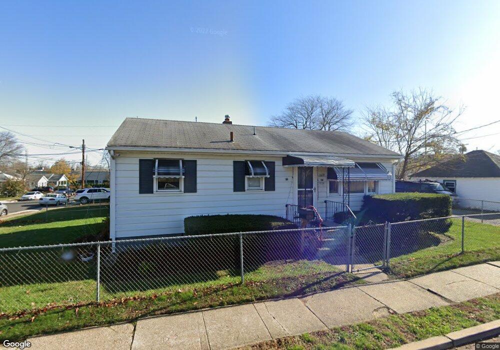
309 S Bridge Ave Red Bank, NJ 07701
Estimated Value: $378,000 - $464,000
3
Beds
1
Bath
915
Sq Ft
$460/Sq Ft
Est. Value
About This Home
This home is located at 309 S Bridge Ave, Red Bank, NJ 07701 and is currently estimated at $421,294, approximately $460 per square foot. 309 S Bridge Ave is a home located in Monmouth County with nearby schools including Red Bank Primary School, Red Bank Middle School, and Red Bank Regional High School.
Ownership History
Date
Name
Owned For
Owner Type
Purchase Details
Closed on
Mar 31, 2011
Sold by
The Nixon Family Trust and Nixon Stanley D
Bought by
Paganoni Maria De Los Angeles
Current Estimated Value
Purchase Details
Closed on
Jun 21, 2005
Sold by
Nixon Stanley D
Bought by
Nixon Family Trust and Nixon Stanley D
Create a Home Valuation Report for This Property
The Home Valuation Report is an in-depth analysis detailing your home's value as well as a comparison with similar homes in the area
Home Values in the Area
Average Home Value in this Area
Purchase History
| Date | Buyer | Sale Price | Title Company |
|---|---|---|---|
| Paganoni Maria De Los Angeles | $172,000 | Old Republic National Title | |
| Nixon Family Trust | -- | -- | |
| Nixon Stanley D | -- | -- |
Source: Public Records
Tax History Compared to Growth
Tax History
| Year | Tax Paid | Tax Assessment Tax Assessment Total Assessment is a certain percentage of the fair market value that is determined by local assessors to be the total taxable value of land and additions on the property. | Land | Improvement |
|---|---|---|---|---|
| 2025 | $5,981 | $343,200 | $177,400 | $165,800 |
| 2024 | $5,597 | $316,600 | $157,400 | $159,200 |
| 2023 | $5,597 | $292,900 | $138,100 | $154,800 |
| 2022 | $4,317 | $253,600 | $124,500 | $129,100 |
| 2021 | $4,317 | $193,000 | $83,000 | $110,000 |
| 2020 | $4,167 | $183,400 | $83,000 | $100,400 |
| 2019 | $3,989 | $180,400 | $83,000 | $97,400 |
| 2018 | $3,867 | $176,800 | $83,000 | $93,800 |
| 2017 | $3,718 | $176,200 | $83,000 | $93,200 |
| 2016 | $3,662 | $173,800 | $83,000 | $90,800 |
| 2015 | $4,318 | $212,400 | $126,500 | $85,900 |
| 2014 | $5,144 | $268,900 | $183,000 | $85,900 |
Source: Public Records
Map
Nearby Homes
- 19 Sunset Ave E
- 44 Sunset Ave W
- 3 Cedar Crossing
- 23 Cedar Crossing
- 49 Sunset Ave W
- 308 Princeton Ct
- 253 Pearl St S
- 232 S Pearl St
- 58 W Westside Ave
- 24 Cedar Crossing
- 132 Trafford St
- 38 Bank St
- 5 Clifford Graves Ct
- 11 Clifford Graves Ct
- 24 River St
- 195 Bridge Ave
- 171-173 Bridge Ave
- 121 Catherine St
- 167 River St
- 205 Maple Ave
- 39 E Westside Ave
- 43 E Westside Ave
- 31 E Westside Ave
- 38 Drummond Ave
- 40 Drummond Ave
- 38 E Westside Ave
- 45 E Westside Ave
- 42 Drummond Ave
- 27 E Westside Ave
- 32 Drummond Ave
- 30 E Westside Ave
- 44 Drummond Ave
- 47 E Westside Ave
- 30 Drummond Ave
- 40 E Westside Ave
- 25 E Westside Ave
- 42 E Westside Ave
- 0 Drummond Ave
- 28 E Westside Ave
- 44 E Westside Ave