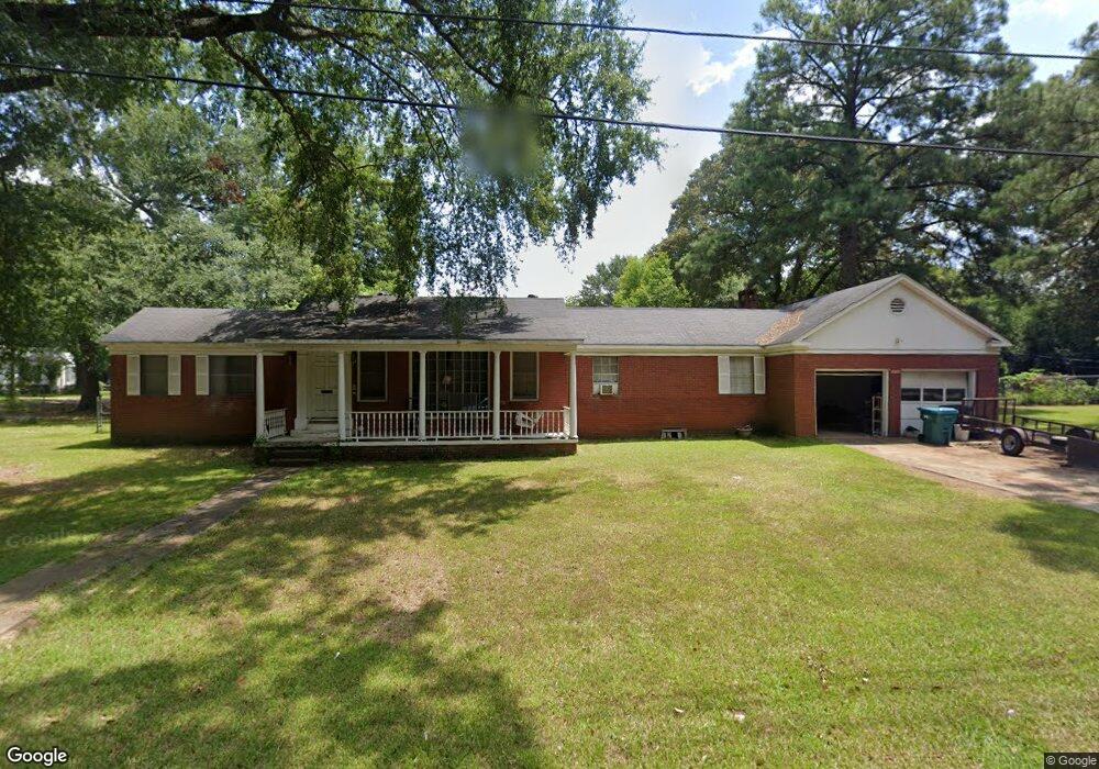
309 S Cox St Bastrop, LA 71220
Estimated Value: $50,000 - $146,051
3
Beds
2
Baths
1,773
Sq Ft
$64/Sq Ft
Est. Value
About This Home
This home is located at 309 S Cox St, Bastrop, LA 71220 and is currently estimated at $113,513, approximately $64 per square foot. 309 S Cox St is a home located in Morehouse Parish with nearby schools including Morehouse Junior High School, Bastrop High School, and St. Joseph Catholic School.
Ownership History
Date
Name
Owned For
Owner Type
Purchase Details
Closed on
May 9, 2012
Sold by
Holdiness Gwendolyn Mckoin
Bought by
Holdiness Dr and Holdiness Mack Richard
Current Estimated Value
Purchase Details
Closed on
Feb 29, 2012
Sold by
Holdiness Mavk Richard and Proctor Gwendolyn Holdiness
Bought by
Atwood
Home Financials for this Owner
Home Financials are based on the most recent Mortgage that was taken out on this home.
Original Mortgage
$67,145
Interest Rate
3.93%
Mortgage Type
Stand Alone First
Create a Home Valuation Report for This Property
The Home Valuation Report is an in-depth analysis detailing your home's value as well as a comparison with similar homes in the area
Purchase History
| Date | Buyer | Sale Price | Title Company |
|---|---|---|---|
| Holdiness Dr | -- | -- | |
| Atwood | $65,000 | -- |
Source: Public Records
Mortgage History
| Date | Status | Borrower | Loan Amount |
|---|---|---|---|
| Previous Owner | Atwood | $67,145 |
Source: Public Records
Tax History
| Year | Tax Paid | Tax Assessment Tax Assessment Total Assessment is a certain percentage of the fair market value that is determined by local assessors to be the total taxable value of land and additions on the property. | Land | Improvement |
|---|---|---|---|---|
| 2025 | $1,107 | $8,366 | $383 | $7,983 |
| 2024 | $1,110 | $8,366 | $383 | $7,983 |
| 2023 | $1,041 | $7,613 | $420 | $7,193 |
| 2022 | $1,041 | $7,613 | $420 | $7,193 |
| 2021 | $1,043 | $7,613 | $420 | $7,193 |
| 2020 | $1,022 | $7,613 | $420 | $7,193 |
| 2019 | $978 | $7,460 | $420 | $7,040 |
| 2018 | $978 | $7,460 | $420 | $7,040 |
| 2017 | $978 | $7,460 | $420 | $7,040 |
| 2016 | $978 | $7,460 | $420 | $7,040 |
| 2015 | $509 | $7,460 | $420 | $7,040 |
| 2013 | $562 | $7,460 | $420 | $7,040 |
Source: Public Records
Map
Nearby Homes
- 110 Fairview Dr
- 120 Fairview Dr
- 0 E Pecan Ave
- 211 N Odom St
- 124 Eastwood Dr
- 605 S Cox St
- 407 Tulane St
- 644 E Jefferson Ave
- Lot 7 Us Highway 425 S Unit Robinson Acres Subd
- 606 Elmhurst Dr
- 204 W Madison Ave
- 1330 Guy Ave
- 203 W Jefferson Ave
- 2014 Capella Dr
- 1333 Guy Ave
- 609 Neptune Dr
- 2022 Saturn Dr
- 700 Boatner St
- 225 Forrest Ave
- 2024 Gemini Dr
- 1406 Alabama Ave
- 1408 Alabama Ave
- 401 S Cox St
- 402 Garfield St
- 302 S Cox St
- 402 S Cox St
- 1405 Alabama Ave
- 403 S Cox St
- 1407 Alabama Ave
- 404 Garfield St
- 1208 Alabama Ave
- 404 S Cox St
- 405 S Cox St
- 230 S Cox St
- 1504 Alabama Ave
- 406 Garfield St
- 1206 Alabama Ave
- 406 S Cox St
- 1406 Texas Ave
- 403 Garfield St
Your Personal Tour Guide
Ask me questions while you tour the home.