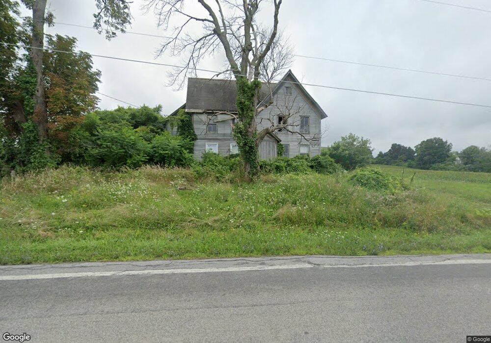
309 State Highway 163 Fort Plain, NY 13339
Estimated Value: $104,764 - $229,000
4
Beds
2
Baths
2,784
Sq Ft
$62/Sq Ft
Est. Value
About This Home
This home is located at 309 State Highway 163, Fort Plain, NY 13339 and is currently estimated at $171,441, approximately $61 per square foot. 309 State Highway 163 is a home located in Montgomery County with nearby schools including Harry Hoag School and Fort Plain Junior/Senior High School.
Ownership History
Date
Name
Owned For
Owner Type
Purchase Details
Closed on
Jun 7, 2019
Sold by
Montgomery County Of
Bought by
Burke James
Current Estimated Value
Purchase Details
Closed on
May 14, 2019
Sold by
Bowerman Shawn J and Burke James
Bought by
Montgomery County Of
Purchase Details
Closed on
Jul 7, 2016
Sold by
Shawn J Bowerman As Montgomery Cty Treas
Bought by
Burke James
Purchase Details
Closed on
May 23, 2016
Sold by
Shawn J Bowerman As Montgomery Cty Treas
Bought by
County Of Montgomery
Purchase Details
Closed on
May 7, 2013
Sold by
County Of Montgomery
Bought by
Burke James
Purchase Details
Closed on
Apr 18, 2013
Sold by
Montgomery County Treasurer Bowerman Shawn J
Bought by
County Of Montgomery
Purchase Details
Closed on
Sep 26, 2008
Sold by
Estate Moyer T Tremain
Bought by
Burke James
Purchase Details
Closed on
Oct 29, 2004
Sold by
Smith Irene
Bought by
Smith Richard
Create a Home Valuation Report for This Property
The Home Valuation Report is an in-depth analysis detailing your home's value as well as a comparison with similar homes in the area
Home Values in the Area
Average Home Value in this Area
Purchase History
| Date | Buyer | Sale Price | Title Company |
|---|---|---|---|
| Burke James | $7,128 | -- | |
| Montgomery County Of | $2,186 | -- | |
| Burke James | $7,512 | -- | |
| County Of Montgomery | $2,207 | -- | |
| Burke James | $7,326 | None | |
| County Of Montgomery | -- | None | |
| Burke James | $71,000 | Richard Weinheimer | |
| Smith Richard | $55,000 | Jason Brott |
Source: Public Records
Tax History Compared to Growth
Tax History
| Year | Tax Paid | Tax Assessment Tax Assessment Total Assessment is a certain percentage of the fair market value that is determined by local assessors to be the total taxable value of land and additions on the property. | Land | Improvement |
|---|---|---|---|---|
| 2024 | $2,708 | $48,500 | $22,700 | $25,800 |
| 2023 | $1,645 | $46,300 | $22,700 | $23,600 |
| 2022 | $1,565 | $43,500 | $19,900 | $23,600 |
| 2021 | $1,570 | $43,500 | $19,900 | $23,600 |
| 2020 | $2,582 | $43,500 | $19,900 | $23,600 |
| 2019 | $2,554 | $43,500 | $19,900 | $23,600 |
| 2018 | $2,554 | $43,500 | $19,900 | $23,600 |
| 2017 | $3,001 | $43,500 | $19,900 | $23,600 |
| 2016 | $2,948 | $43,500 | $19,900 | $23,600 |
| 2015 | -- | $43,500 | $19,900 | $23,600 |
| 2014 | -- | $43,500 | $19,900 | $23,600 |
Source: Public Records
Map
Nearby Homes
- 335 State Highway 163
- 119 Horning Dr
- 342 State Highway 163
- 276 State Highway 163
- 356 State Highway 163
- 262 State Highway 163
- 112 Nestle Rd
- 368 State Highway 163
- 130 Nestle Rd
- 147 Nestle Rd
- 371 State Highway 163
- 144 Nestle Rd
- 379 State Highway 163
- 234 New York 163
- 234 State Highway 163
- 391 State Highway 163
- 394 State Highway 163
- 403 State Highway 163
- 200 State Highway 163
- 214 State Highway 163