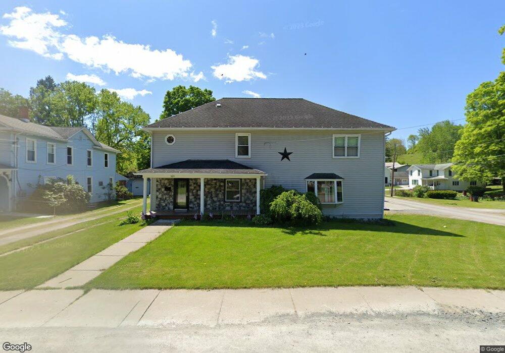
309 W Union St Canton, PA 17724
Estimated Value: $247,000 - $328,000
5
Beds
7
Baths
--
Sq Ft
0.42
Acres
About This Home
This home is located at 309 W Union St, Canton, PA 17724 and is currently estimated at $271,473. 309 W Union St is a home located in Bradford County with nearby schools including Canton Area Elementary School and Canton Junior/Senior High School.
Ownership History
Date
Name
Owned For
Owner Type
Purchase Details
Closed on
Jul 30, 2021
Sold by
Bryington Brian K and Bryington Michelle L
Bought by
Vroman Cody M
Current Estimated Value
Home Financials for this Owner
Home Financials are based on the most recent Mortgage that was taken out on this home.
Original Mortgage
$214,830
Outstanding Balance
$195,435
Interest Rate
2.93%
Mortgage Type
VA
Estimated Equity
$76,038
Purchase Details
Closed on
Dec 15, 2010
Sold by
Ward Michelle L and Bryington Michelle L
Bought by
Bryington Michelle L and Bryington Brian K
Create a Home Valuation Report for This Property
The Home Valuation Report is an in-depth analysis detailing your home's value as well as a comparison with similar homes in the area
Home Values in the Area
Average Home Value in this Area
Purchase History
| Date | Buyer | Sale Price | Title Company |
|---|---|---|---|
| Vroman Cody M | $210,000 | Lg Settlement Services | |
| Bryington Michelle L | -- | None Available |
Source: Public Records
Mortgage History
| Date | Status | Borrower | Loan Amount |
|---|---|---|---|
| Open | Vroman Cody M | $214,830 |
Source: Public Records
Tax History Compared to Growth
Tax History
| Year | Tax Paid | Tax Assessment Tax Assessment Total Assessment is a certain percentage of the fair market value that is determined by local assessors to be the total taxable value of land and additions on the property. | Land | Improvement |
|---|---|---|---|---|
| 2025 | $3,122 | $45,500 | $0 | $0 |
| 2024 | $2,933 | $45,500 | $0 | $0 |
| 2023 | $2,933 | $45,500 | $0 | $0 |
| 2022 | $2,929 | $45,500 | $0 | $0 |
| 2021 | $2,918 | $45,500 | $0 | $0 |
| 2020 | $2,891 | $45,500 | $0 | $0 |
| 2019 | $2,889 | $45,500 | $0 | $0 |
| 2018 | $2,810 | $45,500 | $0 | $0 |
| 2017 | $2,779 | $45,500 | $0 | $0 |
| 2016 | -- | $45,500 | $0 | $0 |
| 2015 | -- | $45,500 | $0 | $0 |
| 2014 | $1,231 | $45,500 | $0 | $0 |
Source: Public Records
Map
Nearby Homes
- 55 Clinton St
- 127 Troy St
- 49-51 T-329
- 290 Troy St
- 94 N Center St
- 386 Troy St
- 85 N Minnequa Ave
- 0 Upper Mountain Rd
- 108 S Washington St
- 374 S Minnequa Ave
- 19 Lovell Ln
- Upper Mountain Rd Lot Unit WP001
- 118 E South Ave
- 63 Brann St
- 1616 W Union St
- 1616 W Union Rd
- 417 Furman Rd
- 7129 Route 14
- 14751 Route 14
- 1909 Mill Hill Rd
- 13 Clinton St
- 335 W Union St
- 9 Clinton St
- 44 Clinton St
- 320 W Union St
- 304 W Union St
- 267 W Union St
- 326 W Union St
- 87 Carnwright Ln Unit 89
- 87 Carnwright Ln
- 357 W Union St
- 336 W Union St
- 290 W Union St Unit 292
- 34 Twin Pines Ln
- 276 W Union St
- 375 W Union St
- 56 Clinton St
- 266 W Union St
- 237 W Union St
- 23 Twin Pines Ln