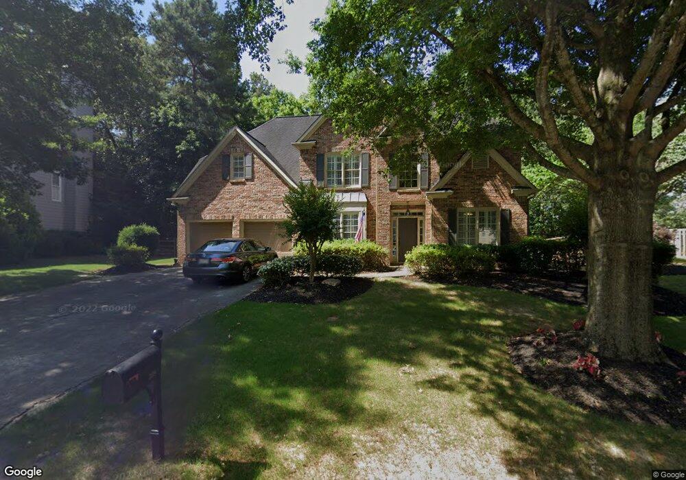
309 Woodbrook Crest Canton, GA 30114
Sutallee NeighborhoodEstimated Value: $517,445 - $550,000
4
Beds
3
Baths
2,530
Sq Ft
$211/Sq Ft
Est. Value
About This Home
This home is located at 309 Woodbrook Crest, Canton, GA 30114 and is currently estimated at $533,723, approximately $210 per square foot. 309 Woodbrook Crest is a home located in Cherokee County with nearby schools including Sixes Elementary School, Freedom Middle School, and Woodstock High School.
Ownership History
Date
Name
Owned For
Owner Type
Purchase Details
Closed on
Nov 5, 1999
Sold by
Venture Homes Inc
Bought by
Schroeder Scott C and Schroeder Rachel E
Current Estimated Value
Home Financials for this Owner
Home Financials are based on the most recent Mortgage that was taken out on this home.
Original Mortgage
$158,300
Outstanding Balance
$46,894
Interest Rate
7.81%
Mortgage Type
New Conventional
Estimated Equity
$486,829
Create a Home Valuation Report for This Property
The Home Valuation Report is an in-depth analysis detailing your home's value as well as a comparison with similar homes in the area
Home Values in the Area
Average Home Value in this Area
Purchase History
| Date | Buyer | Sale Price | Title Company |
|---|---|---|---|
| Schroeder Scott C | $197,900 | -- |
Source: Public Records
Mortgage History
| Date | Status | Borrower | Loan Amount |
|---|---|---|---|
| Open | Schroeder Scott C | $158,300 |
Source: Public Records
Tax History Compared to Growth
Tax History
| Year | Tax Paid | Tax Assessment Tax Assessment Total Assessment is a certain percentage of the fair market value that is determined by local assessors to be the total taxable value of land and additions on the property. | Land | Improvement |
|---|---|---|---|---|
| 2025 | $1,051 | $194,240 | $50,000 | $144,240 |
| 2024 | $1,017 | $185,480 | $46,000 | $139,480 |
| 2023 | $863 | $180,520 | $46,000 | $134,520 |
| 2022 | $3,518 | $145,716 | $36,000 | $109,716 |
| 2021 | $3,211 | $119,876 | $28,800 | $91,076 |
| 2020 | $3,051 | $112,880 | $28,800 | $84,080 |
| 2019 | $2,846 | $104,040 | $28,800 | $75,240 |
| 2018 | $2,718 | $97,880 | $27,200 | $70,680 |
| 2017 | $2,711 | $241,700 | $27,200 | $69,480 |
| 2016 | $2,625 | $231,200 | $27,200 | $65,280 |
| 2015 | $2,441 | $213,300 | $24,000 | $61,320 |
| 2014 | $2,383 | $208,000 | $24,000 | $59,200 |
Source: Public Records
Map
Nearby Homes
- 711 Tall Oaks Dr
- 829 Valley Dr
- 834 Valley Dr Unit 1K
- 601 Redwood Ln
- 302 Magnolia Trace
- 164 Henley St
- 160 Henley St Unit 15
- 160 Henley St
- Jasper II Plan at Cambridge at Steels Bridge
- Newton II Plan at Cambridge at Steels Bridge
- Fulton II Plan at Cambridge at Steels Bridge
- Brookwood Plan at Cambridge at Steels Bridge
- Tifton II Plan at Cambridge at Steels Bridge
- 414 Dogwood Way
- 3008 Heatherbrook Trace Unit 2B
- 106 Birchwood Pass
- 552 Steels Bridge Rd
- 3018 Heatherbrook Trace
- 304 Trecastle Ln
- 307 Woodbrook Crest
- 311 Woodbrook Crest
- 305 Woodbrook Crest
- 100 Springshade Ln
- 313 Woodbrook Crest
- 308 Woodbrook Crest
- 102 Springshade Ln
- 712 Tall Oaks Dr
- 306 Woodbrook Crest
- 104 Springshade Ln
- 303 Woodbrook Crest
- 710 Tall Oaks Dr
- 315 Woodbrook Crest
- 811 Valley Dr
- 106 Springshade Ln
- 809 Valley Dr
- 304 Woodbrook Crest
- 312 Woodbrook Crest
- 102 Misty Valley Dr
- 104 Misty Valley Dr