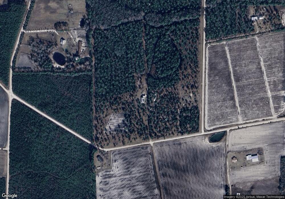
3091 Mattie Shuman Rd Waycross, GA 31503
Estimated Value: $258,000 - $516,000
--
Bed
--
Bath
2,412
Sq Ft
$149/Sq Ft
Est. Value
About This Home
This home is located at 3091 Mattie Shuman Rd, Waycross, GA 31503 and is currently estimated at $359,460, approximately $149 per square foot. 3091 Mattie Shuman Rd is a home with nearby schools including Hoboken Elementary School, Brantley County Middle School, and Brantley County High School.
Ownership History
Date
Name
Owned For
Owner Type
Purchase Details
Closed on
Jul 9, 2015
Sold by
Garrison Pamela E
Bought by
Hereford Warrent Lott and Hereford Katherine J
Current Estimated Value
Home Financials for this Owner
Home Financials are based on the most recent Mortgage that was taken out on this home.
Original Mortgage
$10,000,000
Outstanding Balance
$7,856,871
Interest Rate
4.08%
Mortgage Type
New Conventional
Estimated Equity
-$7,497,411
Create a Home Valuation Report for This Property
The Home Valuation Report is an in-depth analysis detailing your home's value as well as a comparison with similar homes in the area
Home Values in the Area
Average Home Value in this Area
Purchase History
| Date | Buyer | Sale Price | Title Company |
|---|---|---|---|
| Hereford Warrent Lott | $62,000 | -- |
Source: Public Records
Mortgage History
| Date | Status | Borrower | Loan Amount |
|---|---|---|---|
| Open | Hereford Warrent Lott | $10,000,000 |
Source: Public Records
Tax History Compared to Growth
Tax History
| Year | Tax Paid | Tax Assessment Tax Assessment Total Assessment is a certain percentage of the fair market value that is determined by local assessors to be the total taxable value of land and additions on the property. | Land | Improvement |
|---|---|---|---|---|
| 2024 | $2,677 | $107,406 | $1,386 | $106,020 |
| 2023 | $322 | $107,280 | $1,260 | $106,020 |
| 2022 | $2,656 | $106,280 | $1,260 | $105,020 |
| 2021 | $2,608 | $76,860 | $1,260 | $75,600 |
| 2020 | $2,688 | $76,860 | $1,260 | $75,600 |
| 2019 | $2,684 | $76,860 | $1,260 | $75,600 |
| 2018 | $2,640 | $77,972 | $2,372 | $75,600 |
| 2017 | $688 | $20,315 | $2,372 | $17,943 |
| 2016 | $909 | $23,590 | $23,590 | $0 |
| 2015 | -- | $23,590 | $23,590 | $0 |
Source: Public Records
Map
Nearby Homes
- 4947 High Bluff Rock Rd
- 950 Apple Dr
- 5588 Brunswick Hwy
- 12169 Central Ave
- 12091 Central Ave
- 25 Jefferson St
- 20 Marla St
- 220 Chickasaw Rd
- 57 Lynn Holly Ln
- 26 Lynn Holly Ln
- 157 Hwy
- 203 Johnny B St
- 563 Bennett Rd
- 8.84 Strickland Rd
- 300 Josephine Park Rd
- 56 Fj Melton Ln
- 0 Miles Still Rd
- 4807 Doe Rd
- 4086 Memorial Dr
- 7532 Central Ave
- 432 Idle Wild Rd
- 347 Idlewild Ln Unit 169/170
- 6051 Ft Mudge Rd
- (Lot 6) Natchez Trail
- 5956 Ft Mudge Rd
- 3310 Mattie Shuman Rd
- 3300 Mattie Shuman Rd
- 3024 Mattie Shuman Rd
- 187 Mill Pond Rd
- 3901 Mattie Shuman Rd
- 2647 Mattie Shuman Rd
- 3729 Mattie Shuman Rd
- 3568 Mattie Shuman Rd
- 140 Mill Pond Rd
- 491 Mill Pond Rd
- 3822 Mattie Shuman Rd
- 558 Mill Pond Rd
- 521 Mill Pond Rd
- 2413 Mattie Shuman Rd
- 3690 Mattie Shuman Rd
