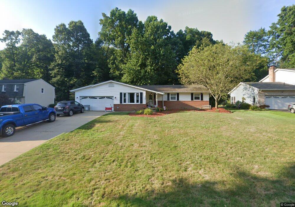
3092 Hampton St NW Uniontown, OH 44685
Estimated Value: $280,273 - $366,000
3
Beds
3
Baths
1,708
Sq Ft
$181/Sq Ft
Est. Value
About This Home
This home is located at 3092 Hampton St NW, Uniontown, OH 44685 and is currently estimated at $309,068, approximately $180 per square foot. 3092 Hampton St NW is a home located in Stark County with nearby schools including Lake Middle/High School, Lake Center Christian School, and Mayfair Christian School.
Ownership History
Date
Name
Owned For
Owner Type
Purchase Details
Closed on
Apr 14, 2015
Sold by
Dearth Beth
Bought by
Dearth Beth and The Shirley L Hathaway Revocable Living
Current Estimated Value
Home Financials for this Owner
Home Financials are based on the most recent Mortgage that was taken out on this home.
Original Mortgage
$113,225
Outstanding Balance
$87,258
Interest Rate
3.77%
Mortgage Type
New Conventional
Estimated Equity
$221,810
Create a Home Valuation Report for This Property
The Home Valuation Report is an in-depth analysis detailing your home's value as well as a comparison with similar homes in the area
Home Values in the Area
Average Home Value in this Area
Purchase History
| Date | Buyer | Sale Price | Title Company |
|---|---|---|---|
| Dearth Beth | $119,200 | Chicago Title |
Source: Public Records
Mortgage History
| Date | Status | Borrower | Loan Amount |
|---|---|---|---|
| Open | Dearth Beth | $113,225 |
Source: Public Records
Tax History Compared to Growth
Tax History
| Year | Tax Paid | Tax Assessment Tax Assessment Total Assessment is a certain percentage of the fair market value that is determined by local assessors to be the total taxable value of land and additions on the property. | Land | Improvement |
|---|---|---|---|---|
| 2025 | -- | $88,800 | $23,490 | $65,310 |
| 2024 | -- | $88,800 | $23,490 | $65,310 |
| 2023 | $2,884 | $56,600 | $13,970 | $42,630 |
| 2022 | $2,894 | $56,600 | $13,970 | $42,630 |
| 2021 | $2,925 | $56,600 | $13,970 | $42,630 |
| 2020 | $2,804 | $48,480 | $12,040 | $36,440 |
| 2019 | $2,781 | $48,480 | $12,040 | $36,440 |
| 2018 | $2,784 | $48,480 | $12,040 | $36,440 |
| 2017 | $2,727 | $43,930 | $10,750 | $33,180 |
| 2016 | $2,732 | $43,930 | $10,750 | $33,180 |
| 2015 | $2,799 | $43,930 | $10,750 | $33,180 |
| 2014 | $371 | $38,120 | $9,350 | $28,770 |
| 2013 | $1,185 | $38,120 | $9,350 | $28,770 |
Source: Public Records
Map
Nearby Homes
- 0 Heckman St NW Unit 5170772
- 11316 Cleveland Ave NW
- 2601 Lake Center St NW
- 3648 Mulberry St NW
- 12235 Cantburg Ave NW
- 3863 Heckman St NW
- 3851 Cromford Cir NW
- 11056 Peach Glen Ave NW
- 10531 Newbury Ave NW
- 11065 Dunsby Ave NW
- 3048 Wright Rd NW
- 3026 Wright Rd NW
- 843 Brodie Ct
- 835 Brodie Ct
- 12494 Bridgemont Ave NW
- 10380 Sudbury Cir NW
- 2490 Ledgestone Dr NW
- 2693 Ledgestone Dr NW
- 2334 Ledgestone Dr NW
- 2244 Ledgestone Dr NW
- 3112 Hampton St NW
- 3074 Hampton St NW
- 3054 Hampton St NW
- 3126 Hampton St NW
- 3105 Hampton St NW
- 3036 Hampton St NW
- 3125 Hampton St NW
- 3146 Hampton St NW
- 11540 Holbrook Ave NW
- 11558 Whitehall Ave NW
- 3029 Hampton St NW
- 11567 Holbrook Ave NW
- 3014 Hampton St NW
- 3178 Hampton St NW
- 11566 Holbrook Ave NW
- 3131 Twin Hills St NW
- 3093 Twin Hills St NW
- 11580 Whitehall Ave NW
- 3011 Hampton St NW
- 3063 Twin Hills St NW