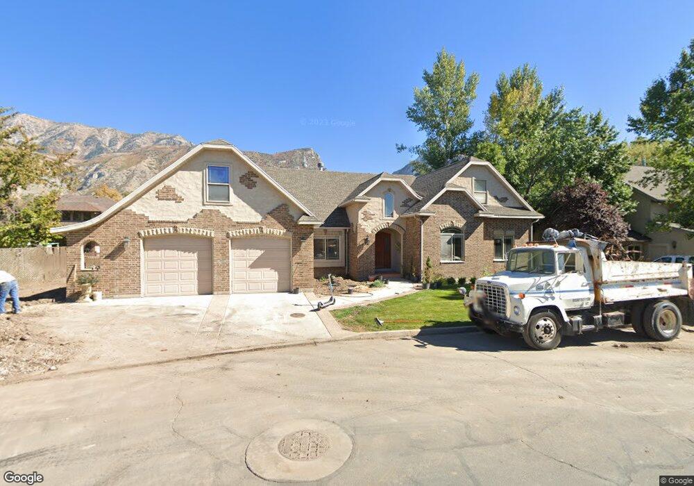
3092 N 100 W Unit 26 Provo, UT 84604
Riverside NeighborhoodEstimated Value: $767,000 - $907,000
5
Beds
3
Baths
3,072
Sq Ft
$263/Sq Ft
Est. Value
About This Home
This home is located at 3092 N 100 W Unit 26, Provo, UT 84604 and is currently estimated at $808,422, approximately $263 per square foot. 3092 N 100 W Unit 26 is a home located in Utah County with nearby schools including Canyon Crest Elementary School, Centennial Middle School, and Timpview High School.
Ownership History
Date
Name
Owned For
Owner Type
Purchase Details
Closed on
Feb 9, 2023
Sold by
Solis Leonor
Bought by
Nordica Investments Llc
Current Estimated Value
Purchase Details
Closed on
Dec 17, 2003
Sold by
Stuart Charles J and Stuart Necia
Bought by
Solis Leonore
Purchase Details
Closed on
Dec 3, 2001
Sold by
Jensen Vonnie
Bought by
B A T Ltd Partnership
Create a Home Valuation Report for This Property
The Home Valuation Report is an in-depth analysis detailing your home's value as well as a comparison with similar homes in the area
Home Values in the Area
Average Home Value in this Area
Purchase History
| Date | Buyer | Sale Price | Title Company |
|---|---|---|---|
| Nordica Investments Llc | -- | Skyline Title | |
| Solis Leonore | -- | Fidelity Land & Title | |
| B A T Ltd Partnership | -- | Backman Stewart Title Servic |
Source: Public Records
Tax History Compared to Growth
Tax History
| Year | Tax Paid | Tax Assessment Tax Assessment Total Assessment is a certain percentage of the fair market value that is determined by local assessors to be the total taxable value of land and additions on the property. | Land | Improvement |
|---|---|---|---|---|
| 2025 | $3,727 | $408,925 | $276,800 | $466,700 |
| 2024 | $3,727 | $366,850 | $0 | $0 |
| 2023 | $13 | $336,985 | $0 | $0 |
| 2022 | $404 | $325,105 | $0 | $0 |
| 2021 | $2,694 | $459,700 | $234,100 | $225,600 |
| 2020 | $2,655 | $424,800 | $203,600 | $221,200 |
| 2019 | $2,553 | $424,800 | $203,600 | $221,200 |
| 2018 | $2,475 | $417,600 | $196,400 | $221,200 |
| 2017 | $2,261 | $209,660 | $0 | $0 |
| 2016 | $120 | $216,040 | $0 | $0 |
| 2015 | $38 | $206,250 | $0 | $0 |
| 2014 | $2,201 | $200,420 | $0 | $0 |
Source: Public Records
Map
Nearby Homes
- 3057 N 100 W
- 3013 N 100 W
- 2939 N Marrcrest Dr W
- 3240 Shadowbrook Dr
- 2888 Marrcrest W
- 2823 N Marrcrest E
- 96 Marrcrest S
- 1636 N 320 E Unit 5
- 1660 N 320 E Unit 3
- 1648 N 320 E Unit 4
- 1625 N 320 E Unit 1
- 1624 N 320 E Unit 6
- 1615 N 320 E Unit 1
- 1612 N 320 E Unit RES
- 3430 Brookside Dr
- 3477 Brookside Dr
- 2774 N 370 E
- 3535 N 160 St W
- 553 E 3400 N
- 597 E 3400 N