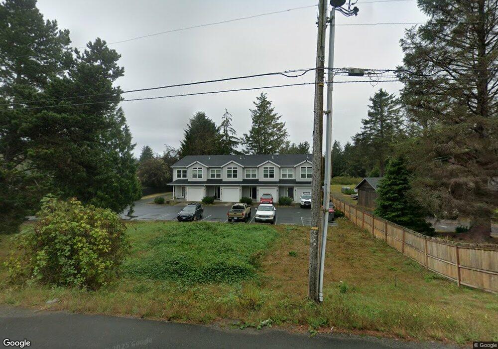
3096 Highway 101 N Seaside, OR 97138
Woodland Park NeighborhoodEstimated Value: $597,000
3
Beds
1
Bath
1,190
Sq Ft
$502/Sq Ft
Est. Value
About This Home
This home is located at 3096 Highway 101 N, Seaside, OR 97138 and is currently estimated at $597,000, approximately $501 per square foot. 3096 Highway 101 N is a home located in Clatsop County with nearby schools including Seaside High School.
Ownership History
Date
Name
Owned For
Owner Type
Purchase Details
Closed on
Jan 11, 2021
Sold by
Morrison Joel and Gronmark Kristi
Bought by
Green Place Properties Llc
Current Estimated Value
Purchase Details
Closed on
Feb 25, 2019
Sold by
Cozart Evelyn Nadine
Bought by
Morrison Joel and Gronmark Kristi
Home Financials for this Owner
Home Financials are based on the most recent Mortgage that was taken out on this home.
Original Mortgage
$595,000
Interest Rate
4.4%
Mortgage Type
Purchase Money Mortgage
Create a Home Valuation Report for This Property
The Home Valuation Report is an in-depth analysis detailing your home's value as well as a comparison with similar homes in the area
Home Values in the Area
Average Home Value in this Area
Purchase History
| Date | Buyer | Sale Price | Title Company |
|---|---|---|---|
| Green Place Properties Llc | -- | Accommodation | |
| Morrison Joel | $102,700 | Pacific Title Co |
Source: Public Records
Mortgage History
| Date | Status | Borrower | Loan Amount |
|---|---|---|---|
| Previous Owner | Morrison Joel | $595,000 |
Source: Public Records
Tax History Compared to Growth
Tax History
| Year | Tax Paid | Tax Assessment Tax Assessment Total Assessment is a certain percentage of the fair market value that is determined by local assessors to be the total taxable value of land and additions on the property. | Land | Improvement |
|---|---|---|---|---|
| 2025 | $7,577 | $693,683 | -- | -- |
| 2024 | $7,703 | $673,479 | -- | -- |
| 2023 | $7,487 | $653,864 | $0 | $0 |
| 2022 | $7,263 | $634,820 | $0 | $0 |
| 2021 | $7,414 | $616,331 | $0 | $0 |
| 2020 | $2,450 | $205,032 | $0 | $0 |
| 2019 | $1,139 | $94,951 | $0 | $0 |
| 2018 | $1,098 | $92,186 | $0 | $0 |
| 2017 | $1,068 | $89,502 | $0 | $0 |
| 2016 | $923 | $86,896 | $42,422 | $44,474 |
| 2015 | $893 | $84,366 | $41,187 | $43,179 |
| 2014 | $848 | $81,910 | $0 | $0 |
| 2013 | -- | $79,525 | $0 | $0 |
Source: Public Records
Map
Nearby Homes
- 782 Woodland Ct
- 1265 D St
- 3389 U S 101
- 3387-3389 U S 101
- 196 Dylan Ct
- 2657 N Hwy 101 Unit 6
- 0 Wellington Ave Unit 25-48
- 0 Wellington Ave Unit 1202
- 2624 Neawanna St
- 735 3rd St
- 1324 Sea Ridge Ln
- 802 25th Ave
- 000 Neawanna St
- 1065 Picture Place
- 1054 Picture Place
- 1396 N Ocean Ave
- 0 McCormick Garden Rd
- 101 13th St Unit 209
- 88161 McCormick Garden Rd
- 856 Neacoxie Blvd
- 3114 Highway 101 N
- 3071 Highway 101 N
- 3134 N Hwy 101
- 3134 Highway 101 N
- 3134 U S 101
- 3134 Oregon Coast Hwy
- 3095 Highway 101 N
- 3142 Highway 101 N
- 3142 U S 101
- 3095 N Hwy 101
- 3095 U S 101
- 1166 G St
- 3174 Highway 101 N
- 3111 U S 101
- 505 Spruce Ave
- 3111 N Hwy 101
- 447 Spruce St
- 447 Spruce Ave
- 3003 Us-101
- 571 Railroad Ave