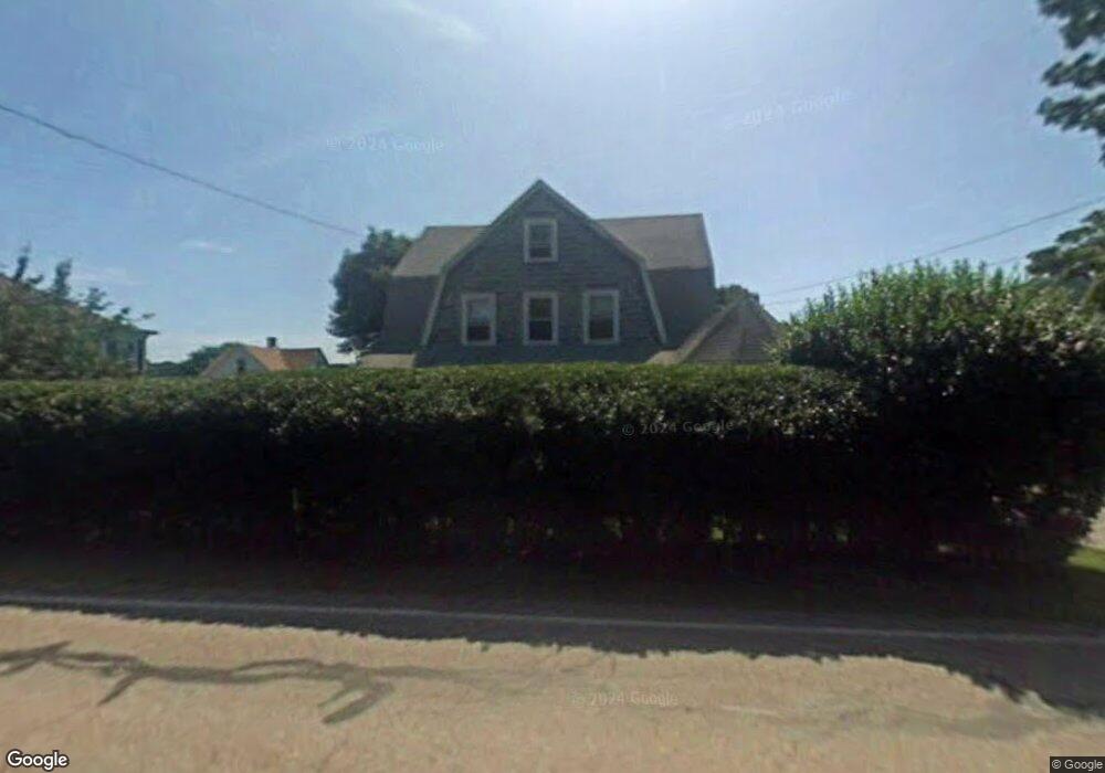
3096 Riverside Ave Somerset, MA 02726
Pottersville NeighborhoodEstimated Value: $518,000 - $549,000
4
Beds
2
Baths
1,875
Sq Ft
$281/Sq Ft
Est. Value
About This Home
This home is located at 3096 Riverside Ave, Somerset, MA 02726 and is currently estimated at $526,628, approximately $280 per square foot. 3096 Riverside Ave is a home located in Bristol County with nearby schools including North Elementary School, Somerset Middle School, and St. Michael's School.
Ownership History
Date
Name
Owned For
Owner Type
Purchase Details
Closed on
Feb 12, 2007
Sold by
Viveiros Dennis and Necchi Olivia
Bought by
Viveiros Dennis
Current Estimated Value
Purchase Details
Closed on
Nov 10, 2004
Sold by
Viveiros Dennis
Bought by
Viveiros Dennis and Necchi Olivia
Home Financials for this Owner
Home Financials are based on the most recent Mortgage that was taken out on this home.
Original Mortgage
$259,000
Interest Rate
5.89%
Purchase Details
Closed on
Sep 23, 2004
Sold by
Viveiros Dennis and Necchi Olivia
Bought by
Viveiros Dennis
Home Financials for this Owner
Home Financials are based on the most recent Mortgage that was taken out on this home.
Original Mortgage
$259,000
Interest Rate
5.89%
Create a Home Valuation Report for This Property
The Home Valuation Report is an in-depth analysis detailing your home's value as well as a comparison with similar homes in the area
Home Values in the Area
Average Home Value in this Area
Purchase History
| Date | Buyer | Sale Price | Title Company |
|---|---|---|---|
| Viveiros Dennis | -- | -- | |
| Viveiros Dennis | -- | -- | |
| Viveiros Dennis | -- | -- | |
| Viveiros Dennis | -- | -- | |
| Viveiros Dennis | -- | -- | |
| Viveiros Dennis | -- | -- |
Source: Public Records
Mortgage History
| Date | Status | Borrower | Loan Amount |
|---|---|---|---|
| Previous Owner | Viveiros Dennis | $259,000 |
Source: Public Records
Tax History Compared to Growth
Tax History
| Year | Tax Paid | Tax Assessment Tax Assessment Total Assessment is a certain percentage of the fair market value that is determined by local assessors to be the total taxable value of land and additions on the property. | Land | Improvement |
|---|---|---|---|---|
| 2025 | $6,118 | $460,000 | $187,400 | $272,600 |
| 2024 | $5,747 | $449,300 | $187,400 | $261,900 |
| 2023 | $5,129 | $404,500 | $170,300 | $234,200 |
| 2022 | $4,741 | $356,700 | $147,500 | $209,200 |
| 2021 | $4,784 | $325,900 | $133,700 | $192,200 |
| 2020 | $4,596 | $302,000 | $134,500 | $167,500 |
| 2019 | $5,585 | $306,000 | $156,800 | $149,200 |
| 2018 | $4,920 | $290,100 | $152,200 | $137,900 |
| 2017 | $4,931 | $283,400 | $152,200 | $131,200 |
| 2016 | $4,962 | $283,400 | $152,200 | $131,200 |
| 2015 | $4,117 | $237,300 | $114,700 | $122,600 |
| 2014 | $5,526 | $228,800 | $114,700 | $114,100 |
Source: Public Records
Map
Nearby Homes
- 2714 Riverside Ave
- 50 Pratt Ave
- 34 Barry Ave
- 224 Chace St
- 3896 N Main St
- 138 Bourn Ave
- 50 Clark St Unit 19
- 190 Gibbs St
- 604 Lafayette St
- 95 Brookside Rd
- 64 Midland Rd
- 3063 N Main St
- 2546 County St
- 4700 N Main St Unit 3E
- 701 Prospect St
- 112 Rounseville Ave
- 287 Bark St
- 0 Bark St Unit 73152576
- 0 Bark St Unit 1342599
- 5 Wayland St
- 3112 Riverside Ave
- 3087 Riverside Ave
- 3077 Riverside Ave
- 88 Gay St
- 109 Warren St
- 109 Warren St Unit 2
- 109 Warren St Unit 1
- 76 Gay St
- 76 Gay St Unit 1
- 3111 Riverside Ave
- 3134 Riverside Ave
- 87 Warren St
- 3060 Riverside Ave
- 108 Warren St
- 3123 Riverside Ave
- 102 Warren St
- 58 Gay St
- 3046 Riverside Ave
- 3061 Riverside Ave
- 67 Warren St