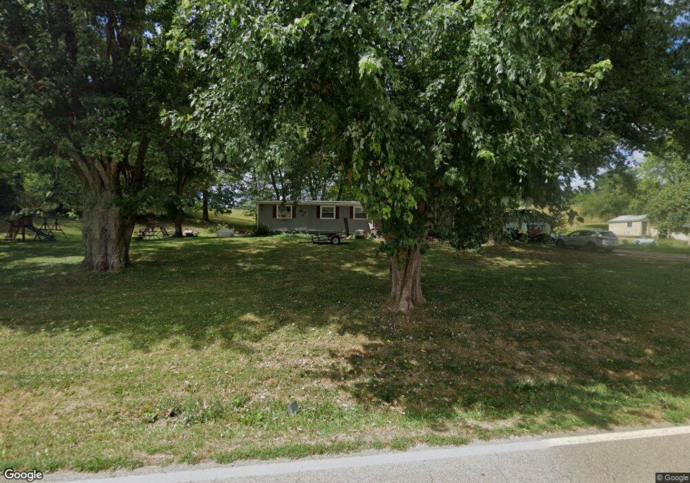
30997 State Route 325 Langsville, OH 45741
Estimated Value: $70,658 - $153,000
--
Bed
2
Baths
1,368
Sq Ft
$82/Sq Ft
Est. Value
About This Home
This home is located at 30997 State Route 325, Langsville, OH 45741 and is currently estimated at $112,665, approximately $82 per square foot. 30997 State Route 325 is a home located in Meigs County with nearby schools including Meigs Primary School, Meigs Intermediate School, and Meigs Middle School.
Ownership History
Date
Name
Owned For
Owner Type
Purchase Details
Closed on
May 10, 2024
Sold by
Tillis Don B and Tillis Gina R
Bought by
George Wendell
Current Estimated Value
Purchase Details
Closed on
Dec 11, 2018
Sold by
Tillis Don B
Bought by
George Wendell
Home Financials for this Owner
Home Financials are based on the most recent Mortgage that was taken out on this home.
Original Mortgage
$22,000
Interest Rate
5%
Mortgage Type
Land Contract Argmt. Of Sale
Purchase Details
Closed on
Sep 11, 2017
Sold by
Tillis Amos
Bought by
Tillis Don B and Tillis Gina R
Purchase Details
Closed on
Dec 9, 2013
Sold by
Meadows William L
Bought by
Tillis Amos
Purchase Details
Closed on
Feb 28, 1997
Bought by
Tillis Amos
Create a Home Valuation Report for This Property
The Home Valuation Report is an in-depth analysis detailing your home's value as well as a comparison with similar homes in the area
Home Values in the Area
Average Home Value in this Area
Purchase History
| Date | Buyer | Sale Price | Title Company |
|---|---|---|---|
| George Wendell | $24,500 | None Listed On Document | |
| George Wendell | $24,500 | None Available | |
| Tillis Don B | $22,500 | None Available | |
| Tillis Amos | $14,667 | None Available | |
| Tillis Amos | -- | -- |
Source: Public Records
Mortgage History
| Date | Status | Borrower | Loan Amount |
|---|---|---|---|
| Previous Owner | George Wendell | $22,000 |
Source: Public Records
Tax History Compared to Growth
Tax History
| Year | Tax Paid | Tax Assessment Tax Assessment Total Assessment is a certain percentage of the fair market value that is determined by local assessors to be the total taxable value of land and additions on the property. | Land | Improvement |
|---|---|---|---|---|
| 2024 | $792 | $24,170 | $3,270 | $20,900 |
| 2023 | $792 | $24,170 | $3,270 | $20,900 |
| 2022 | $829 | $24,170 | $3,270 | $20,900 |
| 2021 | $571 | $14,060 | $2,360 | $11,700 |
| 2020 | $532 | $14,060 | $2,360 | $11,700 |
| 2019 | $525 | $14,060 | $2,360 | $11,700 |
| 2018 | $422 | $11,720 | $1,370 | $10,350 |
| 2017 | $530 | $14,720 | $1,370 | $13,350 |
| 2016 | $525 | $14,720 | $1,370 | $13,350 |
| 2014 | $488 | $15,240 | $1,370 | $13,870 |
| 2013 | $488 | $15,130 | $1,370 | $13,760 |
Source: Public Records
Map
Nearby Homes
- 0 Briar Ridge Rd Unit 11566708
- 0 Briar Ridge Rd Unit 24580050
- 0 Briar Ridge Rd Unit 24580053
- 30286 Briar Ridge Rd
- 32204 Titus Rd Unit (GV Cabin at Titus)
- 32204 Titus Rd
- 30284 Briar Ridge Rd
- 30285 Briar Ridge Rd
- 0 Parkinson Rd
- 31428 Will Vance Rd
- 0 Will Vance Rd Unit 23777611
- 0 Parkinson Rd Unit (Tract 8 at Titus)
- 0 Parkinson Rd Unit 21532380
- 32325 Red Hill Rd Unit (SeclusionCabin at B
- 0 Red Hill Rd Unit 25653294
- 0 Red Hill Rd Unit 11594354
- 28600 Ohio 124
- 0 Edmundson Rd Unit (Tract 5 at Big Timb
- 0 Edmundson Rd Unit (Tract 2 at Big Timb
- 0 Edmundson Rd Unit (Tract 6 at Big Timb
- 30777 State Route 325
- 30951 State Route 325
- 30945 State Route 325
- 30969 State Route 325
- 30981 State Route 325
- 31003 State Route 325
- 30745 State Route 325
- 32106 State Route 325
- 32106 State Route 325
- 0 N Side State Rd 325
- 31908 Briar Ridge Rd
- 31894 Briar Ridge Rd
- 31850 Briar Ridge Rd
- 124 Sr
- 31855 Briar Ridge Rd
- 31510 State Route 124
- 31423 State Route 124
- 31423 State Route 124
- 31771 State Route 325
- 31041 State Route 124