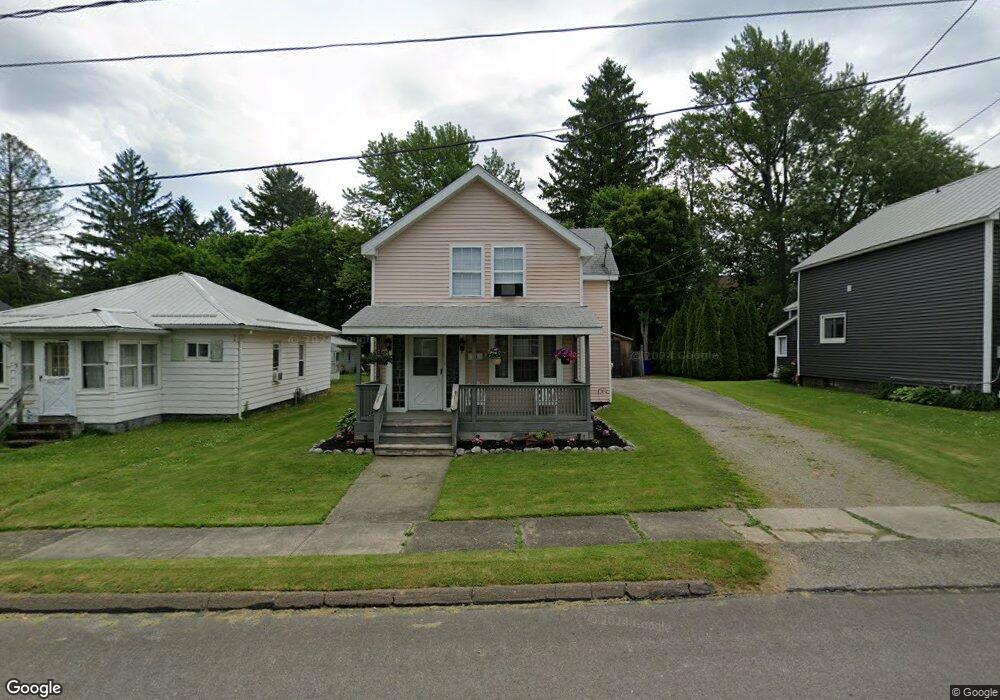
31 5th Ave Union City, PA 16438
Estimated Value: $130,000 - $147,000
3
Beds
1
Bath
1,246
Sq Ft
$111/Sq Ft
Est. Value
About This Home
This home is located at 31 5th Ave, Union City, PA 16438 and is currently estimated at $138,062, approximately $110 per square foot. 31 5th Ave is a home located in Erie County with nearby schools including Union City Elementary School, Union City Middle School, and Union City High School.
Ownership History
Date
Name
Owned For
Owner Type
Purchase Details
Closed on
Mar 18, 2010
Sold by
Barteldt Jason E and Barteldt Jessica
Bought by
Triscuit Jamie D
Current Estimated Value
Home Financials for this Owner
Home Financials are based on the most recent Mortgage that was taken out on this home.
Original Mortgage
$67,900
Outstanding Balance
$45,160
Interest Rate
5.05%
Mortgage Type
New Conventional
Estimated Equity
$92,902
Purchase Details
Closed on
Mar 31, 2005
Sold by
Scoles Brian M and Scoles Marcie A
Bought by
Barteldt Jason E
Home Financials for this Owner
Home Financials are based on the most recent Mortgage that was taken out on this home.
Original Mortgage
$54,320
Interest Rate
5.61%
Mortgage Type
Purchase Money Mortgage
Purchase Details
Closed on
Sep 23, 2004
Sold by
Mellon Bank Na
Bought by
Scoles Brian M
Purchase Details
Closed on
Mar 2, 2004
Sold by
Elias Matt L and Huff Peggy S
Bought by
Mellon Bank Na
Create a Home Valuation Report for This Property
The Home Valuation Report is an in-depth analysis detailing your home's value as well as a comparison with similar homes in the area
Home Values in the Area
Average Home Value in this Area
Purchase History
| Date | Buyer | Sale Price | Title Company |
|---|---|---|---|
| Triscuit Jamie D | $70,000 | None Available | |
| Barteldt Jason E | $56,000 | -- | |
| Scoles Brian M | $37,000 | -- | |
| Mellon Bank Na | $4,900 | -- |
Source: Public Records
Mortgage History
| Date | Status | Borrower | Loan Amount |
|---|---|---|---|
| Open | Triscuit Jamie D | $67,900 | |
| Previous Owner | Barteldt Jason E | $54,320 |
Source: Public Records
Tax History Compared to Growth
Tax History
| Year | Tax Paid | Tax Assessment Tax Assessment Total Assessment is a certain percentage of the fair market value that is determined by local assessors to be the total taxable value of land and additions on the property. | Land | Improvement |
|---|---|---|---|---|
| 2025 | $2,019 | $71,100 | $12,800 | $58,300 |
| 2024 | $2,019 | $71,100 | $12,800 | $58,300 |
| 2023 | $1,891 | $71,100 | $12,800 | $58,300 |
| 2022 | $1,869 | $71,100 | $12,800 | $58,300 |
| 2021 | $1,890 | $71,100 | $12,800 | $58,300 |
| 2020 | $1,790 | $71,100 | $12,800 | $58,300 |
| 2019 | $1,777 | $71,100 | $12,800 | $58,300 |
| 2018 | $1,765 | $71,100 | $12,800 | $58,300 |
| 2017 | $1,738 | $71,100 | $12,800 | $58,300 |
| 2016 | $1,668 | $71,100 | $12,800 | $58,300 |
| 2015 | $1,650 | $71,100 | $12,800 | $58,300 |
| 2014 | $1,132 | $71,100 | $12,800 | $58,300 |
Source: Public Records
Map
Nearby Homes
- 92 S Main St
- 108 S Main St
- 23 Center St
- 58 Odell St
- 24 Gillette St
- 139 S Main St
- 110 N Main St
- Lot 1 Dobbs Rd
- LOT 4 Danner Dr & Lot 15 Linda Ln
- LOT 3 Danner Dr & Lot 14 Linda Ln
- LOT 1 Danner Dr & Lot 12 Linda Ln
- LOT 2 & 13 Danner Dr & Linda Ln
- 15771 Old Wattsburg Rd
- 15900 Wattsburg-Union Rd
- 10500 U S 6
- 3920 Stone Quarry Rd
- 4060 Route 6
- 13134 Clute Rd
- 11097 Route 6
- Lot 614 637 638 Weed Rd