Estimated Value: $95,865 - $197,000
--
Bed
1
Bath
1,204
Sq Ft
$132/Sq Ft
Est. Value
About This Home
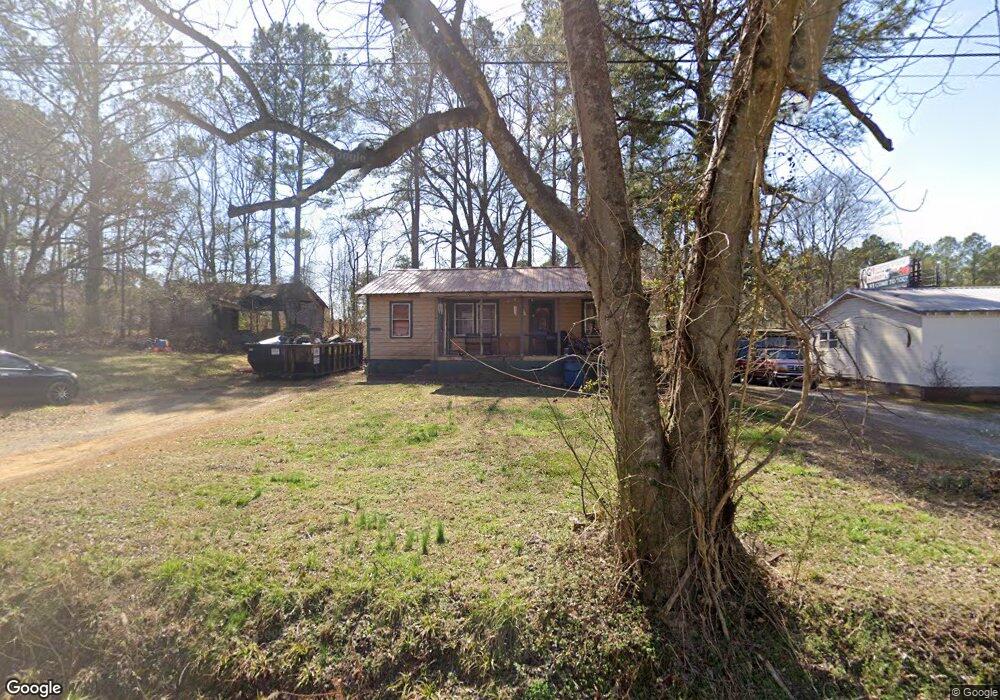
This home is located at 31 Althea Dr NW, Rome, GA 30165 and is currently estimated at $158,466, approximately $131 per square foot. 31 Althea Dr NW is a home located in Floyd County with nearby schools including Coosa Middle School and Coosa High School.
Ownership History
Date
Name
Owned For
Owner Type
Purchase Details
Closed on
Oct 13, 1999
Sold by
Cordle Billy and Pattie Lynn Rogers 2
Bought by
Rogers Pattie Lynn
Current Estimated Value
Purchase Details
Closed on
Mar 26, 1999
Sold by
Cordle Billy and Carey James Rogers
Bought by
Cordle Billy and Pattie Lynn Roge
Purchase Details
Closed on
Nov 22, 1994
Sold by
Cordle Mary Elizabeth and Rance Barry Patt
Bought by
Cordle Billy and Carey James Rogers
Purchase Details
Closed on
Sep 7, 1993
Sold by
Patterson W S
Bought by
Cordle Mary Elizabeth and Rance Barry
Purchase Details
Closed on
Oct 9, 1992
Sold by
Patterson Dula Mae and W S
Bought by
Patterson W S
Purchase Details
Closed on
Mar 19, 1992
Sold by
Patterson Dula Mae
Bought by
Patterson Dula Mae and W S
Purchase Details
Closed on
Jul 22, 1974
Sold by
Dula Patterson W and Dula Mae
Bought by
Patterson Dula Mae
Purchase Details
Closed on
Sep 24, 1971
Bought by
Dula Patterson W and Dula Mae
Create a Home Valuation Report for This Property
The Home Valuation Report is an in-depth analysis detailing your home's value as well as a comparison with similar homes in the area
Home Values in the Area
Average Home Value in this Area
Purchase History
| Date | Buyer | Sale Price | Title Company |
|---|---|---|---|
| Rogers Pattie Lynn | -- | -- | |
| Cordle Billy | -- | -- | |
| Cordle Billy | $23,000 | -- | |
| Cordle Mary Elizabeth | -- | -- | |
| Patterson W S | -- | -- | |
| Patterson Dula Mae | -- | -- | |
| Patterson Dula Mae | -- | -- | |
| Dula Patterson W | -- | -- |
Source: Public Records
Tax History Compared to Growth
Tax History
| Year | Tax Paid | Tax Assessment Tax Assessment Total Assessment is a certain percentage of the fair market value that is determined by local assessors to be the total taxable value of land and additions on the property. | Land | Improvement |
|---|---|---|---|---|
| 2024 | $900 | $26,390 | $7,616 | $18,774 |
| 2023 | $829 | $24,616 | $6,664 | $17,952 |
| 2022 | $663 | $19,835 | $5,236 | $14,599 |
| 2021 | $606 | $17,682 | $4,760 | $12,922 |
| 2020 | $553 | $15,892 | $3,808 | $12,084 |
| 2019 | $517 | $15,070 | $3,808 | $11,262 |
| 2018 | $490 | $14,220 | $3,808 | $10,412 |
| 2017 | $476 | $13,726 | $3,808 | $9,918 |
| 2016 | $466 | $13,214 | $3,800 | $9,414 |
| 2015 | $459 | $13,214 | $3,800 | $9,414 |
| 2014 | $459 | $13,214 | $3,800 | $9,414 |
Source: Public Records
Map
Nearby Homes
- 0 Alabama Hwy Unit 10590171
- 0 Alabama Hwy Unit 7635346
- 0 Alabama Hwy Unit 7494552
- 43 Brownlow Dr NW
- 33 Cedar Ln NW
- 31 Cedar Ln NW
- 4813 Alabama Hwy SW
- 36 Stargazer Trail NW
- 10 Nest Dr NW
- 48 Atwood Dr NW
- 5 Red Fox Dr SW
- 4485 Alabama Hwy
- 775 Mays Bridge Rd SW
- 8 Kayla Dr NW
- 26 Red Fox Dr SW
- 458 Kraftsman Rd SW
- 1 Ann Dr NW
- 293 N Avery Rd NW
- 45 Albert Ave NW
- 86 N Avery Rd NW
- 23 Althea Dr NW
- 33 Althea Dr NW
- 5216 Alabama Hwy NW
- 24 Althea Dr NW
- 26 Althea Dr NW
- 0 Alabama Hwy Unit 5900630
- 0 Alabama Hwy Unit 8249565
- 0 Alabama Hwy Unit 5893715
- 0 Alabama Hwy Unit 8241216
- 0 Alabama Hwy Unit 3245399
- 0 Alabama Hwy Unit 7598004
- 0 Alabama Hwy Unit 7089178
- 0 Alabama Hwy Unit 7173152
- 0 Alabama Hwy Unit 7240795
- 0 Alabama Hwy Unit 7250383
- 0 Alabama Hwy Unit 7250368
- 0 Alabama Hwy Unit 7344829
- 0 Alabama Hwy Unit 7358112
- 0 Alabama Hwy Unit 7423038
- 0 Alabama Hwy Unit 7402136