Estimated Value: $223,000 - $248,000
3
Beds
2
Baths
--
Sq Ft
10,019
Sq Ft Lot
About This Home
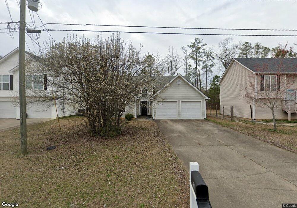
This home is located at 31 Atwood Dr NW, Rome, GA 30165 and is currently estimated at $236,418. 31 Atwood Dr NW is a home located in Floyd County with nearby schools including Coosa Middle School and Coosa High School.
Ownership History
Date
Name
Owned For
Owner Type
Purchase Details
Closed on
Jul 19, 2007
Sold by
Not Provided
Bought by
Vega Hilda J and Vega Pedro N
Current Estimated Value
Home Financials for this Owner
Home Financials are based on the most recent Mortgage that was taken out on this home.
Original Mortgage
$92,800
Outstanding Balance
$58,456
Interest Rate
6.65%
Mortgage Type
New Conventional
Estimated Equity
$177,962
Purchase Details
Closed on
Mar 24, 2006
Sold by
Not Provided
Bought by
Vega Hilda J and Vega Pedro N
Purchase Details
Closed on
Jan 23, 2004
Sold by
Vice Rodney
Bought by
All American Coin Services Llc
Purchase Details
Closed on
Apr 25, 2003
Sold by
Givens James M and Dwight Walraven
Bought by
Vice Rodney
Purchase Details
Closed on
Aug 3, 1995
Bought by
Givens James M and Dwight Walraven
Create a Home Valuation Report for This Property
The Home Valuation Report is an in-depth analysis detailing your home's value as well as a comparison with similar homes in the area
Home Values in the Area
Average Home Value in this Area
Purchase History
| Date | Buyer | Sale Price | Title Company |
|---|---|---|---|
| Vega Hilda J | $116,000 | -- | |
| Vega Hilda J | -- | -- | |
| All American Coin Services Llc | $24,300 | -- | |
| Vice Rodney | $13,900 | -- | |
| Givens James M | -- | -- |
Source: Public Records
Mortgage History
| Date | Status | Borrower | Loan Amount |
|---|---|---|---|
| Open | Vega Hilda J | $92,800 |
Source: Public Records
Tax History Compared to Growth
Tax History
| Year | Tax Paid | Tax Assessment Tax Assessment Total Assessment is a certain percentage of the fair market value that is determined by local assessors to be the total taxable value of land and additions on the property. | Land | Improvement |
|---|---|---|---|---|
| 2024 | $2,746 | $87,786 | $8,400 | $79,386 |
| 2023 | $2,549 | $69,966 | $8,400 | $61,566 |
| 2022 | $1,802 | $59,431 | $8,000 | $51,431 |
| 2021 | $1,677 | $54,324 | $8,000 | $46,324 |
| 2020 | $1,612 | $51,810 | $8,000 | $43,810 |
| 2019 | $1,453 | $47,292 | $8,000 | $39,292 |
| 2018 | $1,326 | $43,017 | $8,000 | $35,017 |
| 2017 | $1,250 | $40,418 | $8,000 | $32,418 |
| 2016 | $1,086 | $34,520 | $8,000 | $26,520 |
| 2015 | -- | $34,520 | $8,000 | $26,520 |
| 2014 | -- | $34,520 | $8,000 | $26,520 |
Source: Public Records
Map
Nearby Homes
- 10 Nest Dr NW
- 48 Atwood Dr NW
- 4485 Alabama Hwy
- 4813 Alabama Hwy SW
- 1 Ann Dr NW
- 43 Brownlow Dr NW
- 33 Cedar Ln NW
- 31 Cedar Ln NW
- 293 N Avery Rd NW
- 45 Albert Ave NW
- 0 Alabama Hwy Unit 10590171
- 0 Alabama Hwy Unit 7635346
- 0 Alabama Hwy Unit 7494552
- 86 N Avery Rd NW
- 53 Northside Dr NW
- 5 Red Fox Dr SW
- 775 Mays Bridge Rd SW
- 26 Red Fox Dr SW
- 87 Northside Dr NW
- 0 Charleston Dr NW Unit 10543945
- 0 Atwood Dr NW Unit 20066814
- 0 Atwood Dr NW Unit 8659364
- 0 Atwood Dr NW Unit 8647732
- 0 Atwood Dr NW Unit 8536607
- 0 Atwood Dr NW Unit 8658374
- 0 Atwood Dr NW Unit 9006804
- 0 Atwood Dr NW Unit 3259369
- 0 Atwood Dr NW Unit 3288326
- 0 Atwood Dr NW Unit 7156866
- 0 Atwood Dr NW Unit 7169591
- 0 Atwood Dr NW Unit 7331331
- 0 Atwood Dr NW Unit 7344053
- 0 Atwood Dr NW Unit 7474368
- 0 Atwood Dr NW Unit 8010004
- 0 Atwood Dr NW Unit 8018182
- 0 Atwood Dr NW Unit 8259236
- 0 Atwood Dr NW
- 33 Atwood Dr NW
- 29 Atwood Dr NW
- 27 Atwood Dr NW