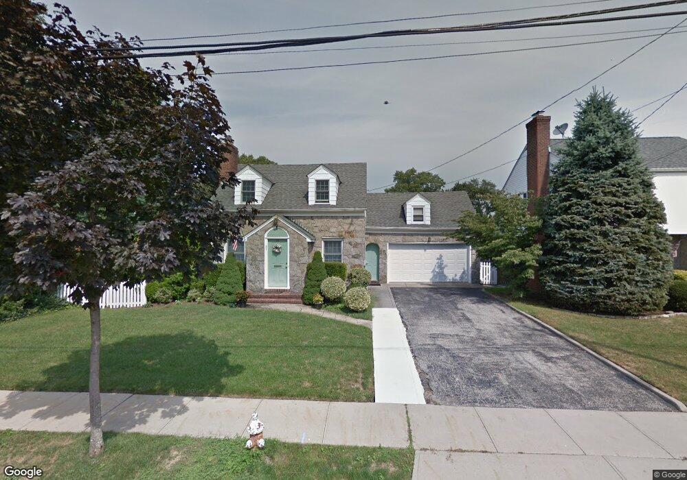
31 Azalia Ct Hempstead, NY 11550
Estimated Value: $720,981 - $830,000
Studio
2
Baths
1,687
Sq Ft
$460/Sq Ft
Est. Value
About This Home
This home is located at 31 Azalia Ct, Hempstead, NY 11550 and is currently estimated at $775,491, approximately $459 per square foot. 31 Azalia Ct is a home located in Nassau County with nearby schools including The Academy Charter School, Crescent School, and St Joseph Elementary School.
Ownership History
Date
Name
Owned For
Owner Type
Purchase Details
Closed on
Aug 18, 2008
Sold by
Gale Paul
Bought by
Lai Arthur
Current Estimated Value
Purchase Details
Closed on
Nov 21, 2006
Sold by
Kearns Brian
Bought by
Garbo Regis
Purchase Details
Closed on
Jun 13, 2003
Sold by
Nolan Christopher
Bought by
Kearns Brian
Purchase Details
Closed on
Sep 4, 1996
Sold by
Gaudreau David and Gaudreau Elizabeth
Bought by
Nolan Christopher and Nolan Kathleen
Create a Home Valuation Report for This Property
The Home Valuation Report is an in-depth analysis detailing your home's value as well as a comparison with similar homes in the area
Home Values in the Area
Average Home Value in this Area
Purchase History
| Date | Buyer | Sale Price | Title Company |
|---|---|---|---|
| Lai Arthur | $505,000 | -- | |
| Garbo Regis | $540,000 | -- | |
| Kearns Brian | $490,000 | -- | |
| Nolan Christopher | $190,000 | -- |
Source: Public Records
Tax History
| Year | Tax Paid | Tax Assessment Tax Assessment Total Assessment is a certain percentage of the fair market value that is determined by local assessors to be the total taxable value of land and additions on the property. | Land | Improvement |
|---|---|---|---|---|
| 2025 | $10,642 | $464 | $235 | $229 |
| 2024 | $1,428 | $547 | $277 | $270 |
Source: Public Records
Map
Nearby Homes
- 91 Bedell Ave
- 42 Mead St
- 73 Stratford Rd
- 26 Hilbert St
- 22 Mulford Place Unit 5C
- 22 Mulford Place Unit 2D
- 35 Mulford Place
- 32 Cathedral Ave Unit 6c
- 24 Mulford Place Unit 4B
- 24 Mulford Place Unit 6A
- 144 Hilton Ave
- 79 Hempstead Turnpike
- 159 Avon Place
- 200 Hilton Ave Unit 66
- 20 Wendell St Unit A16
- 20 Wendell St Unit 18A
- 227 Concord Ave
- 170 Ivy St
- 244 Hamilton Ave
- 14 Parsons Dr
Your Personal Tour Guide
Ask me questions while you tour the home.