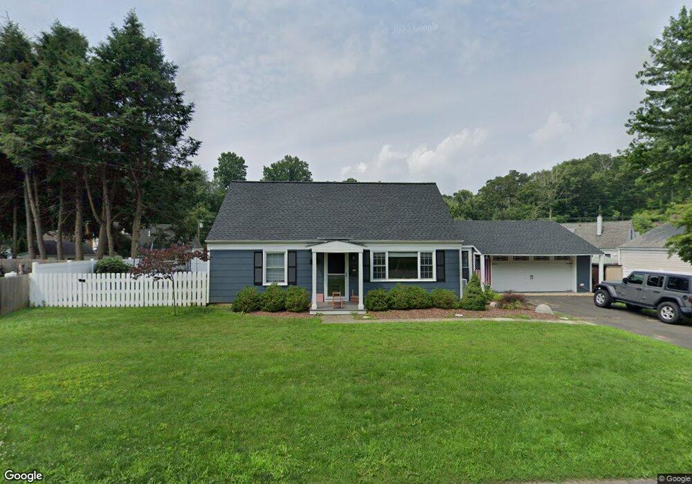
31 Bethpage Dr Bethel, CT 06801
Estimated Value: $423,000 - $533,000
3
Beds
1
Bath
1,436
Sq Ft
$323/Sq Ft
Est. Value
About This Home
This home is located at 31 Bethpage Dr, Bethel, CT 06801 and is currently estimated at $464,281, approximately $323 per square foot. 31 Bethpage Dr is a home located in Fairfield County with nearby schools including R.M.T. Johnson School, Bethel Middle School, and Bethel High School.
Ownership History
Date
Name
Owned For
Owner Type
Purchase Details
Closed on
Aug 31, 2006
Sold by
Wheeler Katherine and Wheeler Jonathan
Bought by
Dance Nils and Balbi Christine
Current Estimated Value
Purchase Details
Closed on
Jul 18, 2001
Sold by
Popp Frank and Popp Lori A
Bought by
Wheeler Jonathan and Wheeler Katherine
Purchase Details
Closed on
Jul 21, 1995
Sold by
Hodgers Robert and Hodgers Dorothy
Bought by
Popp Lori and Popp Francis
Create a Home Valuation Report for This Property
The Home Valuation Report is an in-depth analysis detailing your home's value as well as a comparison with similar homes in the area
Home Values in the Area
Average Home Value in this Area
Purchase History
| Date | Buyer | Sale Price | Title Company |
|---|---|---|---|
| Dance Nils | $332,500 | -- | |
| Wheeler Jonathan | $195,000 | -- | |
| Popp Lori | $137,000 | -- |
Source: Public Records
Mortgage History
| Date | Status | Borrower | Loan Amount |
|---|---|---|---|
| Open | Popp Lori | $337,481 | |
| Closed | Popp Lori | $307,000 |
Source: Public Records
Tax History Compared to Growth
Tax History
| Year | Tax Paid | Tax Assessment Tax Assessment Total Assessment is a certain percentage of the fair market value that is determined by local assessors to be the total taxable value of land and additions on the property. | Land | Improvement |
|---|---|---|---|---|
| 2025 | $7,059 | $232,120 | $94,500 | $137,620 |
| 2024 | $6,771 | $232,120 | $94,500 | $137,620 |
| 2023 | $6,599 | $232,120 | $94,500 | $137,620 |
| 2022 | $6,104 | $176,470 | $94,500 | $81,970 |
| 2021 | $6,046 | $176,470 | $94,500 | $81,970 |
| 2020 | $5,954 | $176,470 | $94,500 | $81,970 |
| 2019 | $5,896 | $176,470 | $94,500 | $81,970 |
| 2018 | $5,801 | $176,470 | $94,500 | $81,970 |
| 2017 | $5,257 | $159,880 | $70,700 | $89,180 |
| 2016 | $5,143 | $159,880 | $70,700 | $89,180 |
| 2015 | $5,145 | $159,880 | $70,700 | $89,180 |
| 2014 | $5,134 | $159,880 | $70,700 | $89,180 |
Source: Public Records
Map
Nearby Homes
- 21 Oven Rock Rd
- 89 Knollwood Dr
- 148 Grassy Plain St Unit B
- 30 Mountain Rd
- 15A Mountainville Rd
- 4 Bailey Blvd Unit 4
- 66 Nashville Rd Unit L
- 6 Paulding Terrace
- 48 & 50 Nashville Rd
- 10 South St Unit 66
- 81 Coalpit Hill Rd Unit B
- 80 Tucker St Unit 80
- 2 Chestnut St
- 95 Chestnut St Unit D
- 51 Kingswood Dr
- 134 Nashville Rd
- 12 Mountainville Rd
- 9 Mountainville Rd
- 12 Eagle Rock Hill Unit 12
- 12 Canaan Dr
- 4 Oven Rock Rd
- 6 Oven Rock Rd
- 33 Bethpage Dr
- 29 Bethpage Dr
- 36 Bethpage Dr
- 34 Bethpage Dr
- 38 Bethpage Dr
- 32 Bethpage Dr
- 40 Bethpage Dr
- 30 Bethpage Dr
- 17 Oven Rock Rd
- 37 Bethpage Dr
- 15 Oven Rock Rd
- 7 Oven Rock Rd
- 19 Oven Rock Rd
- 11 Oven Rock Rd
- 9 Oven Rock Rd
- 3 Oven Rock Rd
- 5 Oven Rock Rd
- 1 Oven Rock Rd