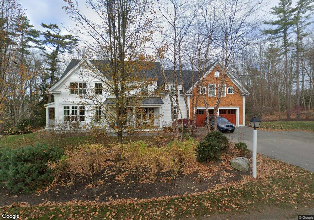
31 Blackberry Lane (Lot 1) Yarmouth, ME 04096
Estimated Value: $2,241,158 - $2,516,000
4
Beds
4
Baths
3,698
Sq Ft
$635/Sq Ft
Est. Value
About This Home
This home is located at 31 Blackberry Lane (Lot 1), Yarmouth, ME 04096 and is currently estimated at $2,348,053, approximately $634 per square foot. 31 Blackberry Lane (Lot 1) is a home located in Cumberland County with nearby schools including William H. Rowe School, Yarmouth Elementary School, and Frank H. Harrison Middle School.
Ownership History
Date
Name
Owned For
Owner Type
Purchase Details
Closed on
Jun 1, 2015
Sold by
Brown Michael W and Brown Kristen S
Bought by
Rockefeller Nancy
Current Estimated Value
Purchase Details
Closed on
Oct 10, 2013
Sold by
Eagle Trace Llc
Bought by
Brown Michael W and Brown Kristen S
Home Financials for this Owner
Home Financials are based on the most recent Mortgage that was taken out on this home.
Original Mortgage
$1,116,000
Interest Rate
4.53%
Mortgage Type
Purchase Money Mortgage
Purchase Details
Closed on
Jul 6, 2010
Sold by
Santillo David J
Bought by
Eagle Trace Llc
Create a Home Valuation Report for This Property
The Home Valuation Report is an in-depth analysis detailing your home's value as well as a comparison with similar homes in the area
Home Values in the Area
Average Home Value in this Area
Purchase History
| Date | Buyer | Sale Price | Title Company |
|---|---|---|---|
| Rockefeller Nancy | -- | -- | |
| Brown Michael W | -- | -- | |
| Eagle Trace Llc | -- | -- |
Source: Public Records
Mortgage History
| Date | Status | Borrower | Loan Amount |
|---|---|---|---|
| Previous Owner | Brown Michael W | $1,116,000 |
Source: Public Records
Tax History Compared to Growth
Tax History
| Year | Tax Paid | Tax Assessment Tax Assessment Total Assessment is a certain percentage of the fair market value that is determined by local assessors to be the total taxable value of land and additions on the property. | Land | Improvement |
|---|---|---|---|---|
| 2024 | $27,511 | $1,071,700 | $186,400 | $885,300 |
| 2023 | $25,228 | $1,071,700 | $186,400 | $885,300 |
| 2022 | $23,170 | $1,071,700 | $186,400 | $885,300 |
| 2021 | $21,220 | $1,071,700 | $186,400 | $885,300 |
| 2020 | $32,328 | $1,071,700 | $186,400 | $885,300 |
| 2019 | $20,212 | $1,071,700 | $186,400 | $885,300 |
| 2018 | $19,076 | $1,071,700 | $186,400 | $885,300 |
| 2017 | $18,390 | $1,071,700 | $186,400 | $885,300 |
| 2016 | $18,288 | $1,072,000 | $186,700 | $885,300 |
| 2015 | $16,215 | $752,100 | $124,000 | $628,100 |
| 2014 | $16,245 | $752,100 | $124,000 | $628,100 |
| 2013 | $7,621 | $346,400 | $0 | $0 |
Source: Public Records
Map
Nearby Homes
- 6 Ebb Tide Dr
- 51 Meeting House Farms Rd
- 21 Ledge Rd
- 24 Daybreak Ln
- 1 Ledge Rd
- 16 Town Landing Rd
- 86 Pleasant St
- 186 Foreside Rd
- 51 Pleasant St
- 51 Oakland Ave
- 69 Rand Rd
- 52 Blueberry Cove Rd Unit 52
- 30 Blueberry Cove
- 62 Blueberry Cove Rd Unit 62
- 70 Main St
- 87 Wharf Rd
- 44 Essex Dr
- 184 Spruce Point Rd
- 12 Sea Cove Rd
- 92 Spruce Point Rd
- 31 Blackberry Ln
- 45 Blackberry Lane (Lot 2)
- 45 Blackberry Ln
- 551 Princes Point Rd
- 52 High Winds Dr
- 581 Princes Point Rd
- 62 High Winds Dr
- 571 Princes Point Rd
- 72 Blackberry Ln
- 56 Blackberry Ln
- 134 High Winds Dr
- 74 High Winds Dr
- Lot 4 Pittee Creek Way
- 14 High Winds Dr
- 14 High Winds Dr
- 3 Pittee Creek Way
- 570 Princes Point Rd
- 8 Pittee Creek Way
- 4 High Winds Dr
- 619 Princes Point Rd