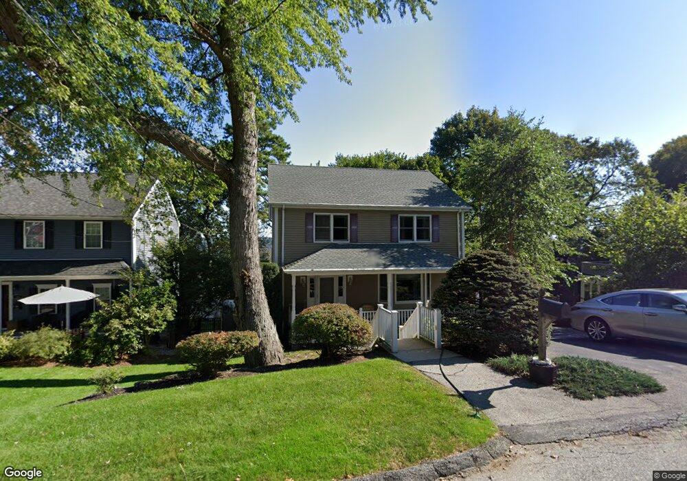
31 Bradley Rd Arlington, MA 02474
Arlington Heights NeighborhoodEstimated Value: $1,408,000 - $1,586,000
3
Beds
4
Baths
2,665
Sq Ft
$553/Sq Ft
Est. Value
About This Home
This home is located at 31 Bradley Rd, Arlington, MA 02474 and is currently estimated at $1,473,156, approximately $552 per square foot. 31 Bradley Rd is a home located in Middlesex County with nearby schools including M. Norcross Stratton Elementary School, Ottoson Middle School, and Arlington High School.
Ownership History
Date
Name
Owned For
Owner Type
Purchase Details
Closed on
Jun 14, 2001
Sold by
Rudin Joel and Burnett-Rudin Emily
Bought by
Chetty Veerappa K and Chetty Anbukili K
Current Estimated Value
Home Financials for this Owner
Home Financials are based on the most recent Mortgage that was taken out on this home.
Original Mortgage
$479,900
Interest Rate
7.15%
Mortgage Type
Purchase Money Mortgage
Purchase Details
Closed on
Jun 20, 1994
Sold by
Johnson and Johnson J
Bought by
Rudin Joel
Create a Home Valuation Report for This Property
The Home Valuation Report is an in-depth analysis detailing your home's value as well as a comparison with similar homes in the area
Home Values in the Area
Average Home Value in this Area
Purchase History
| Date | Buyer | Sale Price | Title Company |
|---|---|---|---|
| Chetty Veerappa K | $599,900 | -- | |
| Rudin Joel | $305,000 | -- |
Source: Public Records
Mortgage History
| Date | Status | Borrower | Loan Amount |
|---|---|---|---|
| Open | Rudin Joel | $272,125 | |
| Closed | Rudin Joel | $310,000 | |
| Closed | Rudin Joel | $479,900 |
Source: Public Records
Tax History Compared to Growth
Tax History
| Year | Tax Paid | Tax Assessment Tax Assessment Total Assessment is a certain percentage of the fair market value that is determined by local assessors to be the total taxable value of land and additions on the property. | Land | Improvement |
|---|---|---|---|---|
| 2025 | $13,083 | $1,214,800 | $517,900 | $696,900 |
| 2024 | $12,526 | $1,182,800 | $517,900 | $664,900 |
| 2023 | $11,800 | $1,052,600 | $445,600 | $607,000 |
| 2022 | $11,133 | $974,900 | $421,500 | $553,400 |
| 2021 | $10,876 | $959,100 | $421,500 | $537,600 |
| 2020 | $10,607 | $959,000 | $421,500 | $537,500 |
| 2019 | $9,469 | $840,900 | $421,500 | $419,400 |
| 2018 | $9,470 | $780,700 | $361,300 | $419,400 |
| 2017 | $9,503 | $756,600 | $337,200 | $419,400 |
| 2016 | $9,069 | $708,500 | $289,100 | $419,400 |
| 2015 | $9,139 | $674,500 | $258,900 | $415,600 |
Source: Public Records
Map
Nearby Homes
- 12 Longmeadow Rd
- 334 Mystic St
- 5A Wood Ln
- 5 Wood Ln
- 335 Mystic St
- 6 Pawnee Dr
- 37 Pine St
- 10 Viking Rd
- 52-56 Dudley St
- 16 Ridge St
- 281 Forest St
- 10 Apache Trail
- 18-20 Brattle St
- 3 Victoria Rd Unit 3
- 3 Victoria Rd Unit 5
- 4 Beck Rd
- 975 Mass Ave Unit 106
- 975 Massachusetts Ave Unit 307
- 1025 Massachusetts Ave Unit 204
- 204 Plan at Majestic Mill Brook