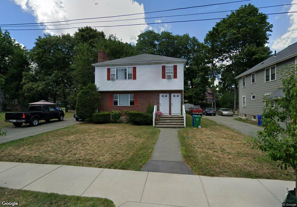
31 Bridges Ave Unit 33 Newtonville, MA 02460
Newtonville NeighborhoodEstimated Value: $1,480,000 - $1,740,251
4
Beds
4
Baths
2,700
Sq Ft
$589/Sq Ft
Est. Value
About This Home
This home is located at 31 Bridges Ave Unit 33, Newtonville, MA 02460 and is currently estimated at $1,589,063, approximately $588 per square foot. 31 Bridges Ave Unit 33 is a home located in Middlesex County with nearby schools including Cabot Elementary School, F.A. Day Middle School, and Newton North High School.
Ownership History
Date
Name
Owned For
Owner Type
Purchase Details
Closed on
May 1, 1985
Bought by
Lee Robert H and Brennan Linda M
Current Estimated Value
Create a Home Valuation Report for This Property
The Home Valuation Report is an in-depth analysis detailing your home's value as well as a comparison with similar homes in the area
Home Values in the Area
Average Home Value in this Area
Purchase History
| Date | Buyer | Sale Price | Title Company |
|---|---|---|---|
| Lee Robert H | $255,000 | -- |
Source: Public Records
Mortgage History
| Date | Status | Borrower | Loan Amount |
|---|---|---|---|
| Open | Lee Robert H | $3,850,000 | |
| Closed | Lee Robert H | $281,250 |
Source: Public Records
Tax History Compared to Growth
Tax History
| Year | Tax Paid | Tax Assessment Tax Assessment Total Assessment is a certain percentage of the fair market value that is determined by local assessors to be the total taxable value of land and additions on the property. | Land | Improvement |
|---|---|---|---|---|
| 2025 | $14,507 | $1,480,300 | $835,500 | $644,800 |
| 2024 | $14,027 | $1,437,200 | $811,200 | $626,000 |
| 2023 | $13,409 | $1,317,200 | $657,600 | $659,600 |
| 2022 | $12,830 | $1,219,600 | $608,900 | $610,700 |
| 2021 | $12,039 | $1,118,900 | $558,600 | $560,300 |
| 2020 | $11,681 | $1,118,900 | $558,600 | $560,300 |
| 2019 | $10,928 | $1,045,700 | $522,100 | $523,600 |
| 2018 | $10,796 | $997,800 | $490,300 | $507,500 |
| 2017 | $10,179 | $915,400 | $449,800 | $465,600 |
| 2016 | $9,557 | $839,800 | $412,700 | $427,100 |
| 2015 | $9,113 | $784,900 | $385,700 | $399,200 |
Source: Public Records
Map
Nearby Homes
- 110 Harvard St
- 206-208 Cabot St
- 48 Harvard St Unit 1
- 34 Winchester Rd Unit 34
- 96 E Side Pkwy
- 22 Holland St Unit 22
- 21 Lewis St
- 95 Blake St
- 28 Laudholm Rd
- 14 Princeton St Unit 14
- 14 Princeton St
- 230 Bellevue St Unit 1
- 230 Bellevue St Unit 2
- 232 Bellevue St Unit 2
- 112 Washington Park Unit 1
- 46 Lenglen Rd Unit A
- 77 Court St Unit 205
- 22 Walnut Place Unit 1
- 324 Adams St Unit 2
- 51 Clinton St
- 31 Bridges Ave Unit 2
- 23-25 Bridges Ave Unit 23
- 23-25 Bridges Ave Unit 25
- 23-25 Bridges Ave
- 23 Bridges Ave Unit 25
- 23 Bridges Ave Unit 1
- 20 Clarendon St
- 19 Bridges Ave Unit 21
- 41 Bridges Ave Unit 1
- 41 Bridges Ave Unit 43
- 30 Clarendon St
- 26 Clarendon St Unit 1
- 26 Clarendon St Unit 28
- 120 Norwood Ave
- 15-17 Bridges Ave
- 15 Bridges Ave Unit 17
- 15 Bridges Ave Unit 15
- 47 Bridges Ave Unit 49
- 49 Bridges Ave
- 34 Clarendon St