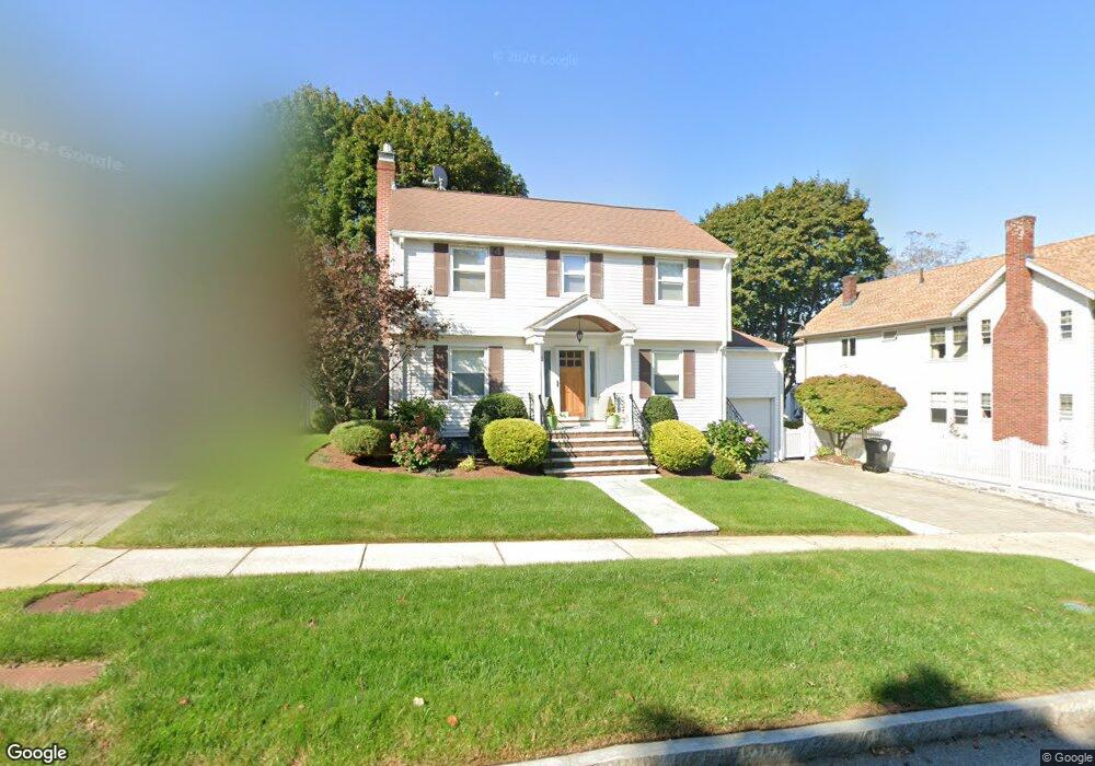
31 Bright Rd Belmont, MA 02478
Belmont Center NeighborhoodEstimated Value: $1,363,118 - $1,516,000
3
Beds
3
Baths
1,931
Sq Ft
$751/Sq Ft
Est. Value
About This Home
This home is located at 31 Bright Rd, Belmont, MA 02478 and is currently estimated at $1,450,280, approximately $751 per square foot. 31 Bright Rd is a home located in Middlesex County with nearby schools including Mary Lee Burbank Elementary School, Winthrop L Chenery Middle School, and Belmont High School.
Ownership History
Date
Name
Owned For
Owner Type
Purchase Details
Closed on
Apr 8, 2019
Sold by
Phillips Vlasis and Phillips Kathy
Bought by
Vlasis Phillips Ft
Current Estimated Value
Purchase Details
Closed on
Jul 6, 1973
Bought by
Vlasis Phillips and Phillips Kathy
Create a Home Valuation Report for This Property
The Home Valuation Report is an in-depth analysis detailing your home's value as well as a comparison with similar homes in the area
Home Values in the Area
Average Home Value in this Area
Purchase History
| Date | Buyer | Sale Price | Title Company |
|---|---|---|---|
| Vlasis Phillips Ft | -- | -- | |
| Vlasis Phillips | -- | -- |
Source: Public Records
Mortgage History
| Date | Status | Borrower | Loan Amount |
|---|---|---|---|
| Previous Owner | Vlasis Phillips | $50,000 | |
| Previous Owner | Vlasis Phillips | $120,000 | |
| Previous Owner | Vlasis Phillips | $80,000 | |
| Previous Owner | Vlasis Phillips | $100,000 |
Source: Public Records
Tax History
| Year | Tax Paid | Tax Assessment Tax Assessment Total Assessment is a certain percentage of the fair market value that is determined by local assessors to be the total taxable value of land and additions on the property. | Land | Improvement |
|---|---|---|---|---|
| 2025 | $12,666 | $1,112,000 | $639,000 | $473,000 |
| 2024 | $12,376 | $1,172,000 | $796,000 | $376,000 |
| 2023 | $11,645 | $1,036,000 | $695,000 | $341,000 |
| 2022 | $11,213 | $970,000 | $653,000 | $317,000 |
| 2021 | $10,894 | $944,000 | $681,000 | $263,000 |
| 2020 | $10,230 | $930,000 | $667,000 | $263,000 |
| 2019 | $9,429 | $808,000 | $525,000 | $283,000 |
| 2018 | $9,234 | $760,000 | $477,000 | $283,000 |
| 2017 | $9,149 | $721,000 | $438,000 | $283,000 |
| 2016 | $9,031 | $719,000 | $438,000 | $281,000 |
| 2015 | $8,308 | $644,000 | $364,000 | $280,000 |
Source: Public Records
Map
Nearby Homes
- 51 Gale Rd
- 27-29 S Normandy Ave
- 95 Griswold St Unit 95
- 773 Concord Ave Unit 103
- 92 Shaw Rd
- 23 Loomis St Unit 23
- 314 Channing Rd
- 6 Shaw Rd
- 17 Smith Place
- 23 Stearns Rd
- 27 Little Pond Rd
- 73 Foster Rd Unit 2
- 75 Foster Rd Unit 1
- 207 Slade St
- 10 Fresh Pond Place Unit 10
- 72 Fairview Ave Unit 72
- 676 Huron Ave Unit 44
- 29 Wheeler St Unit 108
- 29 Wheeler St Unit 310
- 161 Cushing St
- 25 Bright Rd Unit 27
- 37 Bright Rd
- 27 Bright Rd Unit 1
- 42 Watson Rd
- 48 Watson Rd
- 48 Watson Rd
- 34 Watson Rd Unit 36
- 36 Watson Rd Unit 36
- 21 Bright Rd Unit 23
- 23 Bright Rd
- 23 Bright Rd Unit 1
- 43 Bright Rd
- 54 Watson Rd
- 28 Watson Rd Unit 30
- 30 Watson Rd Unit 30
- 28 Watson Rd Unit 28
- 30 Watson Rd
- 3 Dana Rd
- 15-17 Bright Rd Unit 17
- 22 Watson Rd Unit 24
Your Personal Tour Guide
Ask me questions while you tour the home.