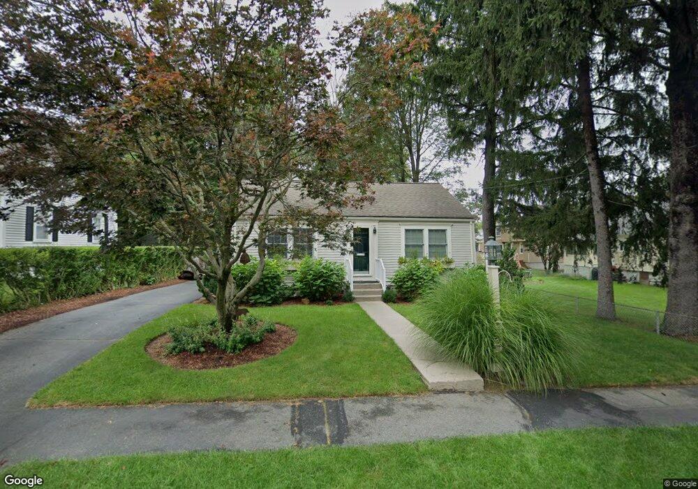
31 Calvert Rd East Walpole, MA 02032
Estimated Value: $549,000 - $701,000
2
Beds
1
Bath
1,375
Sq Ft
$452/Sq Ft
Est. Value
About This Home
This home is located at 31 Calvert Rd, East Walpole, MA 02032 and is currently estimated at $621,132, approximately $451 per square foot. 31 Calvert Rd is a home located in Norfolk County with nearby schools including Old Post Road School, Walpole Middle School, and Walpole High School.
Ownership History
Date
Name
Owned For
Owner Type
Purchase Details
Closed on
Mar 3, 2010
Sold by
Kane Vincent D
Bought by
Kane Vincent D and Love-Kane Ellen
Current Estimated Value
Home Financials for this Owner
Home Financials are based on the most recent Mortgage that was taken out on this home.
Original Mortgage
$230,000
Interest Rate
5%
Mortgage Type
Purchase Money Mortgage
Purchase Details
Closed on
Apr 1, 1998
Sold by
First Bk Of Beverly Hl
Bought by
Kane Vincent D
Home Financials for this Owner
Home Financials are based on the most recent Mortgage that was taken out on this home.
Original Mortgage
$133,000
Interest Rate
6.89%
Mortgage Type
Purchase Money Mortgage
Purchase Details
Closed on
Feb 17, 1998
Sold by
Caplis-Lopes Martin E
Bought by
Girard Sb Fsb
Home Financials for this Owner
Home Financials are based on the most recent Mortgage that was taken out on this home.
Original Mortgage
$133,000
Interest Rate
6.89%
Mortgage Type
Purchase Money Mortgage
Purchase Details
Closed on
May 10, 1991
Sold by
Caplis Tr Thomas A
Bought by
Caplis-Lopes Patrice A
Create a Home Valuation Report for This Property
The Home Valuation Report is an in-depth analysis detailing your home's value as well as a comparison with similar homes in the area
Home Values in the Area
Average Home Value in this Area
Purchase History
| Date | Buyer | Sale Price | Title Company |
|---|---|---|---|
| Kane Vincent D | -- | -- | |
| Kane Vincent D | $140,000 | -- | |
| Girard Sb Fsb | $106,000 | -- | |
| Caplis-Lopes Patrice A | $130,000 | -- |
Source: Public Records
Mortgage History
| Date | Status | Borrower | Loan Amount |
|---|---|---|---|
| Open | Caplis-Lopes Patrice A | $230,000 | |
| Closed | Kane Vincent D | $230,000 | |
| Previous Owner | Caplis-Lopes Patrice A | $30,000 | |
| Previous Owner | Caplis-Lopes Patrice A | $133,000 |
Source: Public Records
Tax History
| Year | Tax Paid | Tax Assessment Tax Assessment Total Assessment is a certain percentage of the fair market value that is determined by local assessors to be the total taxable value of land and additions on the property. | Land | Improvement |
|---|---|---|---|---|
| 2025 | $7,178 | $559,500 | $324,600 | $234,900 |
| 2024 | $6,937 | $524,700 | $312,100 | $212,600 |
| 2023 | $6,739 | $485,200 | $271,300 | $213,900 |
| 2022 | $6,250 | $432,200 | $251,200 | $181,000 |
| 2021 | $5,900 | $397,600 | $237,000 | $160,600 |
| 2020 | $5,915 | $394,600 | $223,600 | $171,000 |
| 2019 | $5,733 | $379,700 | $215,000 | $164,700 |
| 2018 | $5,209 | $341,100 | $206,700 | $134,400 |
| 2017 | $5,045 | $329,100 | $198,700 | $130,400 |
| 2016 | $4,834 | $310,700 | $189,600 | $121,100 |
| 2015 | $4,570 | $291,100 | $172,300 | $118,800 |
| 2014 | $4,384 | $278,200 | $172,300 | $105,900 |
Source: Public Records
Map
Nearby Homes
- 0 Charlotte Rd
- Unit 11 Powder House Ln Unit 11
- 8 Powder House Ln Unit 2
- Unit 12 Powder House Ln Unit 12
- Unit 3 Powder House Ln Unit 3
- 40 Endean Dr
- 7 Washington Green
- 120 Polley Ln
- 3 York Cir
- 363 - 367 Washington St
- 74 Alandale Pkwy
- 65 Alandale Pkwy
- 26 Saint Josephs Ave
- 53 Tremont St
- 70 Endicott St Unit 401
- 1086 Washington St
- 7 Cape Club Dr Unit 9
- 38 Cape Club Dr Unit 38
- 40 Cape Club Dr Unit 40
- 6 Orchard Dr
Your Personal Tour Guide
Ask me questions while you tour the home.