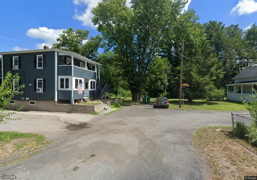
31 Central Ave Northbridge, MA 01534
Estimated Value: $433,000 - $508,000
3
Beds
2
Baths
1,050
Sq Ft
$444/Sq Ft
Est. Value
About This Home
This home is located at 31 Central Ave, Northbridge, MA 01534 and is currently estimated at $465,802, approximately $443 per square foot. 31 Central Ave is a home located in Worcester County with nearby schools including Northbridge Elementary School, Northbridge Middle School, and Northbridge High School.
Ownership History
Date
Name
Owned For
Owner Type
Purchase Details
Closed on
Jul 13, 2004
Sold by
Schomberg Joanna C and Firth Lisa B
Bought by
Schomberg Joanna C and Firth Lisa B
Current Estimated Value
Purchase Details
Closed on
Feb 25, 2003
Sold by
Ross Robert R and Ross Annette T
Bought by
Firth Lisa B and Schomberg Joanna C
Create a Home Valuation Report for This Property
The Home Valuation Report is an in-depth analysis detailing your home's value as well as a comparison with similar homes in the area
Home Values in the Area
Average Home Value in this Area
Purchase History
| Date | Buyer | Sale Price | Title Company |
|---|---|---|---|
| Schomberg Joanna C | -- | -- | |
| Schomberg Joanna C | -- | -- | |
| Firth Lisa B | $225,000 | -- | |
| Firth Lisa B | $225,000 | -- |
Source: Public Records
Mortgage History
| Date | Status | Borrower | Loan Amount |
|---|---|---|---|
| Open | Firth Lisa B | $195,200 |
Source: Public Records
Tax History Compared to Growth
Tax History
| Year | Tax Paid | Tax Assessment Tax Assessment Total Assessment is a certain percentage of the fair market value that is determined by local assessors to be the total taxable value of land and additions on the property. | Land | Improvement |
|---|---|---|---|---|
| 2025 | $4,349 | $368,900 | $148,800 | $220,100 |
| 2024 | $4,265 | $352,800 | $148,800 | $204,000 |
| 2023 | $4,355 | $336,000 | $141,000 | $195,000 |
| 2022 | $3,916 | $284,400 | $108,600 | $175,800 |
| 2021 | $1,127 | $254,100 | $103,500 | $150,600 |
| 2020 | $3,428 | $247,700 | $103,500 | $144,200 |
| 2019 | $3,108 | $239,600 | $103,500 | $136,100 |
| 2018 | $4,175 | $228,200 | $98,500 | $129,700 |
| 2017 | $2,958 | $218,600 | $98,500 | $120,100 |
| 2016 | $2,725 | $198,200 | $84,500 | $113,700 |
| 2015 | $2,652 | $198,200 | $84,500 | $113,700 |
| 2014 | $2,628 | $198,200 | $84,500 | $113,700 |
Source: Public Records
Map
Nearby Homes
- 94 Heritage Dr Unit 94
- 237 Heritage Dr Unit 237
- 35 Highland Park Unit 35
- 0 Louis St
- 44 Arthur Dr Unit 44
- 50 Carrington Ln
- 99 Country Club Dr
- 235 Rivulet St
- 129 Elm St Unit Lot 7
- 0 Homestead Ave
- 38 William Ward St
- 36 Elm St
- 128 Linwood Ave
- 113 Rogerson Crossing Unit 113
- 121 East St Unit 121
- 18 East St Unit 24
- 179 Sutton St
- 21 Granite St
- 5 Summit St
- 831 Providence Rd Unit 837
- 107 Upton St
- 101 Upton St
- 36 Central Ave
- 91 Upton St Unit 93
- 77 Upton St Unit 79
- 41 Court St
- 41-97 Court St Unit 77
- 77 Court St
- 79 Court St
- 75 Court St
- 40-46 Court St
- 145 Heritage Dr
- 144 Heritage Dr
- 143 Heritage Dr
- 137 Heritage Dr
- 136 Heritage Dr
- 135 Heritage Dr
- 133 Heritage Dr
- 132 Heritage Dr
- 130 Heritage Dr