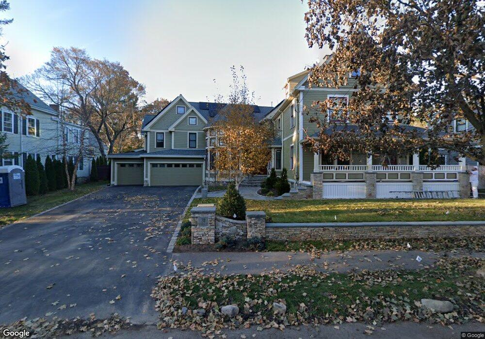
31 Clarke St Lexington, MA 02421
Munroe Hill NeighborhoodEstimated Value: $3,036,295 - $3,836,000
6
Beds
6
Baths
5,783
Sq Ft
$595/Sq Ft
Est. Value
About This Home
This home is located at 31 Clarke St, Lexington, MA 02421 and is currently estimated at $3,438,824, approximately $594 per square foot. 31 Clarke St is a home located in Middlesex County with nearby schools including Fiske Elementary School, William Diamond Middle School, and Lexington High School.
Ownership History
Date
Name
Owned For
Owner Type
Purchase Details
Closed on
Jul 11, 2011
Sold by
Nijhawan Vinit and Nijhawan Deepti
Bought by
Duff David A and Luperfoy Susann D
Current Estimated Value
Home Financials for this Owner
Home Financials are based on the most recent Mortgage that was taken out on this home.
Original Mortgage
$975,000
Outstanding Balance
$381,306
Interest Rate
4.6%
Mortgage Type
Purchase Money Mortgage
Estimated Equity
$3,057,518
Purchase Details
Closed on
Sep 30, 2002
Sold by
Williams Marie O
Bought by
Nijhawan Vinit and Nijhawan Deepit
Create a Home Valuation Report for This Property
The Home Valuation Report is an in-depth analysis detailing your home's value as well as a comparison with similar homes in the area
Home Values in the Area
Average Home Value in this Area
Purchase History
| Date | Buyer | Sale Price | Title Company |
|---|---|---|---|
| Duff David A | $1,515,000 | -- | |
| Nijhawan Vinit | $730,000 | -- |
Source: Public Records
Mortgage History
| Date | Status | Borrower | Loan Amount |
|---|---|---|---|
| Open | Duff David A | $975,000 |
Source: Public Records
Tax History Compared to Growth
Tax History
| Year | Tax Paid | Tax Assessment Tax Assessment Total Assessment is a certain percentage of the fair market value that is determined by local assessors to be the total taxable value of land and additions on the property. | Land | Improvement |
|---|---|---|---|---|
| 2025 | $33,522 | $2,741,000 | $1,072,000 | $1,669,000 |
| 2024 | $31,826 | $2,598,000 | $1,021,000 | $1,577,000 |
| 2023 | $29,484 | $2,268,000 | $928,000 | $1,340,000 |
| 2022 | $29,325 | $2,125,000 | $844,000 | $1,281,000 |
| 2021 | $3,825 | $1,949,000 | $804,000 | $1,145,000 |
| 2020 | $28,044 | $1,996,000 | $804,000 | $1,192,000 |
| 2019 | $3,576 | $1,904,000 | $765,000 | $1,139,000 |
| 2018 | $5,610 | $2,029,000 | $709,000 | $1,320,000 |
| 2017 | $3,876 | $1,901,000 | $675,000 | $1,226,000 |
| 2016 | $25,127 | $1,721,000 | $620,000 | $1,101,000 |
| 2015 | $24,296 | $1,635,000 | $563,000 | $1,072,000 |
| 2014 | $23,079 | $1,488,000 | $504,000 | $984,000 |
Source: Public Records
Map
Nearby Homes
- 32 Forest St
- 1900 Massachusetts Ave
- 1894 Massachusetts Ave
- 223 Waltham St
- 42 Winthrop Rd
- 32 Edgewood Rd Unit 1
- 30 Meriam St Unit 30
- 20 Loring Rd
- 93 Bedford St Unit 201
- 93 Bedford St Unit 308
- 93 Bedford St Unit 101
- 45 Hancock St
- 92 Hill St
- 1437 Massachusetts Ave
- 24 Grapevine Ave
- 7 Carmel Cir
- 2380 Massachusetts Ave
- 21 Valleyfield St
- 375 Marrett Rd
- 24 Deering Ave
- 27 Clarke St
- 35 Clarke St
- 34 Forest St
- 36 Forest St
- 39 Clarke St
- 34 Clarke St
- 36 Clarke St
- 38 Forest St
- 30 Forest St
- 00 Maple
- 50 Parker St
- 38 Clarke St
- 33 Forest St Unit 417
- 33 Forest St Unit 416
- 33 Forest St Unit 415
- 33 Forest St Unit 414
- 33 Forest St Unit 413
- 33 Forest St Unit 319
- 33 Forest St Unit 318
- 33 Forest St Unit 312