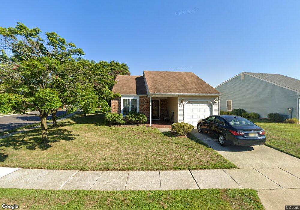
31 Emory Ln Mount Laurel, NJ 08054
Estimated Value: $393,564 - $443,000
--
Bed
--
Bath
1,331
Sq Ft
$311/Sq Ft
Est. Value
About This Home
This home is located at 31 Emory Ln, Mount Laurel, NJ 08054 and is currently estimated at $413,391, approximately $310 per square foot. 31 Emory Ln is a home located in Burlington County with nearby schools including Hillside Elementary School, T.E. Harrington Middle School, and Mount Laurel Hartford School.
Ownership History
Date
Name
Owned For
Owner Type
Purchase Details
Closed on
Nov 9, 2005
Sold by
Lawless Martha A
Bought by
Steinberg Joel M
Current Estimated Value
Home Financials for this Owner
Home Financials are based on the most recent Mortgage that was taken out on this home.
Original Mortgage
$201,600
Interest Rate
6.14%
Mortgage Type
Fannie Mae Freddie Mac
Purchase Details
Closed on
Jul 14, 1995
Sold by
Mccullough Edward A and Mccullough Mary E
Bought by
Jackle Nancy E
Create a Home Valuation Report for This Property
The Home Valuation Report is an in-depth analysis detailing your home's value as well as a comparison with similar homes in the area
Home Values in the Area
Average Home Value in this Area
Purchase History
| Date | Buyer | Sale Price | Title Company |
|---|---|---|---|
| Steinberg Joel M | $252,500 | Weichert Title Agency | |
| Jackle Nancy E | $135,000 | -- |
Source: Public Records
Mortgage History
| Date | Status | Borrower | Loan Amount |
|---|---|---|---|
| Closed | Steinberg Joel M | $201,600 |
Source: Public Records
Tax History Compared to Growth
Tax History
| Year | Tax Paid | Tax Assessment Tax Assessment Total Assessment is a certain percentage of the fair market value that is determined by local assessors to be the total taxable value of land and additions on the property. | Land | Improvement |
|---|---|---|---|---|
| 2025 | $5,414 | $171,500 | $54,500 | $117,000 |
| 2024 | $5,210 | $171,500 | $54,500 | $117,000 |
| 2023 | $5,210 | $171,500 | $54,500 | $117,000 |
| 2022 | $5,193 | $171,500 | $54,500 | $117,000 |
| 2021 | $5,095 | $171,500 | $54,500 | $117,000 |
| 2020 | $4,996 | $171,500 | $54,500 | $117,000 |
| 2019 | $4,944 | $171,500 | $54,500 | $117,000 |
| 2018 | $4,907 | $171,500 | $54,500 | $117,000 |
| 2017 | $4,780 | $171,500 | $54,500 | $117,000 |
| 2016 | $4,708 | $171,500 | $54,500 | $117,000 |
| 2015 | $4,653 | $171,500 | $54,500 | $117,000 |
| 2014 | $4,607 | $171,500 | $54,500 | $117,000 |
Source: Public Records
Map
Nearby Homes
- 23 Emory Ln
- 8 Raven Ct
- 1 Adner Dr
- 12 Taconia Ct
- 10 Gretna Ct
- 23 E Oleander Dr
- 266 Saint David Dr
- 11 E Berwin Way
- 3 Village Ct
- 223 Saint David Dr
- 317 Saint David Dr
- 13 Marcy Ct
- 70B Sumac Ct Unit 70B
- 31 Quince Ct
- 1201A Ginger Ct
- 102 Union Mill Terrace
- 420 Elderberry Ct
- 422 Elderberry Ct
- 130B Birchfield Ct Unit 130B
- 123A Birchfield Ct Unit 123A