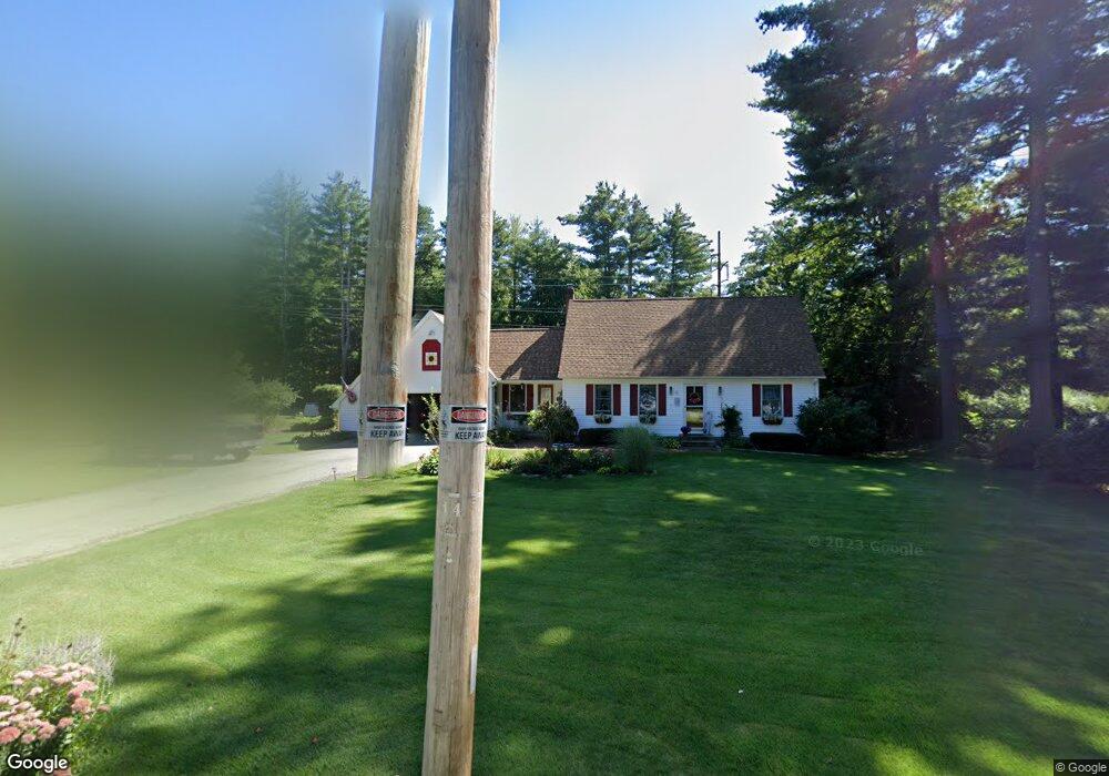
31 Fenton Rd Monson, MA 01057
Estimated Value: $355,000 - $424,000
2
Beds
1
Bath
1,044
Sq Ft
$374/Sq Ft
Est. Value
About This Home
This home is located at 31 Fenton Rd, Monson, MA 01057 and is currently estimated at $389,994, approximately $373 per square foot. 31 Fenton Rd is a home located in Hampden County with nearby schools including Quarry Hill Community School, Granite Valley School, and Monson High School.
Ownership History
Date
Name
Owned For
Owner Type
Purchase Details
Closed on
Apr 6, 2018
Sold by
Woods Holly J
Bought by
Alan G Stickles Lt
Current Estimated Value
Purchase Details
Closed on
Jun 30, 1999
Sold by
Miller Paul R and Miller Suzanne L
Bought by
Woods Holly J
Home Financials for this Owner
Home Financials are based on the most recent Mortgage that was taken out on this home.
Original Mortgage
$126,630
Interest Rate
7.19%
Mortgage Type
Purchase Money Mortgage
Purchase Details
Closed on
Apr 28, 1995
Sold by
Mcdonald Frederick L
Bought by
Trembley Suzanne L and Miller Paul R
Home Financials for this Owner
Home Financials are based on the most recent Mortgage that was taken out on this home.
Original Mortgage
$100,000
Interest Rate
8.33%
Mortgage Type
Purchase Money Mortgage
Purchase Details
Closed on
Sep 16, 1994
Sold by
North Robert E and North Florence M
Bought by
Mcdonald Frederick L
Create a Home Valuation Report for This Property
The Home Valuation Report is an in-depth analysis detailing your home's value as well as a comparison with similar homes in the area
Home Values in the Area
Average Home Value in this Area
Purchase History
| Date | Buyer | Sale Price | Title Company |
|---|---|---|---|
| Alan G Stickles Lt | $235,000 | -- | |
| Woods Holly J | $140,700 | -- | |
| Trembley Suzanne L | $125,000 | -- | |
| Mcdonald Frederick L | $30,000 | -- |
Source: Public Records
Mortgage History
| Date | Status | Borrower | Loan Amount |
|---|---|---|---|
| Previous Owner | Mcdonald Frederick L | $126,630 | |
| Previous Owner | Mcdonald Frederick L | $100,000 |
Source: Public Records
Tax History Compared to Growth
Tax History
| Year | Tax Paid | Tax Assessment Tax Assessment Total Assessment is a certain percentage of the fair market value that is determined by local assessors to be the total taxable value of land and additions on the property. | Land | Improvement |
|---|---|---|---|---|
| 2025 | $4,907 | $330,000 | $68,300 | $261,700 |
| 2024 | $4,765 | $307,400 | $68,300 | $239,100 |
| 2023 | $4,395 | $277,100 | $68,300 | $208,800 |
| 2022 | $4,235 | $237,500 | $68,300 | $169,200 |
| 2021 | $4,008 | $221,200 | $68,300 | $152,900 |
| 2020 | $3,994 | $218,600 | $68,300 | $150,300 |
| 2019 | $3,822 | $208,400 | $68,300 | $140,100 |
| 2018 | $3,589 | $203,900 | $75,700 | $128,200 |
| 2017 | $3,411 | $195,900 | $72,600 | $123,300 |
| 2016 | $3,383 | $197,600 | $68,400 | $129,200 |
| 2015 | $3,294 | $197,600 | $68,400 | $129,200 |
| 2014 | $3,201 | $197,600 | $68,400 | $129,200 |
Source: Public Records
Map
Nearby Homes
- 9 Silva St
- 1415 Park St
- 268 Palmer Rd Unit 27
- 268 Palmer Rd Unit 57
- 268 Palmer Rd Unit 44
- 11 Allen St
- 169 Palmer Rd
- 7 Cedar Hill St
- 4 Salem St
- 65 Breckenridge St
- 0 Palmer Rd
- 72 Quaboag Valley Co Op St Unit 70
- 2034 Pleasant St
- 0 Bethany Rd
- 16 Old Farm Rd
- 22 Beebe Rd
- 207 Breckenridge St
- 0 Flynt St
- 44 Converse St
- 58 Old Reed Rd