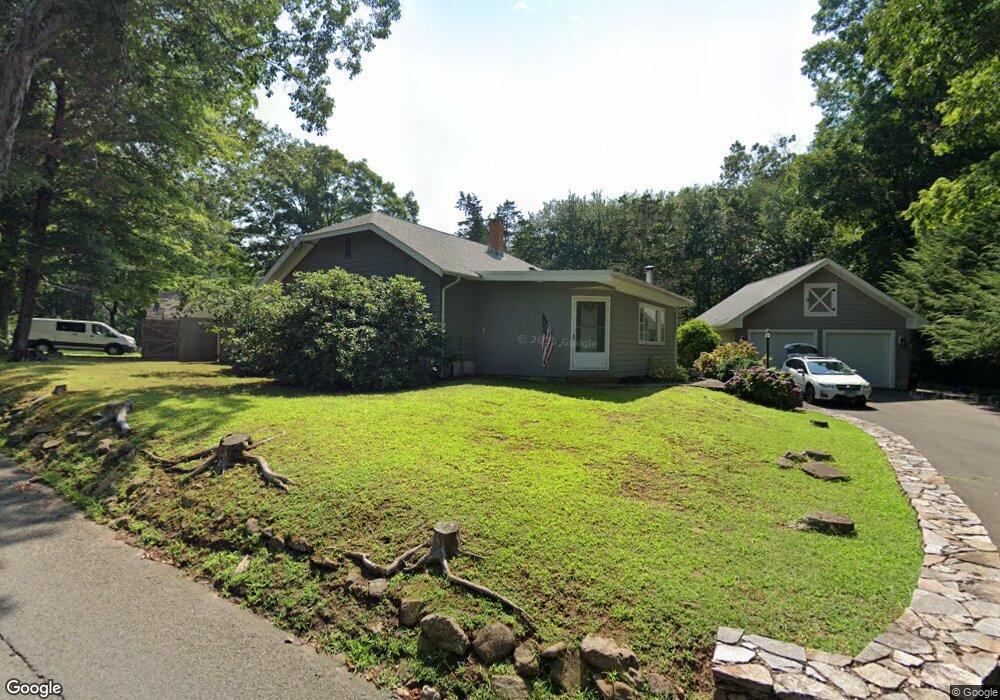
31 Flat Iron Rd Guilford, CT 06437
Estimated Value: $352,000 - $441,000
2
Beds
1
Bath
1,190
Sq Ft
$344/Sq Ft
Est. Value
About This Home
This home is located at 31 Flat Iron Rd, Guilford, CT 06437 and is currently estimated at $409,856, approximately $344 per square foot. 31 Flat Iron Rd is a home located in New Haven County with nearby schools including A. Baldwin Middle School, E.C. Adams Middle School, and Guilford High School.
Ownership History
Date
Name
Owned For
Owner Type
Purchase Details
Closed on
Nov 4, 1992
Sold by
Conklin Vernon A and Conklin Beverly A
Bought by
Montano Vincent P and Montano Tina B
Current Estimated Value
Home Financials for this Owner
Home Financials are based on the most recent Mortgage that was taken out on this home.
Original Mortgage
$117,000
Interest Rate
7.99%
Mortgage Type
Purchase Money Mortgage
Create a Home Valuation Report for This Property
The Home Valuation Report is an in-depth analysis detailing your home's value as well as a comparison with similar homes in the area
Home Values in the Area
Average Home Value in this Area
Purchase History
| Date | Buyer | Sale Price | Title Company |
|---|---|---|---|
| Montano Vincent P | $132,500 | -- | |
| Montano Vincent P | $132,500 | -- |
Source: Public Records
Mortgage History
| Date | Status | Borrower | Loan Amount |
|---|---|---|---|
| Closed | Montano Vincent P | $108,350 | |
| Closed | Montano Vincent P | $117,000 | |
| Previous Owner | Montano Vincent P | $103,000 |
Source: Public Records
Tax History
| Year | Tax Paid | Tax Assessment Tax Assessment Total Assessment is a certain percentage of the fair market value that is determined by local assessors to be the total taxable value of land and additions on the property. | Land | Improvement |
|---|---|---|---|---|
| 2025 | $6,619 | $239,400 | $151,340 | $88,060 |
| 2024 | $6,363 | $239,400 | $151,340 | $88,060 |
| 2023 | $6,196 | $239,400 | $151,340 | $88,060 |
| 2022 | $5,163 | $155,290 | $116,460 | $38,830 |
| 2021 | $5,066 | $155,290 | $116,460 | $38,830 |
| 2020 | $5,017 | $155,290 | $116,460 | $38,830 |
| 2019 | $4,974 | $155,290 | $116,460 | $38,830 |
| 2018 | $4,857 | $155,290 | $116,460 | $38,830 |
| 2017 | $4,823 | $164,260 | $118,440 | $45,820 |
| 2016 | $4,709 | $164,260 | $118,440 | $45,820 |
| 2015 | $4,639 | $164,260 | $118,440 | $45,820 |
| 2014 | $4,504 | $164,260 | $118,440 | $45,820 |
Source: Public Records
Map
Nearby Homes
- 2125 Long Hill Rd
- 0 Tamarack Ln Unit Lot 19 24071360
- 2064 Long Hill Rd
- 375 Sea Hill Rd
- 71 Glenwood Rd
- 250 Elm St
- 46 Mcmahon Ln
- 154 Wilburs Ln
- 1789 Foxon Rd Unit 5D
- 286 Weatherly Trail
- 310 Notch Hill Rd
- 77 Pinebrook Cir
- 72 Notch Hill Rd
- 229 Branford Rd Unit 324
- LOT 28B Bruce Ln Unit MAP 83
- LOT #22 Kenneth Cir Unit MAP 77
- 20 Long Hill Farm
- 83 Long Hill Farm Unit 83
- 24 Echo Point Rd
- 296 Valley Shore Dr
- 41 Flat Iron Rd
- 9 Flat Iron Rd
- 59 Flat Iron Rd
- 51 Flat Iron Rd
- 31 Saddle Hill Dr
- 11 Edgewood Dr
- 19 Saddle Hill Dr
- 45 Saddle Hill Dr
- 61 Flat Iron Rd
- 65 Flat Iron Rd
- 23 Edgewood Dr
- 26 Edgewood Dr
- 75 Flat Iron Rd
- 99 Flat Iron Rd
- 61 Saddle Hill Dr
- 1825 Route 80
- 138 Edgewood Dr
- 85 Flat Iron Rd
- 14 Saddle Hill Dr
- 1843 Route 80
Your Personal Tour Guide
Ask me questions while you tour the home.