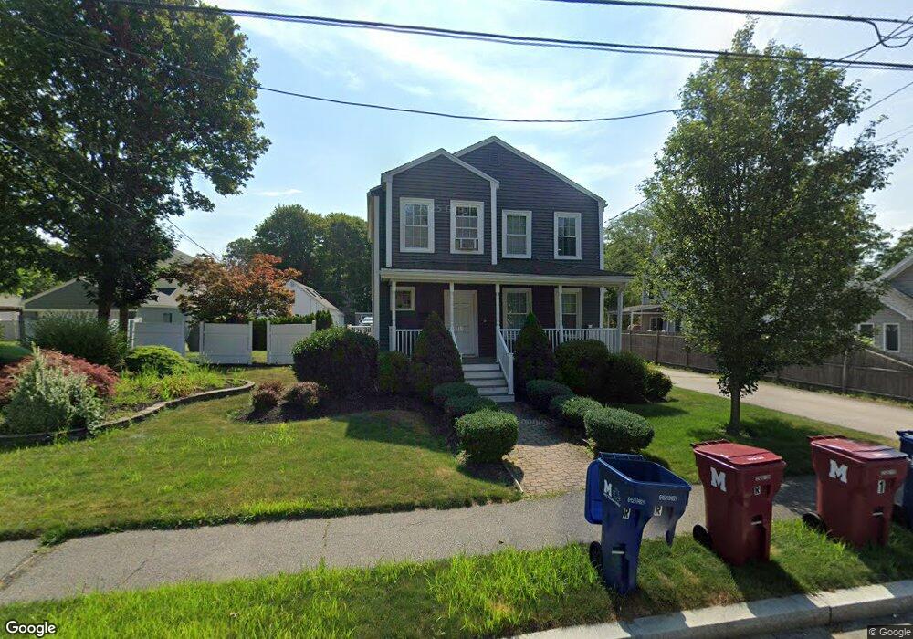
31 Forest St Unit 2 Melrose, MA 02176
Oak Grove-Pine Banks NeighborhoodEstimated Value: $944,000 - $1,053,827
2
Beds
1
Bath
9,999
Sq Ft
$101/Sq Ft
Est. Value
About This Home
This home is located at 31 Forest St Unit 2, Melrose, MA 02176 and is currently estimated at $1,008,957, approximately $100 per square foot. 31 Forest St Unit 2 is a home located in Middlesex County with nearby schools including Hoover Elementary School, Lincoln Elementary School, and Winthrop Elementary School.
Ownership History
Date
Name
Owned For
Owner Type
Purchase Details
Closed on
Sep 19, 2003
Sold by
Savage Brian L and Savage Richard J
Bought by
Szymczak Adam and Cacici Soraya
Current Estimated Value
Home Financials for this Owner
Home Financials are based on the most recent Mortgage that was taken out on this home.
Original Mortgage
$394,250
Outstanding Balance
$183,773
Interest Rate
6.31%
Mortgage Type
Purchase Money Mortgage
Estimated Equity
$825,184
Purchase Details
Closed on
Feb 23, 1996
Sold by
Gonnella Robert
Bought by
Halloran Leonard P
Home Financials for this Owner
Home Financials are based on the most recent Mortgage that was taken out on this home.
Original Mortgage
$171,000
Interest Rate
7.04%
Mortgage Type
Purchase Money Mortgage
Create a Home Valuation Report for This Property
The Home Valuation Report is an in-depth analysis detailing your home's value as well as a comparison with similar homes in the area
Home Values in the Area
Average Home Value in this Area
Purchase History
| Date | Buyer | Sale Price | Title Company |
|---|---|---|---|
| Szymczak Adam | $415,000 | -- | |
| Halloran Leonard P | $190,000 | -- |
Source: Public Records
Mortgage History
| Date | Status | Borrower | Loan Amount |
|---|---|---|---|
| Open | Szymczak Adam | $394,250 | |
| Previous Owner | Halloran Leonard P | $171,000 | |
| Previous Owner | Halloran Leonard P | $77,200 |
Source: Public Records
Tax History Compared to Growth
Tax History
| Year | Tax Paid | Tax Assessment Tax Assessment Total Assessment is a certain percentage of the fair market value that is determined by local assessors to be the total taxable value of land and additions on the property. | Land | Improvement |
|---|---|---|---|---|
| 2025 | $83 | $841,900 | $468,400 | $373,500 |
| 2024 | $7,865 | $792,000 | $438,400 | $353,600 |
| 2023 | $7,866 | $754,900 | $408,100 | $346,800 |
| 2022 | $7,706 | $729,000 | $393,100 | $335,900 |
| 2021 | $7,477 | $682,800 | $378,100 | $304,700 |
| 2020 | $7,175 | $649,300 | $348,100 | $301,200 |
| 2019 | $6,759 | $625,300 | $333,100 | $292,200 |
| 2018 | $6,345 | $560,000 | $276,900 | $283,100 |
| 2017 | $6,197 | $525,200 | $265,600 | $259,600 |
| 2016 | $5,786 | $469,300 | $235,600 | $233,700 |
| 2015 | $6,065 | $468,000 | $235,600 | $232,400 |
| 2014 | $5,696 | $428,900 | $216,900 | $212,000 |
Source: Public Records
Map
Nearby Homes
- 0 S Mountain Avenue & O Cargil
- 11 Church St
- 73 Lanark Rd
- 27 Temple St
- 26 Lanark Rd
- 153 Cherry St
- 17 Swains Pond Ave
- 76 Kimball St
- 46 Pagum St
- 170 Columbia St
- 65 Beacon St
- 68 Princeton Rd
- 42 Fairfield Ave
- 117-119 Rockwell St
- 47 Rocky Nook Unit 47
- 7 Valley St
- 156 Bainbridge St
- 56 Rocky Nook Unit 56
- 7 Sawyer Ct
- 11 Granville Place
- 31 Forest St
- 41 Forest St
- 10 Hunt Terrace
- 20 Hunt Terrace
- 20 Hunts Terrace
- 8 Hunt Terrace
- 35 Forest St
- 6 Hunt Terrace
- 39 Forest St
- 18 S Mountain Ave
- 22 S Mountain Ave
- 14 S Mountain Ave
- 26 S Mountain Ave
- 28 S Mountain Ave
- 88 Lebanon St
- 10 S Mountain Ave
- 98 Lebanon St
- 90 Lebanon St
- 23 Hunt Terrace
- 9 Hunt Terrace