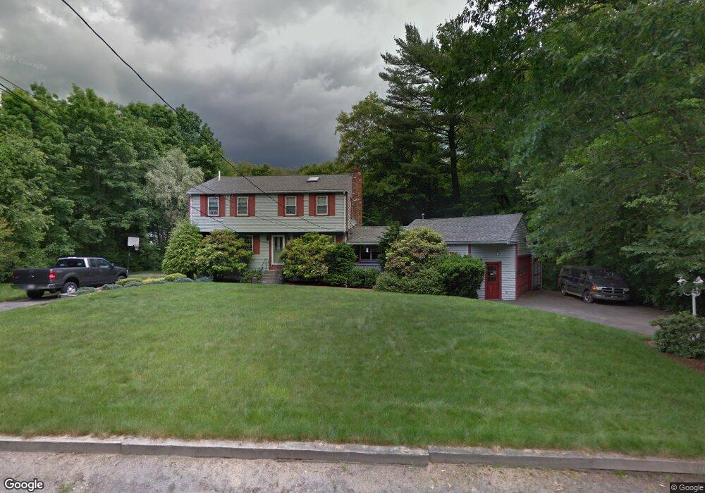
31 Forest Trail Hanson, MA 02341
Estimated Value: $710,210 - $770,000
5
Beds
2
Baths
2,075
Sq Ft
$357/Sq Ft
Est. Value
About This Home
This home is located at 31 Forest Trail, Hanson, MA 02341 and is currently estimated at $741,303, approximately $357 per square foot. 31 Forest Trail is a home located in Plymouth County with nearby schools including St Bridget School.
Ownership History
Date
Name
Owned For
Owner Type
Purchase Details
Closed on
Mar 24, 2005
Sold by
Mcandrews Kathleen A
Bought by
Coronity Joseph A and Coronity Robin D
Current Estimated Value
Home Financials for this Owner
Home Financials are based on the most recent Mortgage that was taken out on this home.
Original Mortgage
$250,000
Interest Rate
5.56%
Mortgage Type
Purchase Money Mortgage
Create a Home Valuation Report for This Property
The Home Valuation Report is an in-depth analysis detailing your home's value as well as a comparison with similar homes in the area
Home Values in the Area
Average Home Value in this Area
Purchase History
| Date | Buyer | Sale Price | Title Company |
|---|---|---|---|
| Coronity Joseph A | $438,000 | -- |
Source: Public Records
Mortgage History
| Date | Status | Borrower | Loan Amount |
|---|---|---|---|
| Open | Coronity Joseph A | $230,000 | |
| Closed | Coronity Joseph A | $250,000 | |
| Previous Owner | Coronity Joseph A | $250,000 |
Source: Public Records
Tax History
| Year | Tax Paid | Tax Assessment Tax Assessment Total Assessment is a certain percentage of the fair market value that is determined by local assessors to be the total taxable value of land and additions on the property. | Land | Improvement |
|---|---|---|---|---|
| 2025 | $7,976 | $596,100 | $182,700 | $413,400 |
| 2024 | $7,744 | $578,800 | $177,400 | $401,400 |
| 2023 | $7,552 | $532,600 | $177,400 | $355,200 |
| 2022 | $7,310 | $484,400 | $161,300 | $323,100 |
| 2021 | $6,528 | $432,300 | $155,100 | $277,200 |
| 2020 | $6,435 | $421,400 | $149,800 | $271,600 |
| 2019 | $6,134 | $395,000 | $146,900 | $248,100 |
| 2018 | $5,998 | $378,900 | $141,300 | $237,600 |
| 2017 | $5,684 | $355,700 | $134,600 | $221,100 |
| 2016 | $5,710 | $345,000 | $134,600 | $210,400 |
| 2015 | $5,411 | $339,900 | $134,600 | $205,300 |
Source: Public Records
Map
Nearby Homes
- 23 Live Oak Way
- 22 Howland Trail Unit 34
- 724 Whitman St
- 7 Hayford Trail Unit 12
- 5 Hayford Trail Unit 11
- 17 Hayford Trail Unit 12
- 10 Proud Foot Way
- Lot 5 Princeton Way
- 84 Liberty St
- 214 Winter St
- 10 Birch Bottom Cir
- 139 Fairwood Dr
- 361 County Rd
- 361A County Rd
- 61 Sawmill Ln
- 61 Sawmill Ln Unit 61
- 108 Waterford Dr
- 161 Winter St Unit 11
- 170 Pleasant St
- 5 Alpine St
- 49 Forest Trail
- 34 Forest Trail
- 881 Whitman St
- 867 Whitman St
- 52 Forest Trail
- 899 Whitman St
- 63 Forest Trail
- 849 Whitman St
- 913 Whitman St
- 835 Whitman St
- 884 Whitman St
- 852 Whitman St
- 864 Whitman St
- 78 Forest Trail
- 825 Whitman St
- 842 Whitman St
- 91 Forest Trail
- 894 Whitman St
- 31 Birchbark Dr
- 94 Forest Trail
Your Personal Tour Guide
Ask me questions while you tour the home.