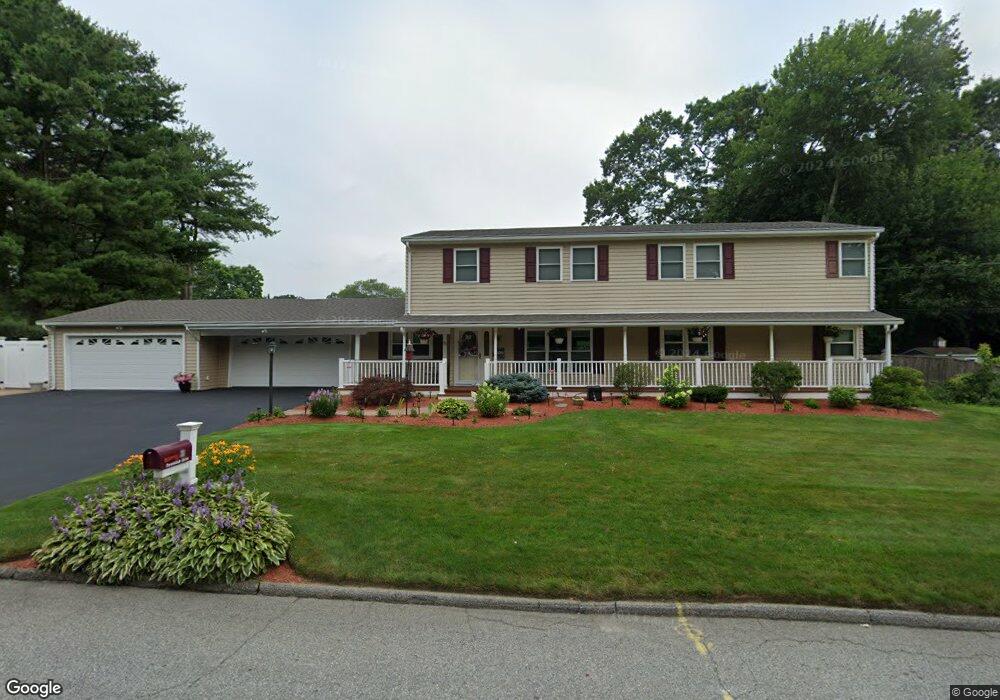
31 Forestdale Dr Cumberland, RI 02864
Cumberland Hill NeighborhoodEstimated Value: $746,835 - $866,000
4
Beds
3
Baths
2,912
Sq Ft
$273/Sq Ft
Est. Value
About This Home
This home is located at 31 Forestdale Dr, Cumberland, RI 02864 and is currently estimated at $795,459, approximately $273 per square foot. 31 Forestdale Dr is a home located in Providence County with nearby schools including Ashton School, North Cumberland Middle School, and Cumberland High School.
Ownership History
Date
Name
Owned For
Owner Type
Purchase Details
Closed on
Nov 14, 2024
Sold by
Michael and Shiralynn Massu
Bought by
Massud Family Relt and Massud
Current Estimated Value
Purchase Details
Closed on
Aug 29, 2024
Sold by
Massud Michael A and Massud Shiralynn
Bought by
Shiralynn Michael A and Shiralynn Mas
Purchase Details
Closed on
Feb 2, 2024
Sold by
New England Homes Inc
Bought by
Massud Michael A and Massud Shiralynn
Purchase Details
Closed on
Jun 14, 2023
Sold by
Massud Michael A and Massud Shiralynn
Bought by
Michael A Massud Lt and Massud
Purchase Details
Closed on
Feb 20, 1998
Sold by
Bruce Thomas P and Bruce Donna
Bought by
Massud Michael A and Silva Shiralynn
Purchase Details
Closed on
Sep 28, 1992
Sold by
Reilly Kevin F and Reilly Teresa
Bought by
Bruce Thomas P and Anderson Donna L
Create a Home Valuation Report for This Property
The Home Valuation Report is an in-depth analysis detailing your home's value as well as a comparison with similar homes in the area
Home Values in the Area
Average Home Value in this Area
Purchase History
| Date | Buyer | Sale Price | Title Company |
|---|---|---|---|
| Massud Family Relt | -- | None Available | |
| Shiralynn Michael A | -- | None Available | |
| Shiralynn Michael A | -- | None Available | |
| Massud Michael A | -- | None Available | |
| Massud Michael A | -- | None Available | |
| Michael A Massud Lt | -- | None Available | |
| Michael A Massud Lt | -- | None Available | |
| Massud Michael A | $132,000 | -- | |
| Massud Michael A | $132,000 | -- | |
| Bruce Thomas P | $130,000 | -- |
Source: Public Records
Mortgage History
| Date | Status | Borrower | Loan Amount |
|---|---|---|---|
| Previous Owner | Bruce Thomas P | $250,000 | |
| Previous Owner | Bruce Thomas P | $40,000 |
Source: Public Records
Tax History Compared to Growth
Tax History
| Year | Tax Paid | Tax Assessment Tax Assessment Total Assessment is a certain percentage of the fair market value that is determined by local assessors to be the total taxable value of land and additions on the property. | Land | Improvement |
|---|---|---|---|---|
| 2025 | $7,616 | $620,700 | $154,200 | $466,500 |
| 2024 | $7,417 | $620,700 | $154,200 | $466,500 |
| 2023 | $7,213 | $620,700 | $154,200 | $466,500 |
| 2022 | $6,975 | $465,300 | $121,800 | $343,500 |
| 2021 | $6,701 | $454,600 | $121,800 | $332,800 |
| 2020 | $6,510 | $454,600 | $121,800 | $332,800 |
| 2019 | $6,277 | $395,300 | $103,800 | $291,500 |
| 2018 | $6,096 | $395,300 | $103,800 | $291,500 |
| 2017 | $6,013 | $395,300 | $103,800 | $291,500 |
| 2016 | $6,241 | $365,400 | $103,800 | $261,600 |
| 2015 | $6,241 | $365,400 | $103,800 | $261,600 |
| 2014 | $6,241 | $365,400 | $103,800 | $261,600 |
| 2013 | $5,764 | $365,300 | $103,800 | $261,500 |
Source: Public Records
Map
Nearby Homes
- 17 Doire Rd
- 2 School St Unit 403
- 16 Tallyho Rd
- 2 School St Unit 311
- 2 School St Unit 204
- 2 School St Unit 241
- 2 School St Unit 133
- 1402 Hunting Hill Dr
- 1302 Hunting Hill Dr
- 35 Timberland Dr
- 2 Main St Unit 15
- 22 Briarwood Rd
- 10 Oak Hill Dr
- 1504 Hunting Hill Dr
- 1503 Hunting Hill Dr
- 22 Secluded Ct
- 61 School St Unit 2R
- 1 Rocky Crest Rd
- 7 Cathedral Ct
- 26 Mashie Rd
- 27 Forestdale Dr
- 35 Forestdale Dr
- 30 Forestdale Dr
- 32 Forestdale Dr
- 36 Forestdale Dr
- 26 Forestdale Dr
- 56 Circledale Dr
- 21 Forestdale Dr
- 40 Forestdale Dr
- 41 Forestdale Dr
- 60 Circledale Dr
- 24 Forestdale Dr
- 17 Forestdale Dr
- 44 Forestdale Dr
- 53 Circledale Dr
- 45 Forestdale Dr
- 50 Circledale Dr
- 66 Circledale Dr
- 11 Forestdale Dr
- 18 Forestdale Dr