Estimated Value: $1,246,000 - $2,340,000
4
Beds
4
Baths
3,399
Sq Ft
$461/Sq Ft
Est. Value
About This Home
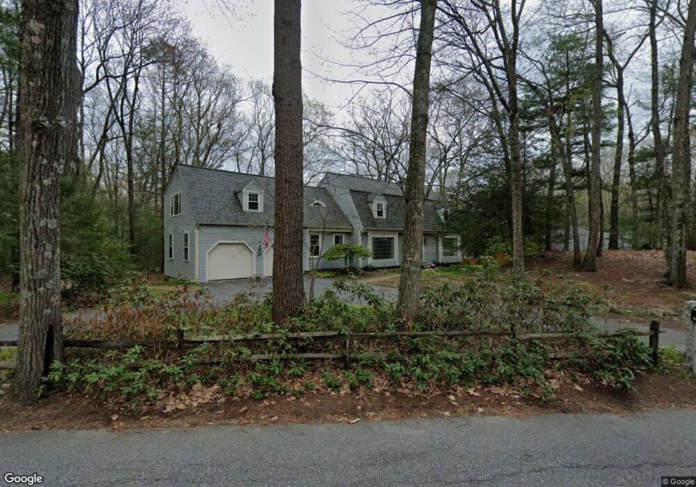
This home is located at 31 Fort Pond Rd, Acton, MA 01720 and is currently estimated at $1,567,913, approximately $461 per square foot. 31 Fort Pond Rd is a home located in Middlesex County with nearby schools including Acton-Boxborough Regional High School.
Ownership History
Date
Name
Owned For
Owner Type
Purchase Details
Closed on
Jul 27, 1995
Sold by
Dea Robert A and Dea Mry A
Bought by
Halter Susan K and Halter Mark A
Current Estimated Value
Purchase Details
Closed on
Jun 30, 1993
Sold by
Harrison Bruce R and Harrison Helen E
Bought by
Dea Robert A and Dea Mary A
Purchase Details
Closed on
Sep 21, 1988
Sold by
Buxton John H
Bought by
Harrison Bruce R
Create a Home Valuation Report for This Property
The Home Valuation Report is an in-depth analysis detailing your home's value as well as a comparison with similar homes in the area
Home Values in the Area
Average Home Value in this Area
Purchase History
| Date | Buyer | Sale Price | Title Company |
|---|---|---|---|
| Halter Susan K | $415,000 | -- | |
| Dea Robert A | $405,000 | -- | |
| Harrison Bruce R | $460,000 | -- |
Source: Public Records
Mortgage History
| Date | Status | Borrower | Loan Amount |
|---|---|---|---|
| Open | Harrison Bruce R | $305,000 | |
| Closed | Harrison Bruce R | $310,000 | |
| Closed | Harrison Bruce R | $275,000 |
Source: Public Records
Tax History Compared to Growth
Tax History
| Year | Tax Paid | Tax Assessment Tax Assessment Total Assessment is a certain percentage of the fair market value that is determined by local assessors to be the total taxable value of land and additions on the property. | Land | Improvement |
|---|---|---|---|---|
| 2025 | $19,177 | $1,118,200 | $425,900 | $692,300 |
| 2024 | $17,914 | $1,074,600 | $425,900 | $648,700 |
| 2023 | $17,504 | $996,800 | $388,300 | $608,500 |
| 2022 | $16,754 | $861,400 | $337,900 | $523,500 |
| 2021 | $16,366 | $809,000 | $313,100 | $495,900 |
| 2020 | $15,432 | $802,100 | $313,100 | $489,000 |
| 2019 | $14,992 | $774,000 | $313,100 | $460,900 |
| 2018 | $14,721 | $759,600 | $313,100 | $446,500 |
| 2017 | $14,569 | $764,400 | $313,100 | $451,300 |
| 2016 | $14,271 | $742,100 | $313,100 | $429,000 |
| 2015 | $13,994 | $734,600 | $313,100 | $421,500 |
| 2014 | $13,494 | $693,800 | $313,100 | $380,700 |
Source: Public Records
Map
Nearby Homes
- 200 Newtown Rd
- 4 Omega Way
- 9 Lillian Rd
- 27 Lincoln Dr
- 117 Skyline Dr Unit 117
- 163 Nagog Hill Rd
- 54 Mohawk Dr
- 9 Breezy Point Rd
- 31 Springfield Dr
- 417 Central St
- 484 Great Rd
- 484 Great Rd
- 31 Mohawk Dr
- 484 Great Road -6
- 484 Great Road -4
- 484 Great Road -3
- 524 Main St
- 35 Queen Rd
- 445 Old Stone Brook
- 522 Tumbling Hawk
- 27 Fort Pond Rd
- 35 Fort Pond Rd
- 30 Fort Pond Rd
- 30 Fort Pond Rd
- 39 Fort Pond Rd
- 59 Fort Pond Rd
- 38 Fort Pond Rd
- 21 Fort Pond Rd
- 19 Fort Pond Rd
- 22 Fort Pond Rd
- 43 Fort Pond Rd
- 47 Fort Pond Rd
- 18 Fort Pond Rd
- 23 Fort Pond Rd
- 23 Fort Pond Rd
- 23 Fort Pond Rd
- 51 Fort Pond Rd
- 15 Fort Pond Rd
- 53 Fort Pond Rd
- 10 Fort Pond Rd