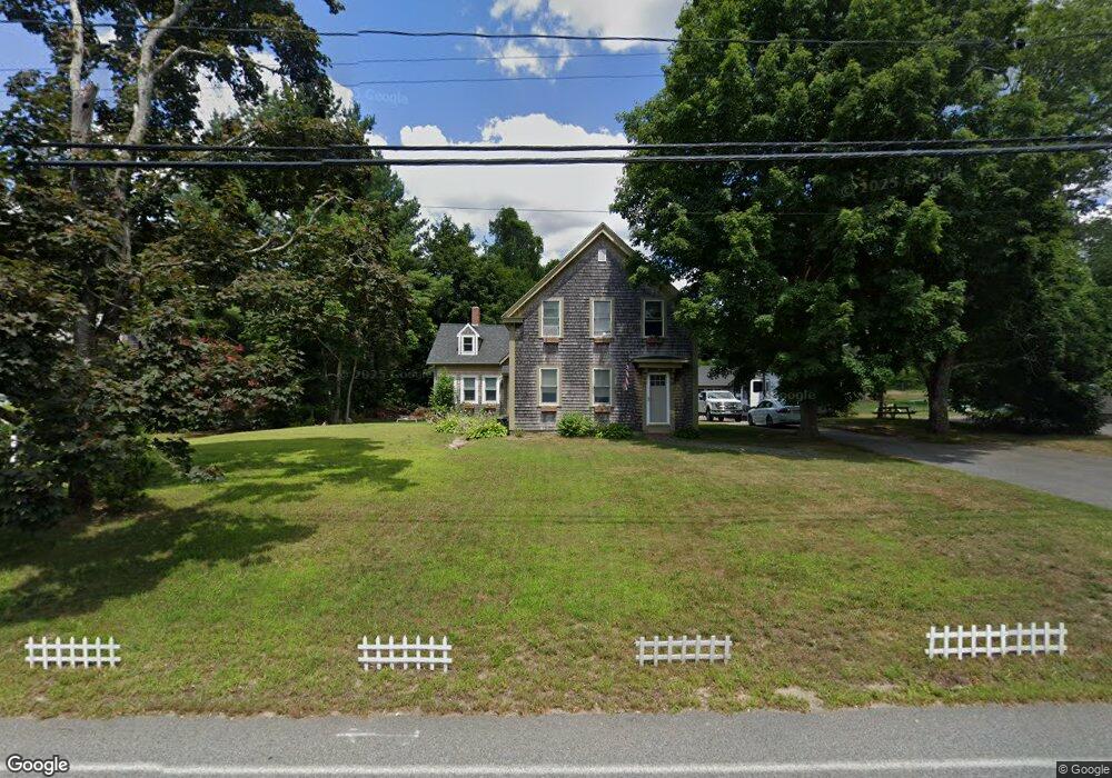
31 Gault Rd West Wareham, MA 02576
Estimated Value: $403,000 - $716,000
4
Beds
1
Bath
2,302
Sq Ft
$241/Sq Ft
Est. Value
About This Home
This home is located at 31 Gault Rd, West Wareham, MA 02576 and is currently estimated at $554,039, approximately $240 per square foot. 31 Gault Rd is a home located in Plymouth County.
Ownership History
Date
Name
Owned For
Owner Type
Purchase Details
Closed on
Sep 9, 1999
Sold by
Tripp Russell H
Bought by
Annis David A and Tripp Tammy
Current Estimated Value
Create a Home Valuation Report for This Property
The Home Valuation Report is an in-depth analysis detailing your home's value as well as a comparison with similar homes in the area
Home Values in the Area
Average Home Value in this Area
Purchase History
| Date | Buyer | Sale Price | Title Company |
|---|---|---|---|
| Annis David A | $75,000 | -- | |
| Annis David A | $75,000 | -- |
Source: Public Records
Mortgage History
| Date | Status | Borrower | Loan Amount |
|---|---|---|---|
| Open | Annis David A | $140,000 | |
| Closed | Annis David A | $60,000 | |
| Closed | Annis David A | $30,000 |
Source: Public Records
Tax History
| Year | Tax Paid | Tax Assessment Tax Assessment Total Assessment is a certain percentage of the fair market value that is determined by local assessors to be the total taxable value of land and additions on the property. | Land | Improvement |
|---|---|---|---|---|
| 2025 | $4,730 | $453,900 | $115,400 | $338,500 |
| 2024 | $4,940 | $439,900 | $91,800 | $348,100 |
| 2023 | $4,364 | $400,500 | $83,400 | $317,100 |
| 2022 | $4,364 | $331,100 | $83,400 | $247,700 |
| 2021 | $3,988 | $296,500 | $83,400 | $213,100 |
| 2020 | $3,811 | $287,400 | $83,400 | $204,000 |
| 2019 | $3,705 | $278,800 | $84,600 | $194,200 |
| 2018 | $3,406 | $249,900 | $84,600 | $165,300 |
| 2017 | $3,361 | $249,900 | $84,600 | $165,300 |
| 2016 | $3,138 | $231,900 | $84,600 | $147,300 |
| 2015 | $2,984 | $228,300 | $84,600 | $143,700 |
| 2014 | $2,844 | $221,300 | $80,400 | $140,900 |
Source: Public Records
Map
Nearby Homes
Your Personal Tour Guide
Ask me questions while you tour the home.