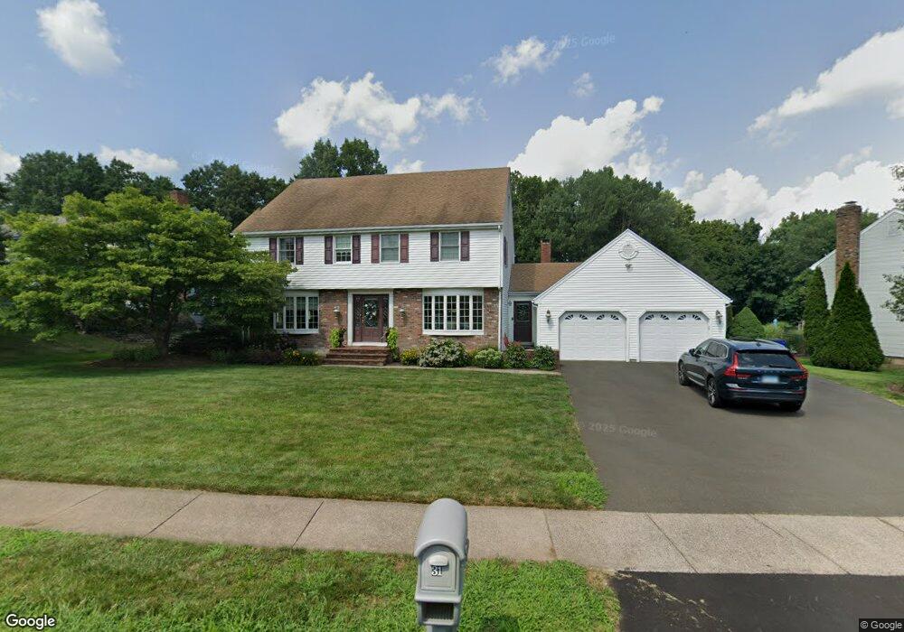
31 Goff Brook Cir Wethersfield, CT 06109
Estimated Value: $572,000 - $639,000
4
Beds
3
Baths
2,841
Sq Ft
$212/Sq Ft
Est. Value
About This Home
This home is located at 31 Goff Brook Cir, Wethersfield, CT 06109 and is currently estimated at $602,331, approximately $212 per square foot. 31 Goff Brook Cir is a home located in Hartford County with nearby schools including Highcrest School, Silas Deane Middle School, and Wethersfield High School.
Ownership History
Date
Name
Owned For
Owner Type
Purchase Details
Closed on
Aug 31, 2007
Sold by
Breglio John and Breglio Susan
Bought by
Susanin Steven E and Susanin Maria A
Current Estimated Value
Purchase Details
Closed on
Apr 3, 2006
Sold by
Chiulli Angela M
Bought by
Breglio John and Breglio Susan
Create a Home Valuation Report for This Property
The Home Valuation Report is an in-depth analysis detailing your home's value as well as a comparison with similar homes in the area
Home Values in the Area
Average Home Value in this Area
Purchase History
| Date | Buyer | Sale Price | Title Company |
|---|---|---|---|
| Susanin Steven E | $430,000 | -- | |
| Breglio John | $405,000 | -- |
Source: Public Records
Mortgage History
| Date | Status | Borrower | Loan Amount |
|---|---|---|---|
| Open | Breglio John | $237,800 | |
| Closed | Breglio John | $119,000 | |
| Closed | Breglio John | $100,000 | |
| Closed | Breglio John | $181,000 |
Source: Public Records
Tax History
| Year | Tax Paid | Tax Assessment Tax Assessment Total Assessment is a certain percentage of the fair market value that is determined by local assessors to be the total taxable value of land and additions on the property. | Land | Improvement |
|---|---|---|---|---|
| 2025 | $16,478 | $399,750 | $112,840 | $286,910 |
| 2024 | $11,659 | $269,760 | $86,910 | $182,850 |
| 2023 | $11,271 | $269,760 | $86,910 | $182,850 |
| 2022 | $11,082 | $269,760 | $86,910 | $182,850 |
| 2021 | $10,971 | $269,760 | $86,910 | $182,850 |
| 2020 | $10,977 | $269,760 | $86,910 | $182,850 |
| 2019 | $10,990 | $269,760 | $86,910 | $182,850 |
| 2018 | $10,285 | $252,200 | $86,600 | $165,600 |
| 2017 | $10,030 | $252,200 | $86,600 | $165,600 |
| 2016 | $9,720 | $252,200 | $86,600 | $165,600 |
| 2015 | $9,685 | $253,600 | $86,600 | $167,000 |
| 2014 | $9,317 | $253,600 | $86,600 | $167,000 |
Source: Public Records
Map
Nearby Homes
- 268 Fox Hill Rd
- 155 Old Common Rd
- 508 Highland St
- 186 Hang Dog Ln
- 25 Heather Hill
- 5 Robeth Ln
- 101 Collier Rd
- 18 Stone Hill Dr
- 0 Collier Rd
- 6 Vinnie Dr
- 8 Stella Dr
- 61 Luca Ln
- 76 Luca Lane Homesite 8
- 229 Cottonwood Rd Unit 229
- 9 Dogwood Ct
- 378 Cypress Rd
- 15 Woodsedge Dr Unit 5C
- 35 Woodsedge Dr Unit 4C
- 39 Denyelle Dr Unit 39
- 89 Merriman Rd
- 39 Goff Brook Cir
- 19 Goff Brook Cir
- 47 Goff Brook Cir
- 30 Goff Brook Cir
- 11 Goff Brook Cir
- 38 Goff Brook Cir
- 22 Goff Brook Cir
- 46 Goff Brook Cir
- 14 Goff Brook Cir
- 22 Quail Hill Rd
- 53 Goff Brook Cir
- 5 Goff Brook Cir
- 56 Goff Brook Cir
- 353 Hang Dog Ln
- 6 Goff Brook Cir
- 14 Quail Hill Rd
- 337 Hang Dog Ln
- 329 Hang Dog Ln
- 285 Highcrest Rd
- 361 Hang Dog Ln
Your Personal Tour Guide
Ask me questions while you tour the home.