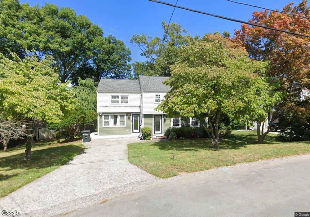
31 Governor Andrew Rd Hingham, MA 02043
Crow Point NeighborhoodEstimated Value: $1,152,000 - $1,443,000
5
Beds
2
Baths
2,800
Sq Ft
$450/Sq Ft
Est. Value
About This Home
This home is located at 31 Governor Andrew Rd, Hingham, MA 02043 and is currently estimated at $1,260,653, approximately $450 per square foot. 31 Governor Andrew Rd is a home located in Plymouth County with nearby schools including William L. Foster Elementary School, Derby Academy, and St. Paul Elementary School.
Ownership History
Date
Name
Owned For
Owner Type
Purchase Details
Closed on
Aug 10, 2007
Sold by
Conroy-Monaco Jeanne and Conroy-Kariofiles Pamela
Bought by
Stoll Jennifer Rose and Archibald Alfred W
Current Estimated Value
Home Financials for this Owner
Home Financials are based on the most recent Mortgage that was taken out on this home.
Original Mortgage
$517,500
Outstanding Balance
$328,659
Interest Rate
6.72%
Mortgage Type
Purchase Money Mortgage
Estimated Equity
$931,994
Purchase Details
Closed on
May 16, 1994
Sold by
Howley Kathleen
Bought by
Frazer Patricia M and Frazer Walter
Purchase Details
Closed on
Feb 23, 1994
Sold by
Conroy Eugene
Bought by
Howley Kathleen
Create a Home Valuation Report for This Property
The Home Valuation Report is an in-depth analysis detailing your home's value as well as a comparison with similar homes in the area
Home Values in the Area
Average Home Value in this Area
Purchase History
| Date | Buyer | Sale Price | Title Company |
|---|---|---|---|
| Stoll Jennifer Rose | $575,000 | -- | |
| Frazer Patricia M | $180,000 | -- | |
| Howley Kathleen | $177,434 | -- |
Source: Public Records
Mortgage History
| Date | Status | Borrower | Loan Amount |
|---|---|---|---|
| Open | Howley Kathleen | $517,500 | |
| Closed | Howley Kathleen | $19,581 |
Source: Public Records
Tax History Compared to Growth
Tax History
| Year | Tax Paid | Tax Assessment Tax Assessment Total Assessment is a certain percentage of the fair market value that is determined by local assessors to be the total taxable value of land and additions on the property. | Land | Improvement |
|---|---|---|---|---|
| 2025 | $10,118 | $946,500 | $453,200 | $493,300 |
| 2024 | $9,802 | $903,400 | $453,200 | $450,200 |
| 2023 | $8,627 | $862,700 | $453,200 | $409,500 |
| 2022 | $8,151 | $705,100 | $377,600 | $327,500 |
| 2021 | $7,982 | $676,400 | $377,600 | $298,800 |
| 2020 | $7,799 | $676,400 | $377,600 | $298,800 |
| 2019 | $7,762 | $657,200 | $377,600 | $279,600 |
| 2018 | $5,573 | $615,100 | $377,600 | $237,500 |
| 2017 | $6,991 | $570,700 | $360,900 | $209,800 |
| 2016 | $6,914 | $553,600 | $343,800 | $209,800 |
| 2015 | $6,731 | $537,200 | $327,400 | $209,800 |
Source: Public Records
Map
Nearby Homes
- 12 Daley Rd
- 6 Whiton Ave
- 17 Paige St
- 53 Bel Air Rd - To Be Built
- 53 Bel Air Rd
- 16 Foley Beach Rd
- 15 Bayberry Rd
- 81 Kimball Beach Rd
- 125 Halsted Dr Unit 125
- 246 North St
- 13 Ship St
- 191 South St
- 21 Hersey St
- 130 Broad Reach Unit 506
- 130 Broad Reach Unit 206
- 102 Central St
- 504 Tuckers Ln
- 10 Shipyard Dr Unit 313
- 73 Broad Reach Unit M36C
- 73 Broad Reach Unit M21C
- 29 Governor Andrew Rd
- 33 Governor Andrew Rd
- 36 Governor Andrew Rd
- 103 Downer Ave
- 25 Governor Andrew Rd
- 101 Downer Ave
- 37 Governor Andrew Rd
- 40 Governor Andrew Rd
- 32 Governor Andrew Rd
- 95 Downer Ave
- 51 Governor Long Rd
- 234 Otis St
- 23 Governor Andrew Rd
- 30 Governor Andrew Rd
- 67 Governor Long Rd
- 53 Governor Long Rd
- 240 Otis St
- 111 Downer Ave
- 228 Otis St
- 26 Governor Andrew Rd