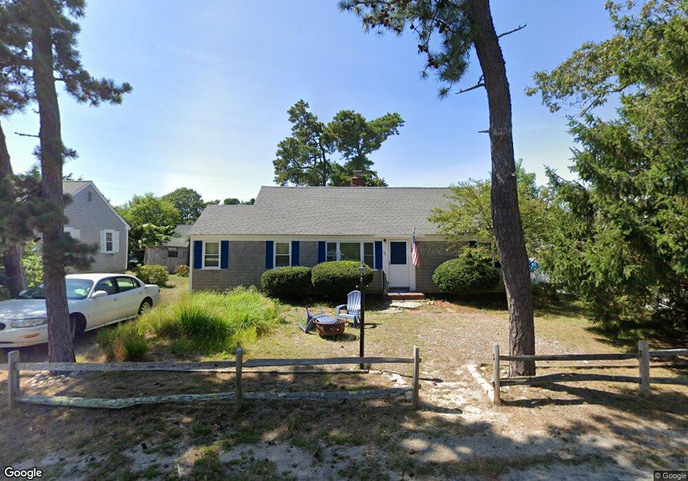
31 Hamilton Rd Dennis Port, MA 02639
Dennis Port NeighborhoodEstimated Value: $692,554 - $733,000
3
Beds
3
Baths
1,097
Sq Ft
$649/Sq Ft
Est. Value
About This Home
This home is located at 31 Hamilton Rd, Dennis Port, MA 02639 and is currently estimated at $712,389, approximately $649 per square foot. 31 Hamilton Rd is a home located in Barnstable County with nearby schools including Dennis-Yarmouth Regional High School and St. Pius X. School.
Ownership History
Date
Name
Owned For
Owner Type
Purchase Details
Closed on
May 21, 2021
Sold by
Nelson Patricia M Est
Bought by
Nelson Warne P and Nelson Jan M
Current Estimated Value
Create a Home Valuation Report for This Property
The Home Valuation Report is an in-depth analysis detailing your home's value as well as a comparison with similar homes in the area
Home Values in the Area
Average Home Value in this Area
Purchase History
| Date | Buyer | Sale Price | Title Company |
|---|---|---|---|
| Nelson Warne P | -- | None Available | |
| Nelson Warne P | -- | None Available |
Source: Public Records
Tax History Compared to Growth
Tax History
| Year | Tax Paid | Tax Assessment Tax Assessment Total Assessment is a certain percentage of the fair market value that is determined by local assessors to be the total taxable value of land and additions on the property. | Land | Improvement |
|---|---|---|---|---|
| 2025 | $2,700 | $623,500 | $276,500 | $347,000 |
| 2024 | $2,583 | $588,400 | $265,900 | $322,500 |
| 2023 | $2,498 | $534,900 | $241,700 | $293,200 |
| 2022 | $2,202 | $393,300 | $190,500 | $202,800 |
| 2021 | $2,136 | $354,300 | $186,800 | $167,500 |
| 2020 | $2,067 | $338,800 | $186,800 | $152,000 |
| 2019 | $2,071 | $335,600 | $198,800 | $136,800 |
| 2018 | $1,988 | $313,600 | $189,300 | $124,300 |
| 2017 | $1,753 | $285,100 | $174,300 | $110,800 |
| 2016 | $1,728 | $264,600 | $164,400 | $100,200 |
| 2015 | $1,693 | $264,600 | $164,400 | $100,200 |
| 2014 | $1,617 | $254,600 | $154,400 | $100,200 |
Source: Public Records
Map
Nearby Homes
- 402 Old Wharf Rd
- 402 Old Wharf Rd
- 7 Ferncliff Rd
- 248 Sea St
- 11 Ocean Park W
- 9 Chase Ave Unit 6
- 37-A Beach Hills Rd
- 37 Beach Hills Rd
- 281 Old Wharf Rd
- 262 Old Wharf Rd Unit 27
- 262 Old Wharf Rd Unit 18
- 262 Old Wharf Rd Unit 67
- 262 Old Wharf Rd Unit 20
- 13 Garden Ln
- 13 Garden Ln
- 22 Manning Rd
- 12 Cross St
- 26 Manning Rd
- 1 Redwing Place Unit 1 & 3
- 251 Old Wharf Rd Unit 109
- 27 Hamilton Rd
- 33 Hamilton Rd
- 28 Highbank Cartway
- 34 Highbank Cartway
- 23 Hamilton Rd
- 34 Hamilton Rd
- 30 Hamilton Rd
- 37 Hamilton Rd
- 24 Highbank Cartway
- 38 Hamilton Rd
- 0 Hamilton Rd
- 24 Hamilton Rd
- 38 Highbank Cartway
- 21 Hamilton Rd
- 72 Union Wharf Rd
- 21 Highbank Cartway
- 68 Union Wharf Rd Unit 3
- 68 Union Wharf Rd Unit 2
- 68 Union Wharf Rd Unit 1
- 68 Union Wharf Rd