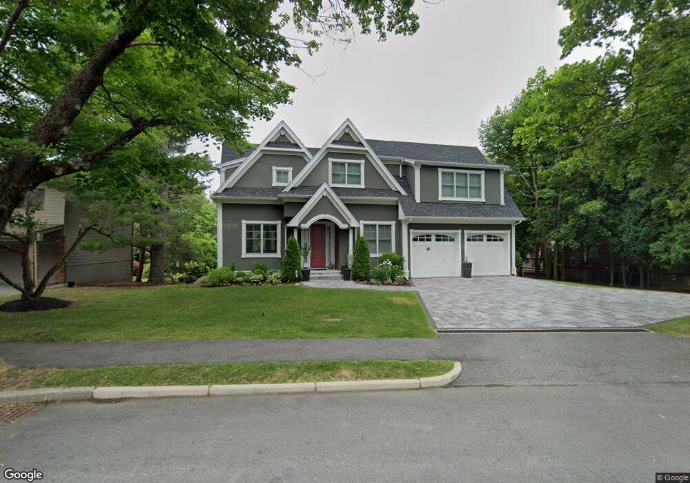
31 Harwich Rd Chestnut Hill, MA 02467
Oak Hill NeighborhoodEstimated Value: $2,844,449 - $3,380,000
5
Beds
6
Baths
3,594
Sq Ft
$882/Sq Ft
Est. Value
About This Home
This home is located at 31 Harwich Rd, Chestnut Hill, MA 02467 and is currently estimated at $3,171,612, approximately $882 per square foot. 31 Harwich Rd is a home located in Middlesex County with nearby schools including Memorial Spaulding Elementary School, Oak Hill Middle School, and Newton South High School.
Ownership History
Date
Name
Owned For
Owner Type
Purchase Details
Closed on
Nov 16, 2017
Sold by
Yin Yi
Bought by
Kader Hisham and Kkoya Shamiin
Current Estimated Value
Home Financials for this Owner
Home Financials are based on the most recent Mortgage that was taken out on this home.
Original Mortgage
$1,075,000
Outstanding Balance
$883,109
Interest Rate
3.13%
Mortgage Type
Unknown
Estimated Equity
$2,288,503
Purchase Details
Closed on
Jun 15, 1994
Sold by
Finn Paul J
Bought by
Yin Yi
Create a Home Valuation Report for This Property
The Home Valuation Report is an in-depth analysis detailing your home's value as well as a comparison with similar homes in the area
Home Values in the Area
Average Home Value in this Area
Purchase History
| Date | Buyer | Sale Price | Title Company |
|---|---|---|---|
| Kader Hisham | $2,150,000 | -- | |
| Yin Yi | $387,000 | -- |
Source: Public Records
Mortgage History
| Date | Status | Borrower | Loan Amount |
|---|---|---|---|
| Open | Kader Hisham | $1,075,000 |
Source: Public Records
Tax History Compared to Growth
Tax History
| Year | Tax Paid | Tax Assessment Tax Assessment Total Assessment is a certain percentage of the fair market value that is determined by local assessors to be the total taxable value of land and additions on the property. | Land | Improvement |
|---|---|---|---|---|
| 2025 | $24,935 | $2,544,400 | $1,176,600 | $1,367,800 |
| 2024 | $24,110 | $2,470,300 | $1,142,300 | $1,328,000 |
| 2023 | $23,437 | $2,302,300 | $884,600 | $1,417,700 |
| 2022 | $22,427 | $2,131,800 | $819,100 | $1,312,700 |
| 2021 | $21,639 | $2,011,100 | $772,700 | $1,238,400 |
| 2020 | $20,996 | $2,011,100 | $772,700 | $1,238,400 |
| 2019 | $20,404 | $1,952,500 | $750,200 | $1,202,300 |
| 2018 | $7,957 | $735,400 | $681,500 | $53,900 |
| 2017 | $7,715 | $693,800 | $642,900 | $50,900 |
| 2016 | $7,379 | $648,400 | $600,800 | $47,600 |
| 2015 | $7,036 | $606,000 | $561,500 | $44,500 |
Source: Public Records
Map
Nearby Homes
- 70 Pond Brook Rd
- 109 Harwich Rd
- 14 Rolling Ln
- 44 Broadlawn Park Unit 22
- 64 Bryon Rd Unit 1
- 42 Bryon Rd Unit 6
- 21 Westgate Rd Unit 6
- 99 Baldpate Hill Rd
- 57 Broadlawn Park Unit 4B
- 23 Westgate Rd Unit 6
- 1206 Lagrange St Unit 1206
- 1206 Lagrange St
- 63 Drumlin Rd
- 65 Lagrange St
- 931 Lagrange St
- 21 Lovett Rd
- 56 Cynthia Rd
- 44 Lovett Rd
- 59 Deborah Rd
- 133 Oak Hill St