Estimated Value: $311,000 - $355,000
3
Beds
2
Baths
1,456
Sq Ft
$225/Sq Ft
Est. Value
About This Home
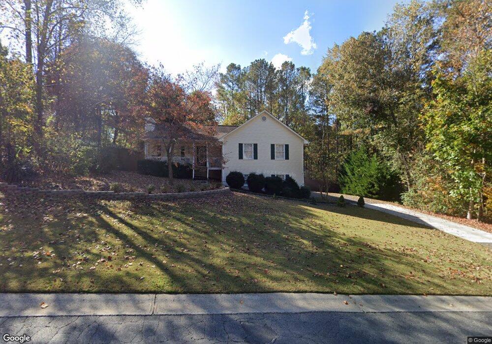
This home is located at 31 High Pointe Dr, White, GA 30184 and is currently estimated at $327,853, approximately $225 per square foot. 31 High Pointe Dr is a home located in Bartow County with nearby schools including White Elementary School, Cass Middle School, and Cass High School.
Ownership History
Date
Name
Owned For
Owner Type
Purchase Details
Closed on
Dec 3, 2010
Sold by
Leary J Mark
Bought by
Leary James Mark
Current Estimated Value
Home Financials for this Owner
Home Financials are based on the most recent Mortgage that was taken out on this home.
Original Mortgage
$97,000
Outstanding Balance
$36,759
Interest Rate
4.32%
Mortgage Type
New Conventional
Estimated Equity
$291,094
Create a Home Valuation Report for This Property
The Home Valuation Report is an in-depth analysis detailing your home's value as well as a comparison with similar homes in the area
Home Values in the Area
Average Home Value in this Area
Purchase History
| Date | Buyer | Sale Price | Title Company |
|---|---|---|---|
| Leary James Mark | -- | -- |
Source: Public Records
Mortgage History
| Date | Status | Borrower | Loan Amount |
|---|---|---|---|
| Open | Leary James Mark | $97,000 |
Source: Public Records
Tax History
| Year | Tax Paid | Tax Assessment Tax Assessment Total Assessment is a certain percentage of the fair market value that is determined by local assessors to be the total taxable value of land and additions on the property. | Land | Improvement |
|---|---|---|---|---|
| 2025 | $1,483 | $109,515 | $22,000 | $87,515 |
| 2024 | $1,483 | $107,032 | $26,000 | $81,032 |
| 2023 | $1,486 | $108,235 | $19,000 | $89,235 |
| 2022 | $2,070 | $88,113 | $18,000 | $70,113 |
| 2021 | $1,709 | $70,673 | $18,000 | $52,673 |
| 2020 | $1,683 | $66,279 | $16,000 | $50,279 |
| 2019 | $1,496 | $58,874 | $16,000 | $42,874 |
| 2018 | $1,369 | $54,123 | $12,000 | $42,123 |
| 2017 | $1,375 | $54,123 | $12,000 | $42,123 |
| 2016 | $1,212 | $47,960 | $6,800 | $41,160 |
| 2015 | $1,168 | $46,320 | $6,800 | $39,520 |
| 2014 | $995 | $39,080 | $4,800 | $34,280 |
| 2013 | -- | $32,520 | $7,200 | $25,320 |
Source: Public Records
Map
Nearby Homes
- 331 Bells Ferry Rd NE
- 000 Country Creek Rd
- 56 Greatwood Dr
- 0 Country Creek Rd Unit 10680526
- 53 Black Rd NE
- 47 Wey Bridge Ct
- 298 Boulder Lake Dr NE
- 20 Spring Lake Trail NE
- 55 Rocky Cir NE
- 38 Mountain Ridge Rd NE
- 52 Lake Overlook Dr
- 67 Timberlake Cove NE
- 16 Altar Rock Ct
- LOT 56 SPRING L Lot
- 11 Lake Overlook Dr
- 10 Altar Rock Ct NE
- 29 Aaron Ln
- 61 Roberson Dr NE
- 15 Isabella Ct NE
- 6101 Highway 20 NE
- 29 High Pointe Dr
- 11 Bent Water Dr
- 30 High Pointe Dr
- 27 High Pointe Dr
- 13 Bent Water Dr
- 28 High Pointe Dr
- 26 High Pointe Dr
- 55 Broadlands Dr
- 25 High Pointe Dr
- 53 Broadlands Dr
- 57 Broadlands Dr
- 58 Broadlands Dr
- 14 Bent Water Dr
- 10 Bent Water Dr
- 23 High Pointe Dr
- 24 High Pointe Dr
- 51 Broadlands Dr
- 12 Bent Water Dr
- 11 Graystone Dr
- 13 Black Water Dr
Your Personal Tour Guide
Ask me questions while you tour the home.