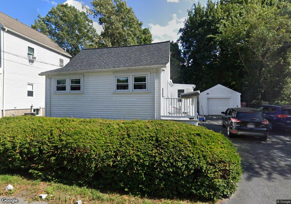
31 Hillside Ave Braintree, MA 02184
East Braintree NeighborhoodEstimated Value: $496,000 - $522,000
2
Beds
1
Bath
857
Sq Ft
$593/Sq Ft
Est. Value
About This Home
This home is located at 31 Hillside Ave, Braintree, MA 02184 and is currently estimated at $508,091, approximately $592 per square foot. 31 Hillside Ave is a home located in Norfolk County with nearby schools including Braintree High School, Noble Academy, and Sacred Heart Elementary School.
Ownership History
Date
Name
Owned For
Owner Type
Purchase Details
Closed on
Sep 10, 1991
Sold by
Clouse Calvin W and Clouse Marhsa A
Bought by
Mccarthy Carol
Current Estimated Value
Home Financials for this Owner
Home Financials are based on the most recent Mortgage that was taken out on this home.
Original Mortgage
$79,650
Interest Rate
9.43%
Mortgage Type
Purchase Money Mortgage
Create a Home Valuation Report for This Property
The Home Valuation Report is an in-depth analysis detailing your home's value as well as a comparison with similar homes in the area
Home Values in the Area
Average Home Value in this Area
Purchase History
| Date | Buyer | Sale Price | Title Company |
|---|---|---|---|
| Mccarthy Carol | $88,000 | -- | |
| Mccarthy Carol | $88,000 | -- |
Source: Public Records
Mortgage History
| Date | Status | Borrower | Loan Amount |
|---|---|---|---|
| Open | Mccarthy Carol | $84,000 | |
| Closed | Mccarthy Carol | $80,500 | |
| Closed | Mccarthy Carol | $79,650 |
Source: Public Records
Tax History
| Year | Tax Paid | Tax Assessment Tax Assessment Total Assessment is a certain percentage of the fair market value that is determined by local assessors to be the total taxable value of land and additions on the property. | Land | Improvement |
|---|---|---|---|---|
| 2025 | $4,405 | $441,400 | $303,700 | $137,700 |
| 2024 | $3,957 | $417,400 | $283,200 | $134,200 |
| 2023 | $3,753 | $384,500 | $254,400 | $130,100 |
| 2022 | $3,581 | $359,900 | $229,800 | $130,100 |
| 2021 | $3,194 | $321,000 | $207,700 | $113,300 |
| 2020 | $2,938 | $298,000 | $188,800 | $109,200 |
| 2019 | $2,786 | $276,100 | $180,600 | $95,500 |
| 2018 | $2,682 | $254,500 | $164,200 | $90,300 |
| 2017 | $2,645 | $246,300 | $156,000 | $90,300 |
| 2016 | $2,374 | $216,200 | $131,300 | $84,900 |
| 2015 | $2,344 | $211,700 | $129,700 | $82,000 |
| 2014 | $2,286 | $200,200 | $118,200 | $82,000 |
Source: Public Records
Map
Nearby Homes
- 312 Shaw St
- 30 Skyline Dr Unit 6
- 25 W Howard St Unit C3
- 16 Beechwood Rd
- 26 Tingley Rd
- 200 Falls Blvd Unit B305
- 41 Lantern Ln
- 51 Faxon St
- 37 Lantern Ln
- 585 Washington St Unit 202
- 585 Washington St Unit model
- 342 Elm St
- 122 Washington St Unit Twenty-two
- 255 River St
- 62 Lawn Ave
- 70 Biscayne Ave
- 11 Richmond St
- 25 Richmond St
- 500 Washington St Unit 201
- 7-9 Kittredge Ave
- 33 Hillside Ave
- 25 Hillside Ave
- 32 Hillside Ave
- 34 Hillside Ave
- 30 Hillside Ave
- 21 Hillside Ave
- 39 Hillside Ave
- 24 Hillside Ave
- 24 Hillside Ave Unit 1
- 24 Hillside Ave Unit 24
- 24 Hillside Ave Unit 2
- 33 Dewey Rd
- 40 Hillside Ave
- 18 Berwick St
- 7 Veranda Rd
- 16 Berwick St
- 49 Dewey Rd
- 23 Dewey Rd Unit 25
- 46 Hillside Ave
- 13 Berwick St
Your Personal Tour Guide
Ask me questions while you tour the home.