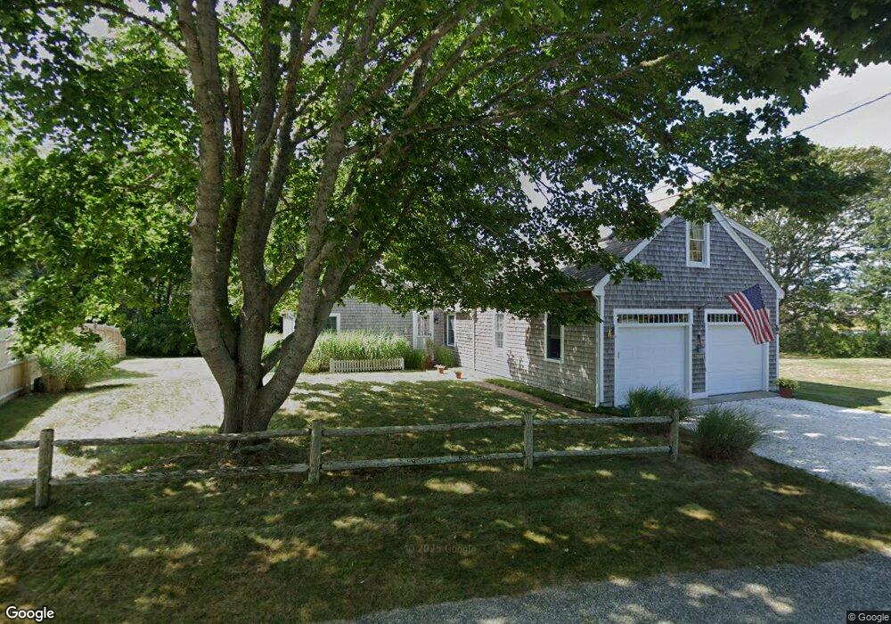
31 Lone Tree Rd Dennis Port, MA 02639
Dennis Port NeighborhoodEstimated Value: $626,000 - $766,000
2
Beds
1
Bath
1,310
Sq Ft
$549/Sq Ft
Est. Value
About This Home
This home is located at 31 Lone Tree Rd, Dennis Port, MA 02639 and is currently estimated at $718,812, approximately $548 per square foot. 31 Lone Tree Rd is a home located in Barnstable County with nearby schools including Dennis-Yarmouth Regional High School and St. Pius X. School.
Ownership History
Date
Name
Owned For
Owner Type
Purchase Details
Closed on
Jul 27, 1990
Sold by
Allen Muriel H
Bought by
Smith William E
Current Estimated Value
Create a Home Valuation Report for This Property
The Home Valuation Report is an in-depth analysis detailing your home's value as well as a comparison with similar homes in the area
Home Values in the Area
Average Home Value in this Area
Purchase History
| Date | Buyer | Sale Price | Title Company |
|---|---|---|---|
| Smith William E | $140,000 | -- |
Source: Public Records
Mortgage History
| Date | Status | Borrower | Loan Amount |
|---|---|---|---|
| Open | Smith William E | $135,000 | |
| Closed | Smith William E | $140,000 | |
| Closed | Smith William E | $120,000 | |
| Closed | Smith William E | $10,000 |
Source: Public Records
Tax History Compared to Growth
Tax History
| Year | Tax Paid | Tax Assessment Tax Assessment Total Assessment is a certain percentage of the fair market value that is determined by local assessors to be the total taxable value of land and additions on the property. | Land | Improvement |
|---|---|---|---|---|
| 2025 | $3,213 | $742,100 | $334,800 | $407,300 |
| 2024 | $3,070 | $699,400 | $322,000 | $377,400 |
| 2023 | $2,932 | $627,800 | $284,600 | $343,200 |
| 2022 | $2,878 | $513,900 | $256,400 | $257,500 |
| 2021 | $4,089 | $467,200 | $251,300 | $215,900 |
| 2020 | $179,093 | $447,200 | $251,300 | $195,900 |
| 2019 | $181,406 | $423,100 | $246,400 | $176,700 |
| 2018 | $3,470 | $395,500 | $234,600 | $160,900 |
| 2017 | $3,294 | $348,900 | $214,500 | $134,400 |
| 2016 | $2,229 | $341,400 | $227,900 | $113,500 |
| 2015 | $2,185 | $341,400 | $227,900 | $113,500 |
| 2014 | $2,168 | $341,400 | $227,900 | $113,500 |
Source: Public Records
Map
Nearby Homes
- 19 Standish Way
- 71 Main St
- 4 Coffey Ln
- 12 Spoonbill Rd
- 125 Main St Unit 3
- 80 Michaels Ave
- 22 Wixon Rd
- 15 Woodside Park Rd
- 31 Easy St
- 72 Bassett Ln
- 268 Main St
- 95 Center St
- 26 Center St
- 61 Trotters Ln
- 3 Pinefield Ln
- 37 Ocean Dr Unit 2
- 20 Aunt Debbys Rd
- 64 Beaten Rd
- 78 Upper County Rd Unit A&B
- 78 Upper County Rd
- 35 Lone Tree Rd
- 9 Michaels Ave
- 7 Michaels Ave
- 25 Lone Tree Rd
- 45 Lone Tree Rd
- 51 Lone Tree Rd
- 55 Lone Tree Rd
- 11 Michaels Ave
- 5 Michaels Ave
- 21 Lone Tree Rd
- 15 Michaels Ave
- 60 Lone Tree Rd
- 32 Lone Tree Rd
- 1 Michaels Ave
- 12 Michaels Ave
- 17 Lone Tree Rd
- 26 Carodor Rd
- 26 Lone Tree Rd
- 26 Lone Tree Rd Unit B
- 26 Lone Tree Rd Unit A