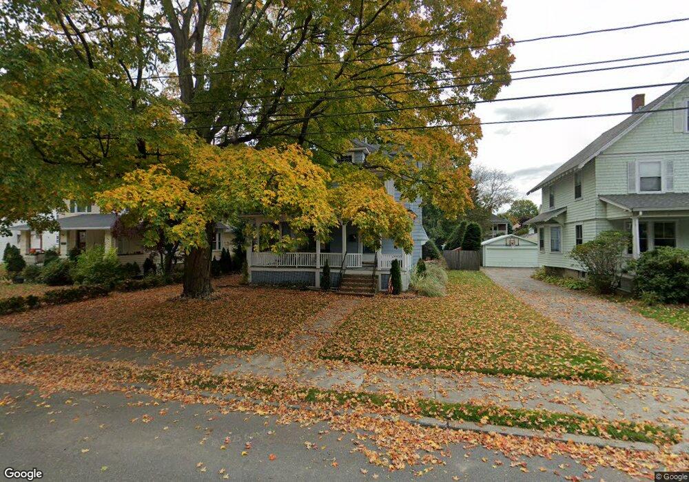
31 Mansfield St Framingham, MA 01702
Estimated Value: $632,877 - $707,000
3
Beds
2
Baths
1,912
Sq Ft
$352/Sq Ft
Est. Value
About This Home
This home is located at 31 Mansfield St, Framingham, MA 01702 and is currently estimated at $672,719, approximately $351 per square foot. 31 Mansfield St is a home located in Middlesex County with nearby schools including Framingham High School, Happy Hollow School, and Marian High School.
Ownership History
Date
Name
Owned For
Owner Type
Purchase Details
Closed on
Jan 13, 2025
Sold by
Kay Patricia A and Kay Joseph M
Bought by
Kay Patricia A
Current Estimated Value
Home Financials for this Owner
Home Financials are based on the most recent Mortgage that was taken out on this home.
Original Mortgage
$110,000
Outstanding Balance
$108,712
Interest Rate
6.69%
Mortgage Type
New Conventional
Estimated Equity
$564,007
Purchase Details
Closed on
Nov 7, 1996
Sold by
Harper John L and Stavis Laurel
Bought by
Kay Joseph M and Kay Patricia A
Purchase Details
Closed on
Nov 1, 1990
Sold by
Goldrick Richard T
Bought by
Stavis Laurel
Create a Home Valuation Report for This Property
The Home Valuation Report is an in-depth analysis detailing your home's value as well as a comparison with similar homes in the area
Home Values in the Area
Average Home Value in this Area
Purchase History
| Date | Buyer | Sale Price | Title Company |
|---|---|---|---|
| Kay Patricia A | -- | Misc Company | |
| Kay Patricia A | -- | Misc Company | |
| Kay Joseph M | $167,000 | -- | |
| Stavis Laurel | $157,500 | -- | |
| Kay Joseph M | $167,000 | -- | |
| Stavis Laurel | $157,500 | -- |
Source: Public Records
Mortgage History
| Date | Status | Borrower | Loan Amount |
|---|---|---|---|
| Open | Kay Patricia A | $110,000 | |
| Closed | Kay Patricia A | $110,000 | |
| Previous Owner | Stavis Laurel | $224,500 | |
| Previous Owner | Stavis Laurel | $133,500 |
Source: Public Records
Tax History
| Year | Tax Paid | Tax Assessment Tax Assessment Total Assessment is a certain percentage of the fair market value that is determined by local assessors to be the total taxable value of land and additions on the property. | Land | Improvement |
|---|---|---|---|---|
| 2025 | $6,122 | $512,700 | $217,800 | $294,900 |
| 2024 | $5,667 | $454,800 | $195,200 | $259,600 |
| 2023 | $5,440 | $415,600 | $174,900 | $240,700 |
| 2022 | $5,153 | $375,000 | $158,800 | $216,200 |
| 2021 | $4,992 | $355,300 | $152,700 | $202,600 |
| 2020 | $4,919 | $328,400 | $132,800 | $195,600 |
| 2019 | $4,815 | $313,100 | $129,000 | $184,100 |
| 2018 | $4,713 | $288,800 | $122,100 | $166,700 |
| 2017 | $4,635 | $277,400 | $118,600 | $158,800 |
| 2016 | $4,453 | $256,200 | $114,800 | $141,400 |
| 2015 | $4,254 | $238,700 | $114,600 | $124,100 |
Source: Public Records
Map
Nearby Homes
- 96 Mansfield St
- 260 Grant St
- 47 Bishop Dr
- 15 Willis St Unit 4
- 56 Morency St Unit D
- 16 Grant Street Extension
- 18 Beaver Ct
- 120 Franklin St
- 126 Beaver St Unit 121
- 126 Beaver St Unit 5
- 50 Kittredge Rd
- 29 Gordon St Unit 107
- 27 Gordon St Unit 305
- 150 2nd St Unit 310
- 23 Village Rock Ln Unit 22
- 21 Village Rock Ln Unit 4
- 9 Village Hill Ln Unit 15
- 5 Village Rock Ln Unit 24
- 4 Village Rock Ln Unit 9
- 29 Village Rock Ln Unit 6
- 37 Mansfield St
- 27 Mansfield St
- 41 Mansfield St
- 23 Mansfield St
- 30 Pond St
- 26 Pond St
- 34 Pond St
- 47 Mansfield St
- 19 Mansfield St
- 34 Mansfield St
- 34 Mansfield St Unit A,34
- 34 Mansfield St Unit B,34
- 34 Mansfield St Unit 1
- 34 Mansfield St Unit A
- 22 Pond St
- 38 Pond St
- 51 Mansfield St
- 30 Mansfield St
- 42 Pond St
- 42 Pond St
Your Personal Tour Guide
Ask me questions while you tour the home.