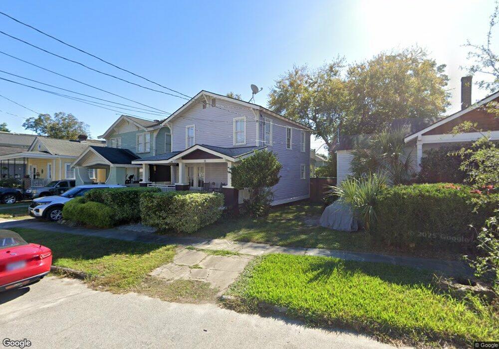
31 Maple St Charleston, SC 29403
North Central NeighborhoodEstimated Value: $705,000 - $899,000
3
Beds
2
Baths
1,433
Sq Ft
$578/Sq Ft
Est. Value
About This Home
This home is located at 31 Maple St, Charleston, SC 29403 and is currently estimated at $828,611, approximately $578 per square foot. 31 Maple St is a home located in Charleston County with nearby schools including James Simons Elementary School, Mitchell Elementary School, and Simmons Pinckney Middle.
Ownership History
Date
Name
Owned For
Owner Type
Purchase Details
Closed on
Oct 27, 2004
Sold by
Patel Hemant and Patel Deepa
Bought by
Abrams David B and Clapp Marvin B
Current Estimated Value
Purchase Details
Closed on
Dec 15, 2003
Sold by
B Salta & Associates Llc
Bought by
Patel Hemant and Patel Deepa
Purchase Details
Closed on
Nov 21, 2003
Sold by
Mundy Esther L
Bought by
B Salta & Associates Llc
Create a Home Valuation Report for This Property
The Home Valuation Report is an in-depth analysis detailing your home's value as well as a comparison with similar homes in the area
Home Values in the Area
Average Home Value in this Area
Purchase History
| Date | Buyer | Sale Price | Title Company |
|---|---|---|---|
| Abrams David B | $229,900 | -- | |
| Patel Hemant | $115,000 | -- | |
| B Salta & Associates Llc | $92,000 | -- | |
| Mundy Esther L | -- | -- |
Source: Public Records
Tax History
| Year | Tax Paid | Tax Assessment Tax Assessment Total Assessment is a certain percentage of the fair market value that is determined by local assessors to be the total taxable value of land and additions on the property. | Land | Improvement |
|---|---|---|---|---|
| 2024 | $1,634 | $11,270 | $0 | $0 |
| 2023 | $1,541 | $11,270 | $0 | $0 |
| 2022 | $1,420 | $11,270 | $0 | $0 |
| 2021 | $1,487 | $11,270 | $0 | $0 |
| 2020 | $1,541 | $11,270 | $0 | $0 |
| 2019 | $1,373 | $9,790 | $0 | $0 |
| 2017 | $1,326 | $9,790 | $0 | $0 |
| 2016 | $1,273 | $9,790 | $0 | $0 |
| 2015 | $1,314 | $9,790 | $0 | $0 |
| 2014 | $1,209 | $0 | $0 | $0 |
| 2011 | -- | $0 | $0 | $0 |
Source: Public Records
Map
Nearby Homes
- 4 Poplar St
- 46 Poplar St
- 90 Romney St
- 163 Romney St
- 6 & 6.5 Addison St
- 3 Addison St
- 81 Simons St
- 43 Poinsett St
- 1 Paige Ct
- 10 Magnolia Ave
- 12 Grove St
- 431 N Hanover St
- 829 Rutledge Ave
- 764 Rutledge Ave
- 119 Simons St
- 924 Rutledge Ave
- 43 N Enston Ave
- 930 Ashley Ave
- 872 Ashley Ave
- 1 Cool Blow St Unit 337
Your Personal Tour Guide
Ask me questions while you tour the home.