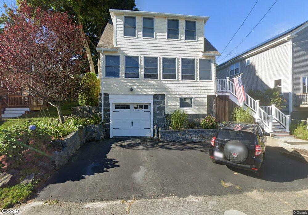
31 Massasoit Rd North Weymouth, MA 02191
North Weymouth NeighborhoodEstimated Value: $550,000 - $619,000
3
Beds
2
Baths
1,318
Sq Ft
$443/Sq Ft
Est. Value
About This Home
This home is located at 31 Massasoit Rd, North Weymouth, MA 02191 and is currently estimated at $583,383, approximately $442 per square foot. 31 Massasoit Rd is a home located in Norfolk County with nearby schools including Wessagusset Elementary School, Abigail Adams Middle School, and Weymouth Middle School Chapman.
Ownership History
Date
Name
Owned For
Owner Type
Purchase Details
Closed on
Dec 28, 2015
Sold by
Donnellen Robert P
Bought by
Donnellen Robert P and Donnellen Cynthia M
Current Estimated Value
Home Financials for this Owner
Home Financials are based on the most recent Mortgage that was taken out on this home.
Original Mortgage
$262,500
Outstanding Balance
$208,977
Interest Rate
3.99%
Mortgage Type
New Conventional
Estimated Equity
$374,406
Purchase Details
Closed on
Jul 29, 1994
Sold by
Mhfa
Bought by
Donnellan Robert P
Home Financials for this Owner
Home Financials are based on the most recent Mortgage that was taken out on this home.
Original Mortgage
$71,250
Interest Rate
8.25%
Mortgage Type
Purchase Money Mortgage
Purchase Details
Closed on
Apr 4, 1994
Sold by
Landers Edward M Est
Bought by
Massachusetts Housing
Create a Home Valuation Report for This Property
The Home Valuation Report is an in-depth analysis detailing your home's value as well as a comparison with similar homes in the area
Home Values in the Area
Average Home Value in this Area
Purchase History
| Date | Buyer | Sale Price | Title Company |
|---|---|---|---|
| Donnellen Robert P | -- | -- | |
| Donnellan Robert P | $75,000 | -- | |
| Massachusetts Housing | $73,500 | -- |
Source: Public Records
Mortgage History
| Date | Status | Borrower | Loan Amount |
|---|---|---|---|
| Open | Donnellen Robert P | $262,500 | |
| Previous Owner | Massachusetts Housing | $247,500 | |
| Previous Owner | Massachusetts Housing | $10,000 | |
| Previous Owner | Massachusetts Housing | $71,250 |
Source: Public Records
Tax History Compared to Growth
Tax History
| Year | Tax Paid | Tax Assessment Tax Assessment Total Assessment is a certain percentage of the fair market value that is determined by local assessors to be the total taxable value of land and additions on the property. | Land | Improvement |
|---|---|---|---|---|
| 2025 | $4,759 | $471,200 | $205,000 | $266,200 |
| 2024 | $4,610 | $448,900 | $195,300 | $253,600 |
| 2023 | $4,441 | $425,000 | $180,800 | $244,200 |
| 2022 | $4,334 | $378,200 | $167,400 | $210,800 |
| 2021 | $3,967 | $337,900 | $167,400 | $170,500 |
| 2020 | $3,767 | $316,000 | $167,400 | $148,600 |
| 2019 | $3,676 | $303,300 | $161,000 | $142,300 |
| 2018 | $3,565 | $285,200 | $153,300 | $131,900 |
| 2017 | $3,333 | $260,200 | $139,400 | $120,800 |
| 2016 | $3,203 | $250,200 | $134,000 | $116,200 |
| 2015 | $3,012 | $233,500 | $127,700 | $105,800 |
| 2014 | $2,885 | $216,900 | $118,800 | $98,100 |
Source: Public Records
Map
Nearby Homes
- 137 Wessagussett Rd
- 10 Hobamack Rd
- 55 Blackstone Rd
- 6 Shore Dr
- 104 Kings Cove Beach Rd
- 16 Caldwell St
- 79 Bicknell St
- 251 Green St
- 109 Merryknoll Rd
- 107 Spring St
- 320 Green St
- 92 Doris Dr
- 300 River St Unit 12
- 73 Broad Reach Unit M36C
- 73 Broad Reach Unit M21C
- 51 Broad Reach Unit T23A
- 14 Littlefield St
- 76 Macy St
- 18 Allerton St
- 88 Turner St
- 35 Massasoit Rd
- 27 Massasoit Rd
- 68 Pequot Rd
- 39 Massasoit Rd
- 12 Pequot Rd
- 23 Massasoit Rd
- 32 Massasoit Rd
- 32 Massasoit Rd Unit 1
- 32 Massasoit Rd Unit 2
- 26 Massasoit Rd Unit 1
- 41 Massasoit Rd
- 26 Massasoit Rd
- 26 Massasoit Rd Unit 1
- 26 Massasoit Rd Unit 2
- 157 Pilgrim Rd
- 19 Massasoit Rd
- 16 Pequot Rd
- 22 Massasoit Rd
- 43 Massasoit Rd
- 161 Pilgrim Rd