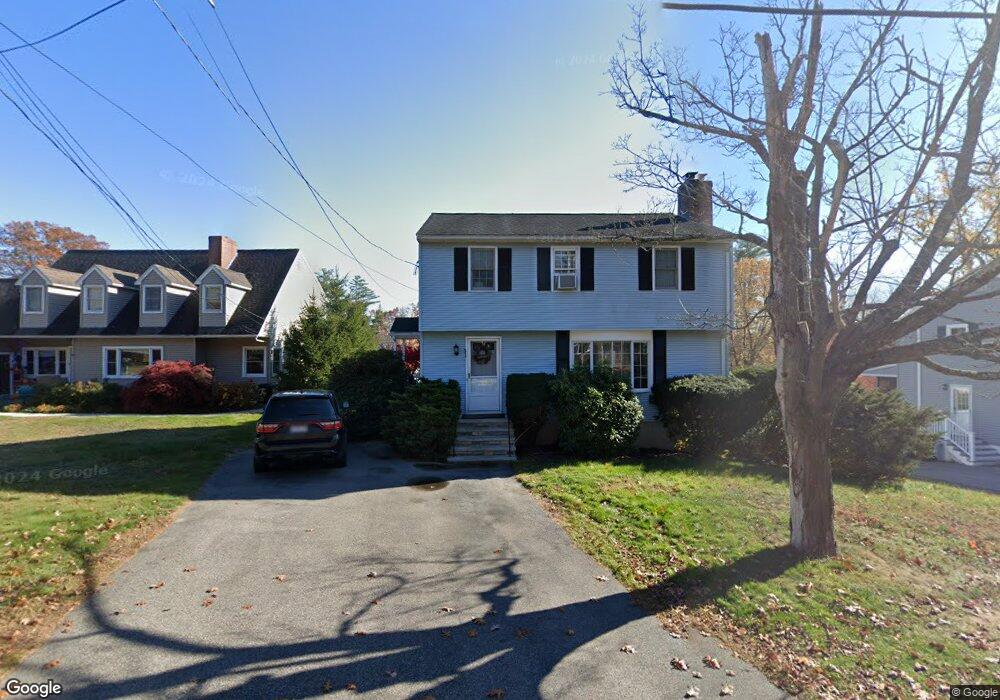
31 Middle Rd Amesbury, MA 01913
Estimated Value: $565,000 - $612,000
3
Beds
2
Baths
1,372
Sq Ft
$424/Sq Ft
Est. Value
About This Home
This home is located at 31 Middle Rd, Amesbury, MA 01913 and is currently estimated at $582,315, approximately $424 per square foot. 31 Middle Rd is a home located in Essex County with nearby schools including Amesbury High School and Amesbury Seventh-Day Adventist School.
Ownership History
Date
Name
Owned For
Owner Type
Purchase Details
Closed on
Jan 28, 2022
Sold by
Ells Jonathan and Ells Kathleen A
Bought by
Ells Ft
Current Estimated Value
Purchase Details
Closed on
Jan 29, 1993
Sold by
Wrobel Mary F
Bought by
Verville Heidi M and Monahan Michael
Create a Home Valuation Report for This Property
The Home Valuation Report is an in-depth analysis detailing your home's value as well as a comparison with similar homes in the area
Home Values in the Area
Average Home Value in this Area
Purchase History
| Date | Buyer | Sale Price | Title Company |
|---|---|---|---|
| Ells Ft | -- | None Available | |
| Verville Heidi M | $124,000 | -- |
Source: Public Records
Mortgage History
| Date | Status | Borrower | Loan Amount |
|---|---|---|---|
| Previous Owner | Verville Heidi M | $193,700 | |
| Previous Owner | Verville Heidi M | $40,000 | |
| Previous Owner | Verville Heidi M | $190,000 |
Source: Public Records
Tax History Compared to Growth
Tax History
| Year | Tax Paid | Tax Assessment Tax Assessment Total Assessment is a certain percentage of the fair market value that is determined by local assessors to be the total taxable value of land and additions on the property. | Land | Improvement |
|---|---|---|---|---|
| 2025 | $7,353 | $480,600 | $203,100 | $277,500 |
| 2024 | $7,182 | $459,200 | $191,600 | $267,600 |
| 2023 | $6,559 | $401,400 | $166,600 | $234,800 |
| 2022 | $6,262 | $354,000 | $144,900 | $209,100 |
| 2021 | $5,641 | $309,100 | $111,900 | $197,200 |
| 2020 | $4,975 | $289,600 | $107,600 | $182,000 |
| 2019 | $5,188 | $282,400 | $107,600 | $174,800 |
| 2018 | $4,991 | $262,800 | $102,500 | $160,300 |
| 2017 | $5,127 | $257,000 | $102,500 | $154,500 |
| 2016 | $5,119 | $252,400 | $102,500 | $149,900 |
| 2015 | $4,975 | $242,200 | $102,500 | $139,700 |
| 2014 | $4,861 | $231,800 | $102,500 | $129,300 |
Source: Public Records
Map
Nearby Homes
- 4 Spindle Tree Ln
- 8 Riverview Heights Unit 61
- 24 1st St
- 47 Cutter Ln Unit 47
- 19 Cutter Ln Unit 19
- 28 Beacon St
- 188 Lions Mouth Rd
- 1 Hillside Ave Unit 3
- 37 Lombard Ave
- 60 Merrimac St Unit 604
- 60 Merrimac St Unit 504
- 4 Greenwood St
- 1 Bisson Ln
- 35 Merrimac St
- 11 Lisa Cir
- 93 Friend St
- 3 B St
- 6 B St
- 12 School St Unit 2
- 7 Harrison Eaton Ln