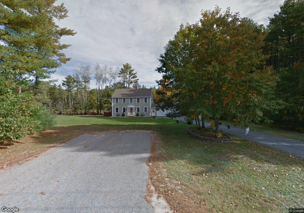
31 Myrtle Ln Buxton, ME 04093
Estimated Value: $384,000 - $508,000
3
Beds
2
Baths
1,632
Sq Ft
$275/Sq Ft
Est. Value
About This Home
This home is located at 31 Myrtle Ln, Buxton, ME 04093 and is currently estimated at $449,314, approximately $275 per square foot. 31 Myrtle Ln is a home located in York County with nearby schools including Bonny Eagle High School.
Ownership History
Date
Name
Owned For
Owner Type
Purchase Details
Closed on
Apr 30, 2025
Sold by
Wiggins Darrell and Murphy Karen
Bought by
Murphy Kady M
Current Estimated Value
Purchase Details
Closed on
Dec 11, 2006
Sold by
Richard Sandra
Bought by
Murphy Karen D
Home Financials for this Owner
Home Financials are based on the most recent Mortgage that was taken out on this home.
Original Mortgage
$191,900
Interest Rate
6.4%
Mortgage Type
Commercial
Create a Home Valuation Report for This Property
The Home Valuation Report is an in-depth analysis detailing your home's value as well as a comparison with similar homes in the area
Home Values in the Area
Average Home Value in this Area
Purchase History
| Date | Buyer | Sale Price | Title Company |
|---|---|---|---|
| Murphy Kady M | -- | None Available | |
| Murphy Kady M | -- | None Available | |
| Murphy Kady M | -- | None Available | |
| Murphy Karen D | -- | -- | |
| Murphy Karen D | -- | -- | |
| Murphy Karen D | -- | -- |
Source: Public Records
Mortgage History
| Date | Status | Borrower | Loan Amount |
|---|---|---|---|
| Previous Owner | Murphy Karen D | $191,900 | |
| Previous Owner | Murphy Karen D | $35,980 |
Source: Public Records
Tax History
| Year | Tax Paid | Tax Assessment Tax Assessment Total Assessment is a certain percentage of the fair market value that is determined by local assessors to be the total taxable value of land and additions on the property. | Land | Improvement |
|---|---|---|---|---|
| 2025 | $4,136 | $362,800 | $114,900 | $247,900 |
| 2024 | $3,987 | $362,800 | $114,900 | $247,900 |
| 2023 | $3,784 | $362,800 | $114,900 | $247,900 |
| 2022 | $3,715 | $362,800 | $114,900 | $247,900 |
| 2021 | $3,557 | $246,009 | $73,000 | $173,009 |
| 2020 | $937 | $246,009 | $73,000 | $173,009 |
| 2019 | $3,253 | $219,500 | $73,000 | $146,500 |
| 2018 | $6,204 | $219,500 | $73,000 | $146,500 |
| 2017 | $2,985 | $219,500 | $73,000 | $146,500 |
| 2016 | $6,228 | $219,500 | $73,000 | $146,500 |
| 2015 | $2,843 | $219,500 | $73,000 | $146,500 |
| 2014 | $2,788 | $219,500 | $73,000 | $146,500 |
| 2013 | $2,744 | $219,500 | $73,000 | $146,500 |
Source: Public Records
Map
Nearby Homes
- 107 Sokokis Trail
- TBD Saco Rd
- Lot 2 Commerce Way
- 7 Pelletier Dr
- Lot 8 Pelletier Dr
- Lot 10 Pelletier Dr
- 71 Chicopee Rd
- 4 Pelletier Dr
- 2 Bonny Eagle Rd
- 21 Holiday Ln
- 500 Ossipee Trail W
- 5 Holiday Ln
- 30 Joan Dixon Way
- 328 Ossipee Trail W Unit 4
- 326 Ossipee Trail W Unit 3
- 324 Ossipee Trail W Unit 2
- 42 Brandons Way
- 866 Parker Farm Lot B Rd
- 866 Parker Farm Lot A Rd
- 866 Parker Farm Rd Unit A
Your Personal Tour Guide
Ask me questions while you tour the home.