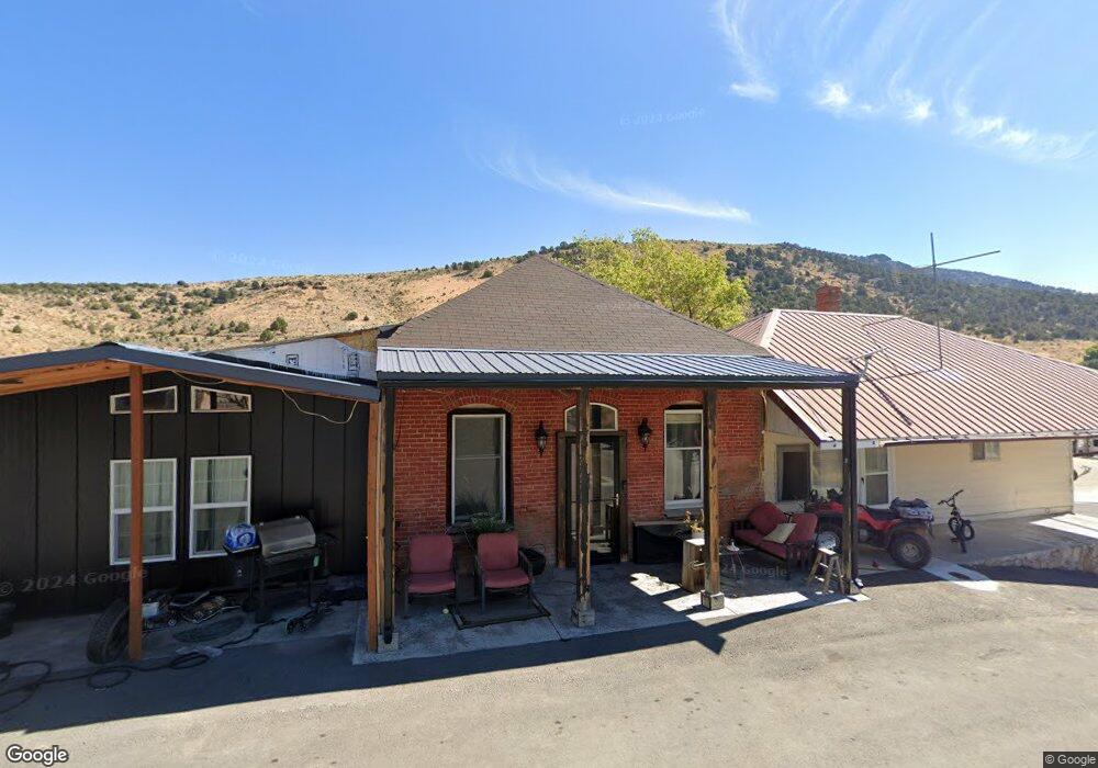
31 N Adams St Eureka, NV 89316
Estimated Value: $181,338 - $732,000
Studio
--
Bath
1,368
Sq Ft
$238/Sq Ft
Est. Value
About This Home
This home is located at 31 N Adams St, Eureka, NV 89316 and is currently estimated at $325,335, approximately $237 per square foot. 31 N Adams St is a home with nearby schools including Eureka County High School.
Ownership History
Date
Name
Owned For
Owner Type
Purchase Details
Closed on
Aug 3, 2023
Sold by
Jones Catherine
Bought by
Jones Michael
Current Estimated Value
Home Financials for this Owner
Home Financials are based on the most recent Mortgage that was taken out on this home.
Original Mortgage
$33,100
Outstanding Balance
$32,332
Interest Rate
6.71%
Estimated Equity
$293,003
Purchase Details
Closed on
Sep 26, 2012
Sold by
Jones Kirah
Bought by
Jones Michael
Home Financials for this Owner
Home Financials are based on the most recent Mortgage that was taken out on this home.
Original Mortgage
$56,632
Interest Rate
3.59%
Mortgage Type
New Conventional
Purchase Details
Closed on
Aug 2, 2007
Sold by
Bradford David S
Bought by
Boudreau Edie
Create a Home Valuation Report for This Property
The Home Valuation Report is an in-depth analysis detailing your home's value as well as a comparison with similar homes in the area
Purchase History
| Date | Buyer | Sale Price | Title Company |
|---|---|---|---|
| Jones Michael | -- | Stewart Title | |
| Jones Michael | -- | Stewart Title Of Nevada | |
| Jones Michael | $55,500 | Stewart Title Of Nevada | |
| Boudreau Edie | $4,400 | None Available |
Source: Public Records
Mortgage History
| Date | Status | Borrower | Loan Amount |
|---|---|---|---|
| Open | Jones Michael | $33,100 | |
| Closed | Jones Michael | $33,100 | |
| Previous Owner | Jones Michael | $56,632 |
Source: Public Records
Tax History
| Year | Tax Paid | Tax Assessment Tax Assessment Total Assessment is a certain percentage of the fair market value that is determined by local assessors to be the total taxable value of land and additions on the property. | Land | Improvement |
|---|---|---|---|---|
| 2025 | $695 | $44,134 | $3,075 | $41,059 |
| 2024 | $695 | $45,660 | $3,075 | $42,585 |
| 2023 | $644 | $45,660 | $3,075 | $42,585 |
| 2022 | $596 | $40,152 | $2,320 | $37,832 |
| 2021 | $281 | $13,435 | $2,320 | $11,115 |
| 2020 | $281 | $13,428 | $2,320 | $11,108 |
| 2019 | $272 | $13,029 | $2,320 | $10,709 |
| 2018 | $262 | $12,546 | $2,320 | $10,226 |
| 2017 | $263 | $12,570 | $2,320 | $10,250 |
| 2016 | $259 | $13,125 | $2,320 | $10,805 |
| 2015 | -- | $12,897 | $2,320 | $10,577 |
| 2014 | -- | $12,466 | $2,320 | $10,146 |
Source: Public Records
Map
Nearby Homes
- 21 N Adams St
- 60 N Monroe St
- 41 N Edwards St
- 51 N Edwards St
- 61 N Edwards St
- 71 N Edwards St
- 60 N Main St
- 90 N Monroe St
- 351 W Bateman St
- 360 W Bateman St
- 320 Ruby Hill Ave
- 71 N Oneil Ave
- 371 W Bateman St
- 80 N Main St
- 50 S Main St
- 577 Highway 50
- 91 N Adams St
- 80 N Edwards St
- 100 N Monroe St
- 90 N Edwards St
Your Personal Tour Guide
Ask me questions while you tour the home.