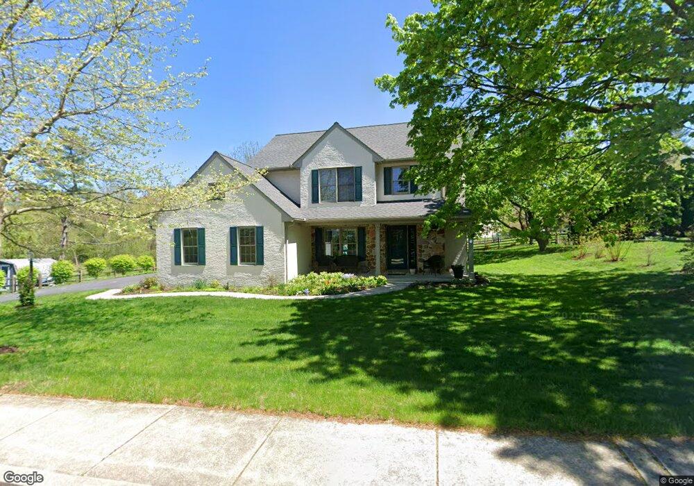
31 N Chestnut St Elverson, PA 19520
Estimated Value: $335,000 - $396,000
3
Beds
2
Baths
1,680
Sq Ft
$222/Sq Ft
Est. Value
About This Home
This home is located at 31 N Chestnut St, Elverson, PA 19520 and is currently estimated at $372,164, approximately $221 per square foot. 31 N Chestnut St is a home located in Chester County with nearby schools including Twin Valley Elementary Center, Twin Valley Middle School, and Twin Valley High School.
Ownership History
Date
Name
Owned For
Owner Type
Purchase Details
Closed on
Mar 27, 2014
Sold by
Shank Jeffrey A and Shank Lois B
Bought by
Bogart Michael Robert and Bogart Bridget F
Current Estimated Value
Home Financials for this Owner
Home Financials are based on the most recent Mortgage that was taken out on this home.
Original Mortgage
$153,200
Outstanding Balance
$116,417
Interest Rate
4.33%
Mortgage Type
VA
Estimated Equity
$255,747
Create a Home Valuation Report for This Property
The Home Valuation Report is an in-depth analysis detailing your home's value as well as a comparison with similar homes in the area
Home Values in the Area
Average Home Value in this Area
Purchase History
| Date | Buyer | Sale Price | Title Company |
|---|---|---|---|
| Bogart Michael Robert | $150,000 | Conestoga Title Insurance |
Source: Public Records
Mortgage History
| Date | Status | Borrower | Loan Amount |
|---|---|---|---|
| Open | Bogart Michael Robert | $153,200 |
Source: Public Records
Tax History
| Year | Tax Paid | Tax Assessment Tax Assessment Total Assessment is a certain percentage of the fair market value that is determined by local assessors to be the total taxable value of land and additions on the property. | Land | Improvement |
|---|---|---|---|---|
| 2025 | $4,273 | $115,340 | $24,100 | $91,240 |
| 2024 | $4,273 | $115,340 | $24,100 | $91,240 |
| 2023 | $4,172 | $115,340 | $24,100 | $91,240 |
| 2022 | $4,124 | $115,340 | $24,100 | $91,240 |
| 2021 | $3,999 | $115,340 | $24,100 | $91,240 |
| 2020 | $3,978 | $115,340 | $24,100 | $91,240 |
| 2019 | $3,898 | $115,340 | $24,100 | $91,240 |
| 2018 | $3,898 | $115,340 | $24,100 | $91,240 |
| 2017 | $3,803 | $115,340 | $24,100 | $91,240 |
| 2016 | $2,963 | $115,340 | $24,100 | $91,240 |
| 2015 | $2,963 | $115,340 | $24,100 | $91,240 |
| 2014 | $2,963 | $115,340 | $24,100 | $91,240 |
Source: Public Records
Map
Nearby Homes
- 59 E Main St
- 21 Meadowview Dr
- 508 Kennelwoods Dr
- 25 S Brick Ln
- 74 Sundance Dr
- 76 S Brick Ln
- 0 Heritage Dr Unit 4A PABK2058798
- 331 Ironstone Ln
- 201 Pine Swamp Rd
- 87 Brownstone Ln
- 86 Brownstone Ln
- 63 Brownstone Ln
- 232 Briarwood Dr
- 11 Brownstone Ln
- 1 Senn Ln
- 6 Lenape Dr
- 602 Heather Way Unit B4B
- 205 Heather Way
- 501 Lexington Way
- 1509 Lexington Way
- 31 N Chestnut St
- 35 N Chestnut St
- 27 N Chestnut St
- 36 Springfield Dr
- 37 N Chestnut St
- 30 N Chestnut St
- 20 Witwer Dr
- 28 N Chestnut St
- 39 N Chestnut St
- 31 Springfield Dr
- 21 N Chestnut St
- 22 Water St
- 43 N Chestnut St
- 47 N Chestnut St Unit 47
- 20 N Chestnut St
- 33 Springfield Dr
- 33 Springfield Dr
- 49 N Chestnut St
- 12 N Chestnut St
- 18 E Main St
Your Personal Tour Guide
Ask me questions while you tour the home.