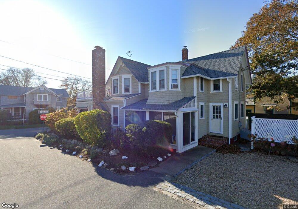
31 Narragansett Ave Oak Bluffs, MA 02557
Oak Bluffs NeighborhoodEstimated Value: $1,254,000 - $1,820,000
4
Beds
2
Baths
1,795
Sq Ft
$893/Sq Ft
Est. Value
About This Home
This home is located at 31 Narragansett Ave, Oak Bluffs, MA 02557 and is currently estimated at $1,602,831, approximately $892 per square foot. 31 Narragansett Ave is a home with nearby schools including Oak Bluffs Elementary School and Martha's Vineyard Regional High School.
Ownership History
Date
Name
Owned For
Owner Type
Purchase Details
Closed on
Jul 6, 2010
Sold by
Dern Tr Dixon Q and Dern Lisa Dunn
Bought by
Pearlman David and Pearlman Jennifer L
Current Estimated Value
Home Financials for this Owner
Home Financials are based on the most recent Mortgage that was taken out on this home.
Original Mortgage
$417,000
Interest Rate
4.88%
Mortgage Type
Purchase Money Mortgage
Purchase Details
Closed on
May 30, 2008
Sold by
Dern Dixon Q
Bought by
Dixon & Lisa Dern Ft
Purchase Details
Closed on
Oct 29, 1998
Sold by
Hatton Ruth Est
Bought by
Dern Dixon and Dunn-Dixon Lisa
Create a Home Valuation Report for This Property
The Home Valuation Report is an in-depth analysis detailing your home's value as well as a comparison with similar homes in the area
Home Values in the Area
Average Home Value in this Area
Purchase History
| Date | Buyer | Sale Price | Title Company |
|---|---|---|---|
| Pearlman David | $530,000 | -- | |
| Dixon & Lisa Dern Ft | -- | -- | |
| Dern Dixon | $300,000 | -- |
Source: Public Records
Mortgage History
| Date | Status | Borrower | Loan Amount |
|---|---|---|---|
| Open | Dern Dixon | $408,000 | |
| Closed | Dern Dixon | $411,000 | |
| Closed | Dern Dixon | $417,000 | |
| Closed | Pearlman David | $417,000 | |
| Previous Owner | Dern Dixon | $320,000 |
Source: Public Records
Tax History Compared to Growth
Tax History
| Year | Tax Paid | Tax Assessment Tax Assessment Total Assessment is a certain percentage of the fair market value that is determined by local assessors to be the total taxable value of land and additions on the property. | Land | Improvement |
|---|---|---|---|---|
| 2025 | $7,644 | $1,513,600 | $802,900 | $710,700 |
| 2024 | $7,154 | $1,367,900 | $689,100 | $678,800 |
| 2023 | $6,426 | $1,217,000 | $630,200 | $586,800 |
| 2022 | $6,026 | $887,500 | $421,300 | $466,200 |
| 2021 | $3,299 | $778,800 | $353,200 | $425,600 |
| 2020 | $3,234 | $730,500 | $336,400 | $394,100 |
| 2019 | $3,736 | $694,000 | $307,800 | $386,200 |
| 2018 | $3,283 | $657,900 | $270,600 | $387,300 |
| 2017 | $2,916 | $611,900 | $265,400 | $346,500 |
| 2016 | $4,731 | $583,400 | $273,600 | $309,800 |
| 2015 | $4,419 | $555,100 | $273,600 | $281,500 |
| 2014 | $4,766 | $610,200 | $278,600 | $331,600 |
Source: Public Records
Map
Nearby Homes
- 46 Kennebec Ave
- 34 Massasoit Ave
- 1 Cottage Park
- 2 Lincoln Ave
- 10 Siloam Ave
- 4 Canonicus Ave
- 50 Canonicus Ave
- 24 School St
- 113 Dukes County Ave Unit Multi-Family
- 181 Circuit Ave
- 47 E East Chop Dr Unit 5
- 47 E Chop Dr Unit 4
- 47 E Chop Dr Unit 2
- 47 E Chop Dr Unit 3
- 47 E Chop Dr Unit 1
- 47 E Chop Dr
- 47 E Chop Dr Unit 5
- 9 Brunswick Ave
- 24 Samoset Ave
- 35 Narragansett Ave
- 14 Naumkeag Ave
- 0 Narragansett Ave Unit 3A 9612
- 0 Narragansett Ave Unit 1
- 14 Narragansett Ave
- 32 Narragansett Ave
- 26 Samoset Ave
- 34 Narragansett Ave
- 20 Samoset Ave
- 36 Narragansett Ave
- 28 Narragansett Ave
- 28 Narragansett Ave
- 28 Samoset Ave
- 37 Pequot Ave
- 18 Samoset Ave
- 39 Pequot Ave
- 35 Pequot Ave
- 8 Naumkeag Ave
- 26 Narragansett Ave