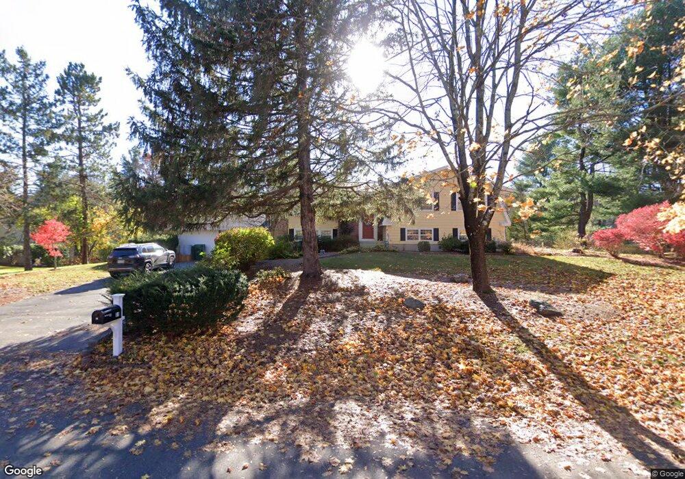
31 Normandy Dr Sudbury, MA 01776
Estimated Value: $1,050,713 - $1,186,000
4
Beds
3
Baths
2,610
Sq Ft
$426/Sq Ft
Est. Value
About This Home
This home is located at 31 Normandy Dr, Sudbury, MA 01776 and is currently estimated at $1,112,928, approximately $426 per square foot. 31 Normandy Dr is a home located in Middlesex County with nearby schools including General John Nixon Elementary School, Ephraim Curtis Middle School, and Lincoln-Sudbury Regional High School.
Ownership History
Date
Name
Owned For
Owner Type
Purchase Details
Closed on
Sep 7, 2010
Sold by
Gamble Susan P and Lee Susan
Bought by
Gamble Tr Clive R and Gamble Susan P
Current Estimated Value
Purchase Details
Closed on
Nov 9, 2007
Sold by
Trocchi Virginia M
Bought by
Gamble Clive and Lee Susan
Home Financials for this Owner
Home Financials are based on the most recent Mortgage that was taken out on this home.
Original Mortgage
$300,000
Interest Rate
6.47%
Mortgage Type
Purchase Money Mortgage
Create a Home Valuation Report for This Property
The Home Valuation Report is an in-depth analysis detailing your home's value as well as a comparison with similar homes in the area
Home Values in the Area
Average Home Value in this Area
Purchase History
| Date | Buyer | Sale Price | Title Company |
|---|---|---|---|
| Gamble Tr Clive R | -- | -- | |
| Gamble Clive | $625,500 | -- |
Source: Public Records
Mortgage History
| Date | Status | Borrower | Loan Amount |
|---|---|---|---|
| Previous Owner | Gamble Clive | $300,000 |
Source: Public Records
Tax History
| Year | Tax Paid | Tax Assessment Tax Assessment Total Assessment is a certain percentage of the fair market value that is determined by local assessors to be the total taxable value of land and additions on the property. | Land | Improvement |
|---|---|---|---|---|
| 2025 | $13,750 | $939,200 | $461,300 | $477,900 |
| 2024 | $13,295 | $910,000 | $447,700 | $462,300 |
| 2023 | $13,124 | $832,200 | $414,500 | $417,700 |
| 2022 | $12,178 | $674,700 | $380,100 | $294,600 |
| 2021 | $11,901 | $632,000 | $380,100 | $251,900 |
| 2020 | $11,660 | $632,000 | $380,100 | $251,900 |
| 2019 | $11,319 | $632,000 | $380,100 | $251,900 |
| 2018 | $10,885 | $607,100 | $400,100 | $207,000 |
| 2017 | $10,447 | $588,900 | $395,300 | $193,600 |
| 2016 | $10,052 | $564,700 | $380,100 | $184,600 |
| 2015 | $9,428 | $535,700 | $350,700 | $185,000 |
| 2014 | $9,422 | $522,600 | $340,300 | $182,300 |
Source: Public Records
Map
Nearby Homes
- 62 Churchill St
- 8 Twillingate Rd
- 15 Huckleberry Ln
- 11 October Rd
- 25 Poplar St
- 557 Dutton Rd Unit 2
- 30 Kendall Rd
- 45 Webster Cir
- 30 Harness Ln
- 111 Willis Rd
- 25 Plantation Cir
- 6 Canterbury Dr
- 55 Widow Rites Ln
- 45 Widow Rites Ln
- 53 Pine St
- 30 Rolling Ln
- 427 Concord Rd
- 46 Brewster Rd
- 355 Maynard Rd
- 11 Great Lake Dr
Your Personal Tour Guide
Ask me questions while you tour the home.